The Heysen Trail, Great Walk of SA

hero media
The longest of Australian Traveller’s epic bushwalks, the Heysen Trail is named after Australia’s most famous euculyptus admirer and painter.

The trail’s best sections are its bookends: the northernmost 60km between Parachilna Gorge and Wilpena Pound Resort, and the southernmost 60km between Cape Jervis and the holiday town of Victor Harbor.


The longest and most committing of the four routes is SA’s Heysen Trail, stretching 1200km from Cape Jervis, south of Adelaide, to Parachilna Gorge in the Northern Flinders Ranges.


Constructed throughout the 1970s and 1980s, it takes its name from Sir Hans Heysen, the artist whose paintings so popularised the Flinders Ranges.

Heysen Trail SA
Walk the Heysen Trail in the Flinders Ranges

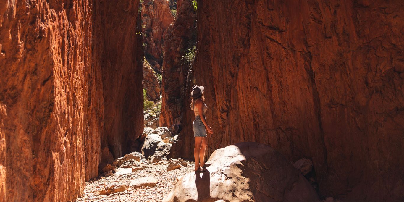
An unforgiving trail, large chunks of it cross through semi-arid lands in and around the Mt Lofty and Flinders Ranges.


Water is scarce, making the hauling of reasonably large volumes of water necessary, and the heat can be brutal, with sections of the track through private land closed to walkers between about November and March.


The nature of the terrain and long sections of road walking mean that the Heysen Trail is the least consistently spectacular of the long-distance routes, though the dry, cleared landscape also makes it perhaps the most representative of the true Australian landmass.


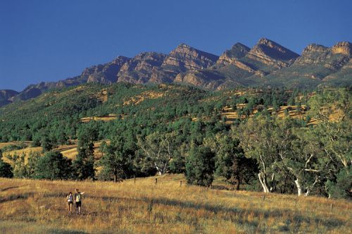
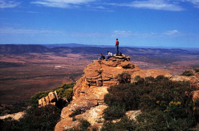
It could be said (for better or worse) to be the full Aussie package, incorporating city views, coast, mountains and vast tracts of outback as it heads north through the Flinders Ranges. Along its course, it crosses many of SA’s major peaks, including Mts Lofty, Remarkable, Brown and the Dutchmans Stern, as well as passing through the flat heart of Wilpena Pound.

Heysen Trail Lookout
The surroundings are enough to make everyone stop and admire.

Most walkers will take about 60 days to walk the Heysen Trail from end to end, though very few take on this enormous mission in one outing.


For many, the process of walking the Heysen takes years, walking it separate section by separate section. The trail’s best sections are its bookends: the northernmost 60km between Parachilna Gorge and Wilpena Pound Resort, and the southernmost 60km between Cape Jervis and the holiday town of Victor Harbor.


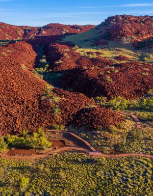
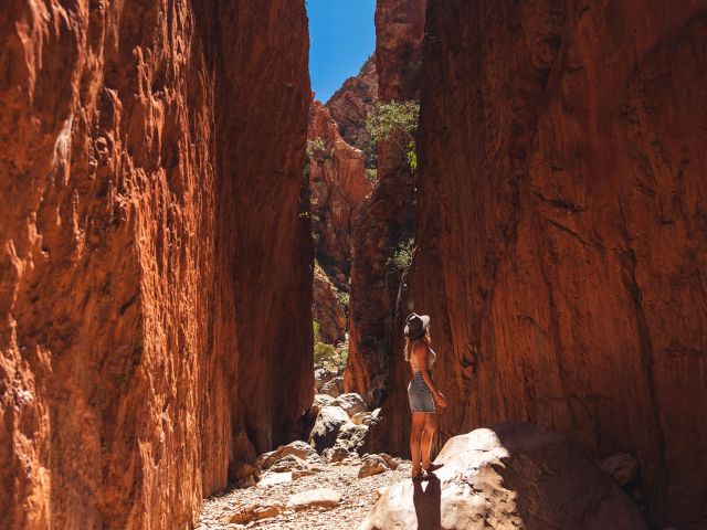
At the northern end, out of Parachilna Gorge, the trail sets out along dry creek beds pinched between the ABC Range and the twisting, swirling rock of the Heysen Range.


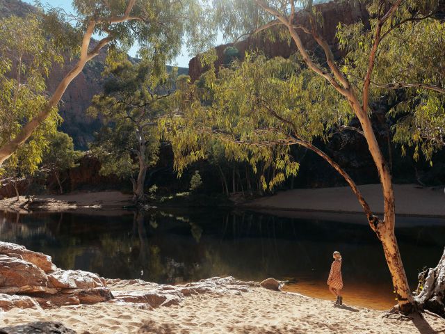
Points of interest along this section are many and varied, including the Aroona Valley, where Hans Heysen painted a number of artworks; a variety of lookouts; and wonderfully isolated views across the Bunyeroo Valley, one of the Flinders’ trademark scenes.


This route makes for a comfortable three-day walk, camping at Aroona Valley and beside Yanyanna Hut. It can also be stretched out to four days with a stop at Trezona campground.


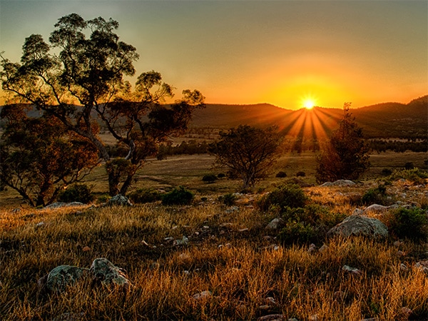
By spending a night at Yanyanna you can have the added bonus of setting out above the Bunyeroo Valley at dawn, the finest time of day for this classic view.


The southern end of the Heysen Trail is a picture of contrast.

Heysen Trail Coast
The Deep Creek Conservation Park at the coastal end of the Heysen Trail.

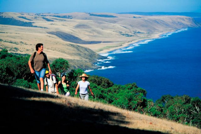
Here, it’s all about the sea and rugged coast, beginning at Cape Jervis and pushing through beautiful Deep Creek Conservation Park, where Blowhole Beach and Boat Harbour Beach stare across Backstairs Passage to Kangaroo Island. Seal and dolphin sightings aren’t uncommon.


Out of Deep Creek there’s a long, sandy haul along Tunkalilla Beach (where the marine sightings are as likely to be sharks) before the track veers inland, returning to the coast at Waitpinga Beach, more famous for its waves than its walking.


Beyond Newland Head, cliff-top roads and tracks lead towards the edge of Victor Harbor, with the cliffs affording seasonal opportunities to spot southern right whales (June to September).This southern section contains no mountains but the severity of the coast means a significant amount of climbing, so it’s worth allowing four days.
 
There are seven campsites along the route, so options are plentiful for breaking up the days.

This hidden region in Victoria is home to a peaceful lake trail

Video credit: Tourism Australia

From pink salt landscapes to oases fringed by forests of red gums, the lakes of this rural region are astounding. 

You’re going to find peace and quiet when you take a road trip through the lakes of the Wimmera Mallee region. Whether it’s mirror-like pink salt lakes that look like an inland sea, or lakes fringed by forests of red gums that showcase Victoria’s arid beauty, there’s a lake for you out here somewhere.  

1. Lake Tyrrell  

Lake Tyrrell
The colours of Lake Tyrrell blend into the sky. (Image: Visit Victoria/Anne Morely)

Located in the dead heart of the Mallee, Victoria’s largest salt lake, Lake Tyrrell , is a landscape photographer’s dream – especially at sunrise and sunset when the pink salt flats look like a gigantic mirror. It’s easy to camp or park a caravan nearby, too, though the tiny town of Sea Lake is just south (with accommodation). In winter, shallow water covers the salt, creating surreal reflections of the sky.  

2. Nhill Lake  

There’s a permanent water source here, so there’s always plenty of water for water skiing, swimming and fishing (the trout and redfin fishing here is legendary). Located beside the pretty heritage town of Nhill with its main street of historic buildings, there’s options for eating and drinking right next door. There’s also a barbecue area with plenty of shady picnic spots and a boardwalk for walking around the lake.  

3. Lake Bringalbert  

Lake Bringalert
Lake Bringalert is a great spot for aquatic adventures.

Located south-west of the pretty Mallee town of Kaniva, Lake Bringalbert epitomises the best of ‘outback’ Victoria. It’s ringed by red gums and red mallee and feels completely hidden from the world – you’ll barely ever see another person. There’s basic camping on its foreshore and Kaniva offers more accommodation options. It’s the perfect lake for swimming, kayaking and skiing, and the stars at night come without even a hint of city glow.  

4. Lake Hindmarsh 

If you’re a bird fan, you’ll love Lake Hindmarsh . Located north of Dimboola, Victoria’s largest natural freshwater lake is like an inland sea full of pelicans, swans and numerous species of ducks – but it also teems with everything from spoonbills to parrots. Sunsets here will blow your mind – the lake is a mirror for the pinks and golds you’ll see on the horizon. There’s free camping spots along the foreshore if you’d like to really contemplate the magic of the lake.  

5. Pink Lake 

pink lake
The Pink Lake is most vivid after rain. (Image: Visit Victoria/Anne Morely)

Also known as Loch Lel , the summer months offer up some seriously vivid pink water colour at this lake north of Dimboola. The pink varies throughout the year, but is best after rain (hence why summer is the time to visit).

pink lake
Pink Lake, also known as Loch Lel, is located near Dimboola in the Grampians. (Image: Tourism Australia)

There’s plenty of birds, including wedge-tailed eagles, but you’re as likely to spot big lace monitors, kangaroos and echidnas. Nearby, check out the uber-cute heritage town of Dimboola and its eclectic shops, and Little Desert National Park, full of walking trails through mallee heathland. 

6. Lake Lascelles 

Lake Lascelles
You can camp at Lake Lascelles.

On a hot summer’s day, there’s nowhere better for a cooling dip, kayak or boat ride. You can camp by the lake , or at powered caravan sites – or the pretty town of Hopetoun offers numerous accommodation options a short walk away. At night you’ll see the lights of Hopetoun reflect off the lake. Fish for yellow belly, redfin or catfish, or try water-skiing. There’s also a great walking trail around the lake, where there’s more birds than you can count.