The joy of an escape to Tasmania’s newly crowned Heartlands is that you can do – and eat – as much or as little as you please.
Rabbits scatter-bolt throughout the misty garden when I close Wandering Trout’s side-entrance door behind me. A few steps and I’m on Mole Creek’s main drag where streetlights are still on even though it’s light enough to see without them. There’s nobody else around except a lone truck driver passing by with a load of felled trees that may have started life well before the name Tasmania was ever spoken here.
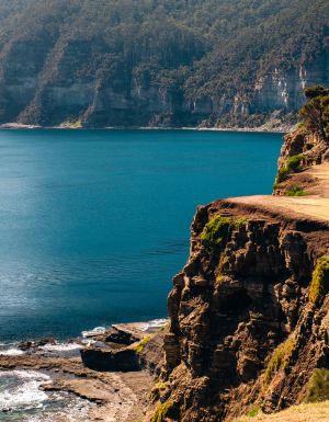
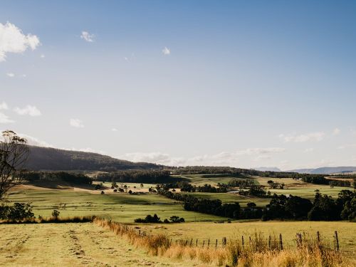
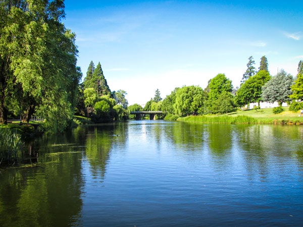
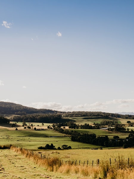
I arrived late yesterday afternoon from Launceston, rejecting the highway for a more inefficient scenic route between blackberry-lined paddocks of red soil while the sinking sun made silhouettes of the surrounding outcrops of kooparoona niara/Great Western Tiers. This northern part of Tasmania’s Central Highlands has recently been rebranded the Heartlands, with signs and everything. Yet, no matter how you reframe it, this is and always will be palawa Country.
Day one: Deloraine & Mole Creek
On this misty morning, with three full days here ahead of me, I’m on my way to the main service town of Deloraine to get better acquainted. Yet, only a few minutes out of Mole Creek, a sign catches my eye. At Alum Cliffs trail car park, I open my door to a glorious chorus of kookaburra, magpie, rooster, crow and cow.
Explore Deloraine’s nearby nature experiences
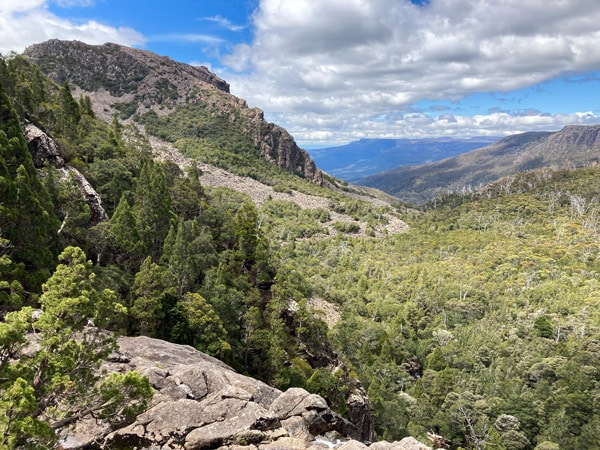
This 40-minute return walk initially seems quite tame. The English-style agriculture and colonial architecture in these parts always lulls me into thinking it’s a relatively moderate landscape. Yet, an extensive karst system, ancient sandstone and Jurassic dolerite intrusions make for some serious geological drama beyond the farmed lands.
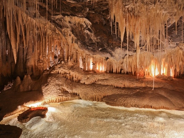
You can take limestone cave tours at King Solomons and Marakoopa to see glow worms, caverns and subterranean streams. Or Devils Gullet is a free alpine walk to a sheer dolerite cliff that looks out at Cradle Mountain (though its road access is currently closed).
I soon realise, reading the interpretive signage, I’m on my way to a place that’s extremely significant to many Aboriginal nations and ancestral groups, especially the Pallittorre, whose traditional homelands I’m on. Within half an hour I’m standing entranced at the edge of a deep river gorge where the water far below is flowing so energetically I can hear it. Then sunlight hits the mountains for the first time today and lights up the sacred place of tulampanga, meaning red ochre hill.
There’s a poem on a plaque written by palawa Elder Phyllis Pitchford called ‘our history our reality’ about kooparoona niara (pronounced KOOP-aroon-NYAH-rah). I stay for ages listening to a honeyeater call, watching birds flit and wondering where the peregrine falcons are nested. On the walk back, I sample tiny ripe fruits from a native cherry tree.
Shopping, craft fairs and car shows
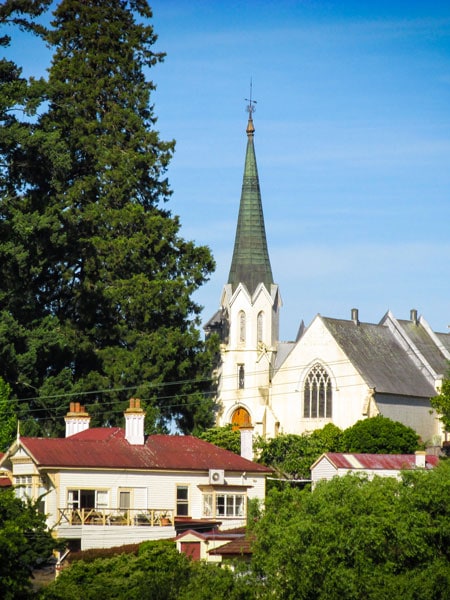
At mid-morning I’m perched on a stool in Brush Rabbit talking about mountain biking over a double espresso and a croissant. At Great Western Tiers Visitor Centre, I learn about the town’s sculptures and its dedication to preserving colonial structures such as its flour mill, band rotunda and Australia’s oldest continuously used racecourse. The working craft fair held here in early November increases Deloraine’s population ten-fold.
Last February I came through during Deloraine Street Car Show when the exit-ramp-shaped main street transforms into an open-air showroom. At the time, I took a break from the vintage V8s to buy a soft brown beanie for a baby from the Alpaca Shoppe. Its owner has since moved the business ‘out to the farm’ on Quamby Brook Road where you can feed her woolly beasts.
This year is the quarter-century anniversary of Yarns Artwork in Silk, displayed at the visitor centre accompanied by an informative 10-minute commentary. Meander Valley’s seasons are represented across four panels that depict Deloraine’s streetscape and the area’s colonial history, agriculture and the natural environment. It was contributed to by the creative minds and talented hands of over 300 community members. Hopefully a fifth panel will one day be added acknowledging First Nations peoples.
Fine food and waterfalls
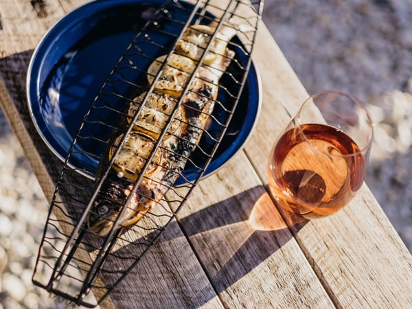
Peckish, I find my way to a great steak and Guinness pie at Mumma Buzz and, across the Meander River, house-made gelato. Dixie Blue uses Ashgrove dairy products and its lemon meringue ice-cream has actual meringue chunks on top. Some say Cruizin’ in the 50’s Diner has put Deloraine on the map but unfortunately I’m at digestive capacity for now.
On Barrack Street, I’m drawn into a nameless secondhand shop where everything including the kitchen sink is thoughtfully displayed and reasonably priced. After a thorough peruse and some good conversation, I leave with a pile of yellow Johnson of Australia bowls and plenty of change from a twenty.
If it was the weekend (and not Friday), about now I’d be beelining for 3 Willows Vineyard to sample its wines and eat Tasmanian cheese in the sun. Instead, I buy vanilla slice from Deloraine Town Cafe bakery and drive the A5 up onto the plateau where a wheelchair accessible boardwalk winds between stands of gnarly old pencil pines to the edge of Pine Lake.
Back in the valley, with only a couple more hours of daylight left, I follow the advice of the junk shop owner and another customer to walk to Westmorland Falls near Caveside. Rainforest mosses and epiphytes grow on just about every surface and tree ferns close to the falls are a massive eight or nine metres tall.
It’s dusk when I drive slowly back to Mole Creek to avoid injuring or killing any animals, especially threatened species like devil and quoll but also wallaby and possum. There’s a cheerful crowd inside Wandering Trout where I find a corner and get lost in a tray of really good chicken tacos.
Day two & three: Meander
The next morning I drive to Meander where, after the S-bends, I’m greeted by every vehicle I pass. “Everyone waves whether you’re from here, not from here, whatever," I’m told at the friendly Meander Bridge Cafe where I have coffee and buy food for today’s 10-kilometre walk. I’m staying at Cedar Cottage for the next two nights but it’s too early to check in so I head to the reserve.
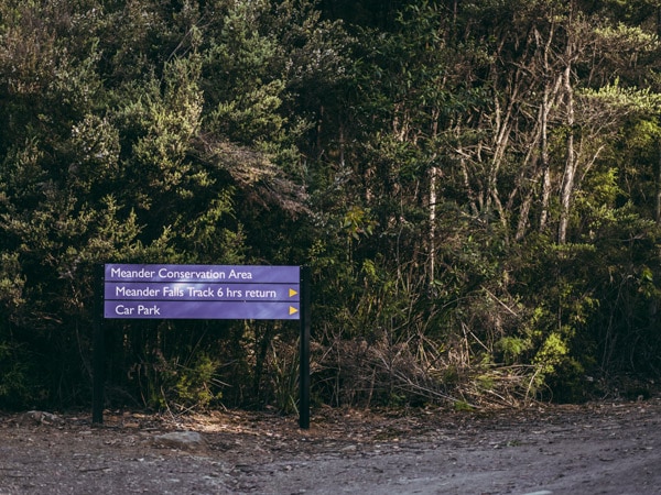
Kooparoona niara means Mountains of Spirits. Meander Falls Track, within this range, is a gradual uphill hike with just one particularly steep section. The forest track follows the river – the same waterway that runs through Deloraine – so there’s a constant reward of waterfall displays, swimming holes and views down into canyons before reaching boulder fields and the final falls.
While lunching in pencil pine shade, with beautiful black rock towering above me, I have the most wonderful realisation: I don’t have to go anywhere tomorrow.
A traveller’s checklist
Getting there
Deloraine is roughly a 40-minute drive west from Launceston and south from Devonport, and 2.5 hours’ drive north-west from Hobart. Meander is 15 minutes south of Deloraine.
Staying there
Glendalough in Deloraine is an Edwardian homestead and one of the few properties in the region providing equal access accommodation.
Wandering Trout in Mole Creek near Deloraine is a small-batch craft brewery with accommodation and a taphouse serving great food.
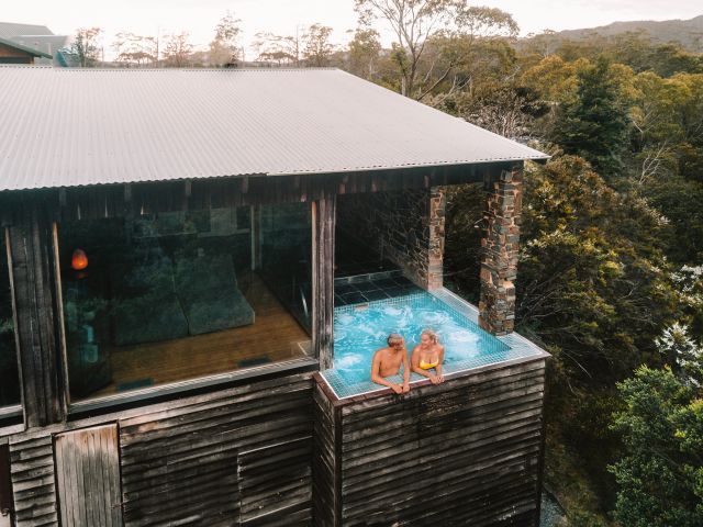
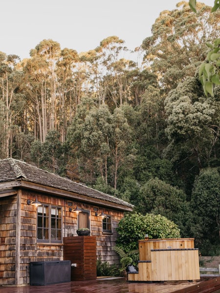
Cedar Cottage in Meander offers self-contained accommodation with a hot tub and views of kooparoona niara.
Hiking there
Many walks in the area are within national parks so organise your Parks pass before your short break.
Conscious traveller
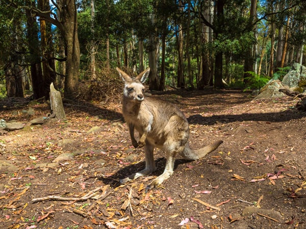
Trowunna Wildlife Sanctuary in Mole Creek is a 28-hectare haven for animals and birds. The sanctuary rehabilitates injured and orphaned wildlife and has a breeding program. Trowunna has a catch and release ethos but also provides habitat for creatures that can’t be returned to the bush and has contributed enormously to Save the Devil. You can support Trowunna by visiting as well as sponsoring a spotted-tailed quoll, a pair of devils or an orphaned bare-nosed wombat called Rosalie.