7 landscapes Australians saved for their grandkids

hero media

Pat yourselves on the back, Australia – your children will thank you. Congratulations, you have saved some of the most stunning landscapes in this wide, brown land for the following generations.

Even in the midst of the all-powerful resources boom, sometimes communities put their collective feet down, taking on governments and industry to defend and conserve these stunning areas. Of course, there are still many battles being fought and to be fought. But in the meantime, here are seven triumphs – landscapes of great environmental, cultural and sentimental significance (and, of course, commercial value) that your grandkids and their grandkids can will be able to experience and enjoy. 
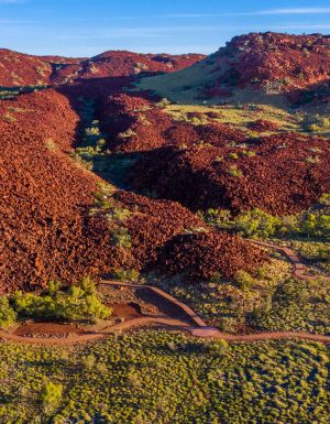
1. Koongarra, NT

Kakadu National Park’s boundaries were declared in 1979, but an area near the famous Nourlangie Rock (famous for indigenous rock art) was excluded from the park because of a large uranium deposit there. For years Jeffrey Lee, the senior Djok traditional owner of Koongarra, was courted by mining companies to use the land but he insisted it be incorporated into Kakadu. Finally, in 2013, the Kakadu Project Area Act was repealed and this extraordinary part of the region was included in the National Park and World Heritage Area.

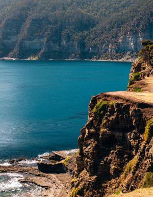
2. Franklin River, Tasmania

Probably Australian environmentalists’ most famous battle and one that was ultimately successful. In 1982-83, 1272 people were arrested at Warner’s Landing, 6km from the junction of the Franklin and Gordon, during protests against the Tasmanian government’s plan to dam the Gordon. These concerted protests (during a federal election campaign) meant the river was saved in 1983 after actions by the Hawke Government and a High Court decision.
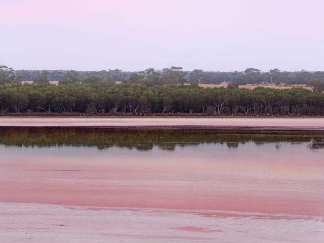
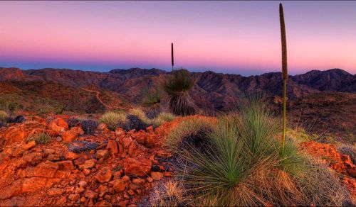
3. Arkaroola, SA

This wilderness reserve in northern Flinders Ranges, about 600km north of Adelaide, was described by Dick Smith as one of Australia’s finest arid landscapes. Sir Douglas Mawson also often brought his Adelaide University students here on field trips. Until 2011 the area was under threat from uranium mining, but after a community campaign in July of that year, the government announced that mining would be banned in Arkaroola, aiming eventually for a World Heritage listing.

4. Hattah Lakes, Victoria

Hattah Lakes wetlands, part of the Murray-Darling river system, did not experience a proper flood between 1996 to 2010. Too much water, mostly for irrigation, was being taken out of the wetlands (one of Australia’s most significant) for the natural floods, which are vital for the area’s birds and animals, to occur. Recently an environmental works program is bringing Hattah’s river redgums and animals back to life in this stunning series of freshwater lakes.

5. Mary River, Queensland

The Queensland government wanted to flood the Mary River Valley at Traveston Crossing, near Gympie, to shore up Brisbane’s water supply. The plan threatened the habitat of Australian lungfish, Mary River cod and Mary River turtle, and would have flooded large tracts of farming land. After a community campaign, then Federal Environment Minister Peter Garrett invoked Commonwealth environmental powers to stop the project.

6. James Price Point, WA

A plan to build a gas processing plant at James Price Point, 50km from Broome on the Kimberley’s coastline, faced opposition from environmentalists, who said the plan posed risks to whales, dugongs, bilbies and dinosaur footprints in the area. There was also a strong opposition from the land’s traditional Goolarabooloo owner Richard Hunter. But in mid 2013, after protracted court action, the gas project was shelved, the companies opting to obtain the gas from a floating platform out at sea instead.

7. Mt Everard, Harts Range and Fishers Ridge, NT

Some of Australia’s most arid landscapes, Mt Everard and Harts Range (near Alice Springs) and Fishers Ridge (NT, near Katherine) had been shortlisted as possible radioactive waste dump sites. But all three sites, of great environmental and cultural significance, have since been removed from consideration after various community campaigns.

Thanks to the Australian Conservation Foundation for use of information and resources.

From coast to bush: these are Gippsland’s best hikes

Video credit: Tourism Australia

From coast to mountains, hiking in Gippsland offers a stunning array of landscapes, with trails that take you deep into the region’s heritage.

I step out onto the sand and it cries out underfoot. Kweek! I take another step and there’s another little yelp. Screet! Picking up the pace, the sounds follow me like my shadow, all the way down to the water. It’s obvious how this spot got its name – Squeaky Beach – from the rounded grains of quartz that make the distinctive sounds under pressure.

For many, Wilsons Promontory National Park is the gateway to Gippsland , and the best way to explore it is by walking its network of hiking trails, from coastal gems such as Squeaky Beach through to the bushland, among the wildlife. But it’s still just a taste of what you’ll find on foot in the region.

Venture a bit further into Gippsland and you’ll discover the lakes, the rainforest, and the alpine peaks, each changing with the season and offering summer strolls or winter walks. Just like that squeaky sand, each step along these trails has something to tell you: perhaps a story about an ancient spirit or a pioneering search for fortune.

The best coastal hikes in Gippsland

sunset at Wilsons Promontory National Park
Wilsons Promontory National Park is a sprawling wilderness with many coastal bushland trails. (Image: Mark Watson)

Wilsons Promontory National Park (or ‘The Prom’, as you’ll end up calling it) is an easy three-hour drive from Melbourne, but you might ditch the car when you arrive, with much of the park’s 50,000 hectares accessible only by foot. From the inky water of Tidal River (dyed dark purple by abundant tea trees), I like the easy walks along the coast, among lichen-laden granite boulders, to golden beaches and bays.

a couple on Mount Oberon
Panoramic views from the summit of Mount Oberon. (Image: Everyday Nicky)

The trail to the panoramic views at the summit of Mount Oberon is a bit harder, up steep timber and granite steps, but it’s a popular 6.8-kilometre return. The more remote hikes are found through the open banksia and stringybark woodland of the park’s north, or along the multi-day Southern Circuit , which ranges from about 35 to 52 kilometres, with sunrises and sunsets, kangaroos and cockatoos, and maybe even whales.

a golden sand beach at Wilsons Promontory National Park
Walk ‘The Prom’s’ golden sand beaches. (Image: Tourism Australia/Time Out Australia)

You might also see whales on the George Bass Coastal Walk , even closer to Melbourne on the western edge of Gippsland. This dramatic seven-kilometre trail along the clifftops takes in sweeping views of the wild ocean, occasionally dipping down from grassy green hills to coastal gullies and a secluded beach. It also now links into the Bass Coast Rail Trail for an extra 14 kilometres.

the George Bass Coastal Walk
George Bass Coastal Walk trails for seven kilometres along clifftops. (Image: Visit Victoria/Time Out Australia)

Over at the eastern edge of Gippsland, in Croajingolong National Park, you can wander along the lakeshores beneath koalas and around goannas (I keep my distance since one chased me here!). For those who are even more adventurous, the park is also the starting point for the 100-kilometre Wilderness Coast Walk , usually done over seven days.

the Croajingolong National Park, Gippsland
Wander along the lakeshores in Croajingolong National Park. (Image: Tourism Australia)

The best bush hikes in Gippsland

the Baw Baw National Park
The alpine heath of Baw Baw National Park. (Image: Everyday Nicky)

Deep in the Long Tunnel Extended Gold Mine at Walhalla, mining guide Richard tells me how this small town in the mountains east of Melbourne boomed when prospectors found gold here in 1862. These days, you’ll find most of the town’s treasure – its heritage – above ground, with the Walhalla Tramline Walk a wonderful way to explore it.

Just seven kilometres long, the walk takes you through decades of Gold Rush history, following the original rail trail from lush bushland to the mining sites, and through the charming village of just 20 residents with its wooden cottages and old shopfronts adorned with turn-of-the-century advertising posters. Blazing a trail where trailblazers once opened up the region, this is also the starting point for the 650-kilometre Australian Alps Walking Track.

Nearby, Baw Baw National Park has walks through gnarled snow gums and alpine heaths that show off the colourful wildflowers in summer and the pristine carpet of white in winter. Several trails are perfect for snowshoes, including a 45-minute route from St Gwinear up to vast views across the Latrobe Valley.

Further up into the mountains, the Toorongo and Amphitheatre Falls Loop Walk is an easy 2.2-kilometre path that serenades you with the sound of flowing water as you pass mossy rocks and tree ferns en route to two sets of waterfalls cascading over boulders in the remote wilderness.

The best cultural hikes in Gippsland

the Mitchell River National Park, Gippsland
Hike the Mitchell River National Park. (Image: Parks Victoria/Grace Lewis)

Across a pool in a natural sandstone amphitheatre, deep within a cave behind a waterfall, it’s said the Nargun has its lair. A fierce creature, half human and half stone, that abducts children and can’t be harmed by boomerangs or spears, the story of the Nargun has been told around the campfires of the local Gunaikurnai people for generations.

As a culturally significant place for women, hikers are asked not to go into the Den of Nargun, but a 3.4-kilometre loop walk leads you through a rainforest gully to the entrance where you can feel the powerful atmosphere here in Mitchell River National Park , along Victoria’s largest remaining wild and free-flowing waterway.

the bee-eaters at Mitchell River National Park
Bee-eaters at Mitchell River National Park. (Image: Parks Victoria/Grace Lewis)

The Den of Nargun is part of the Bataluk Cultural Trail , a series of important traditional Gunaikurnai sites through central Gippsland. Another location is Victoria’s largest cave system, Buchan Caves Reserve, with trails to important archaeological sites of human artefacts up to 18,000 years old. The FJ Wilson Interpreted Walk includes the naturally sculpted white limestone steps of the 400-metre-long Federal Cave, while the Granite Pools Walk goes among tall timber and moss-covered gullies.

the ancient rainforest of Tarra-Bulga National Park
The ancient rainforest of Tarra-Bulga National Park. (Image: Josie Withers)

Also important to the Gunaikurnai people is Tarra-Bulga National Park , known for its ancient myrtle beeches and enormous mountain ash trees. Just 40 minutes return, the Tarra Valley Rainforest Walk offers a taste of this verdant landscape, while the Grand Strzelecki Track takes you deep into the lost world of forest giants on an epic 100-kilometre trail rich with tradition.

A traveller’s checklist

Staying there

the WildernessRetreats in The Prom
Wilderness Retreats in The Prom. (Image: Christian Pearson)

Wilderness Retreats in Wilsons Promontory offers glamping-style tents with luxurious queen beds. Star Hotel is a reconstruction of a Gold Rush-era hotel from 1863 in the heart of heritage Walhalla. Caves House is a historic three-bedroom house with views over the Buchan River.

Eating there

the Carrajung Estate, Gippsland
Enjoy a post-hike lunch at Carrajung Estate. (Image: Everyday Nicky)

Kilcunda General Store serves great coffee and meals of local produce at the George Bass Coastal Walk. Alpine Trout Farm is located near Toorongo Falls in Noojee. Fish for your own lunch and barbecue it with the provided cookware.

Carrajung Estate is a short drive from Tarra-Bulga National Park. The winery’s restaurant offers a seasonal menu of regional ingredients and you can stay at The Lodge.

a seafood feast at Carrajung Estate, Gippsland
The table is set for a seafood feast at the estate.

Video credit: Tourism Australia