The ultimate guide to Wilsons Promontory National Park

hero media
Located at the southern tip of Australia’s mainland, Wilsons Promontory is a coastal wilderness of golden beaches and bushland trails which serves as one of Victoria’s favourite parks for good reason.

At the southernmost point of mainland Australia lies Victoria’s oldest and one of its most-loved national parks. Wilsons Promontory is a 50,000-hectare coastal wilderness of sandy beaches, granite tors, fern gullies, mountain peaks and native wildlife (think emus, wombats and vividly plumed rosellas), and even harbours a vast inland sand dune system. It is an Aboriginal cultural landscape that remains of major spiritual significance to Victorian Koorie communities today.

Getting to Wilsons Prom

Visit for the day, it’s three hours’ drive from Melbourne in South Gippsland, or stay awhile: the Prom’s main hub is the family-friendly Tidal River (named for the tea tree-stained waterway that curls lazily around it), which offers family-friendly campsites and huts (book ahead, especially in peak season) or hike to a secluded campsite or the historic cottages at the Wilsons Promontory Lightstation.
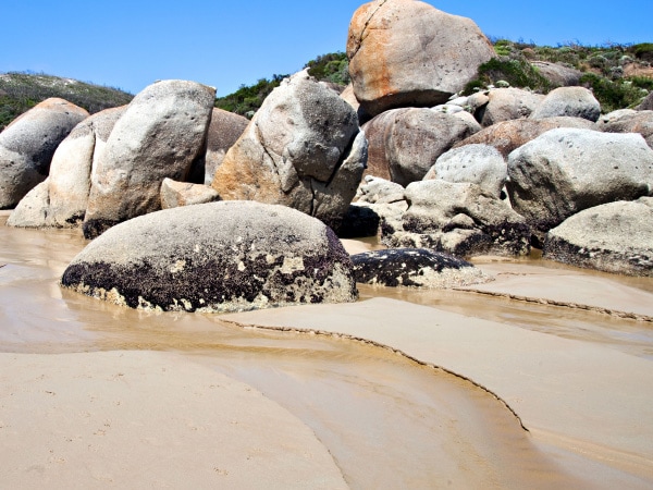
Wilsons Promontory national park
Marvel at the beauty found within one of Victoria’s favourite parks.

What to do at Wilsons Prom

Squeaky Beach

A must-hear sound as much as a must-see sight, powdery white Squeaky Beach gets its name from the noise your feet make as they pad along it. That’s thanks to the fine, rounded grains of quartz sand that compress under your feet as you walk. While here, take a dip in the famously turquoise waters and explore the maze of large granite boulders at the northern end of this iconic beach.

Mt Oberon

Set your sights on the summit of Mt Oberon for one of the best views in Victoria. This trek is short, at 6.8 kilometres return, and steep as you approach the granite peak where you’ll be rewarded with a panorama of Wilsons Promontory: from its pristine coastline and Tidal River to its offshore islands, gullies and other mountains. For a more rugged and challenging trek, hike Mt Bishop.
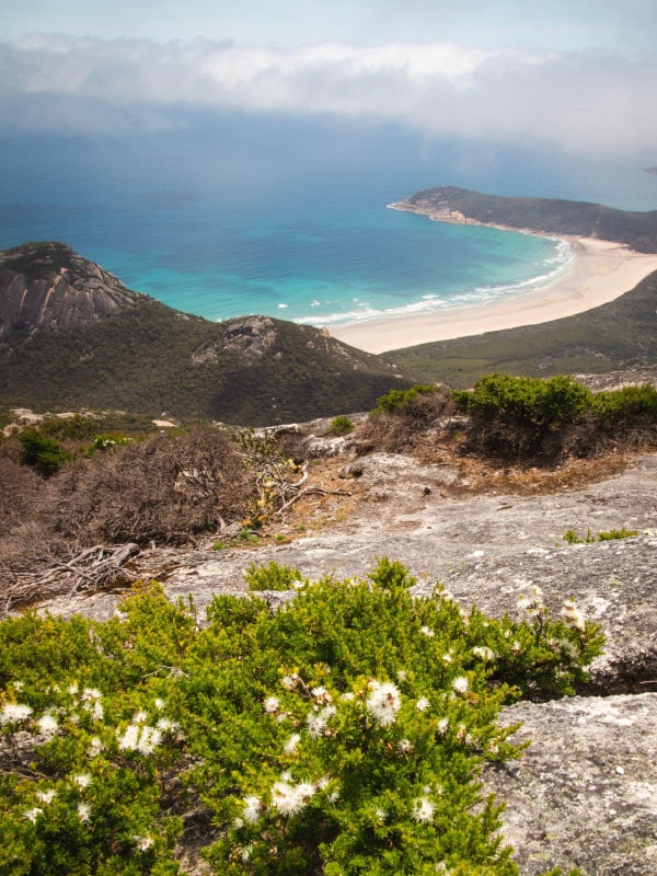
Mt Oberon Wilsons Prom
Views from the summit of Mt Oberon

Whisky Bay

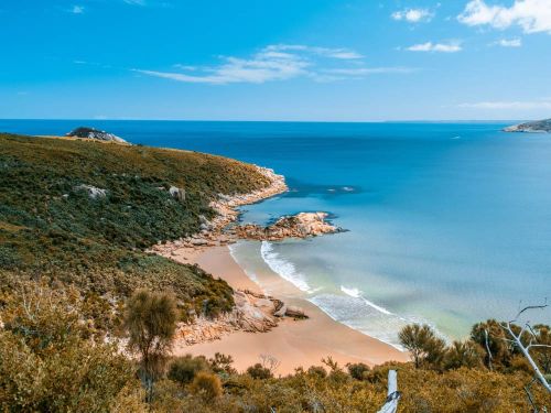
Follow the coastal walk that connects some of Wilsons Prom’s pristine beaches from Squeaky Beach round to Whisky Bay – preferably in time for sunset (also accessible via its own car park). A secluded beach with colourful rock outcrops, its position on the western coast of the peninsula provides the rare opportunity on the east coast of Australia to see the sun go down over the ocean. Watch as sky, sand and sea turn all the shades of a Manhattan, and islands cast perfect silhouettes on the horizon.

Need tips, more detail or itinerary ideas tailored to you? Ask AT.

AI Prompt

Big Drift

One of the most unusual features of Wilsons Prom is rather poetically called the Big Drift: a landscape of vast and ever-shifting sand dunes. Near the park’s entrance yet off the beaten track, to get there it’s a two-kilometre walk from Stockyards Camp along a path that winds through bushland, paddocks and over hills until presenting you with the otherworldly sight. Spend time exploring but keep an eye on where you’ve come from – it can be easy to get lost here.
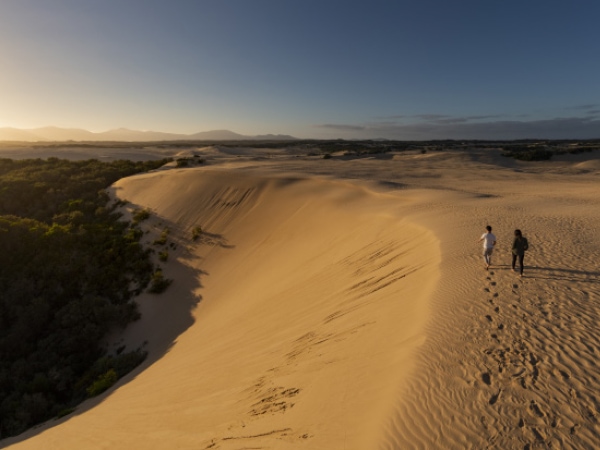
The Big Drift Wilsons Prom
The Big Drift… a landscape of vast and ever-shifting sand dunes.

A Pennicott cruise

Jump aboard one of Pennicott Wilderness Journeys’ amphibious yellow boats to explore the Prom’s rugged coastline and unique wildlife, venture to South Point and take in the granite monolith that is Skull Rock.

Hike to Sealers Cove

No roads lead to this picturesque cove, all sandy shores and forest fringed, so what better excuse to lace up your walking boots? Access to Sealers Cove is only possible via a 25km hike from Telegraph Saddle.

Marine national park

Wilsons Prom is home to Victoria’s largest marine protected area, with waters off the southern coast that harbour a fascinating world ripe for exploration by divers and snorkellers and rivalling the Great Barrier Reef.


Find more memorable things to do at Wilsons Prom here.
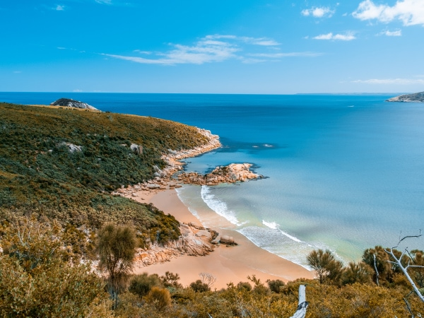
Wilsons Prom
A typical Wilsons Prom view of turquoise waters and golden sands.

Weekly travel news, experiences
insider tips, offers, and more.

Wildlife at Wilsons Prom

Wilsons Promontory is a refuge for native wildlife and a top whale-watching spot to boot.

Wombat

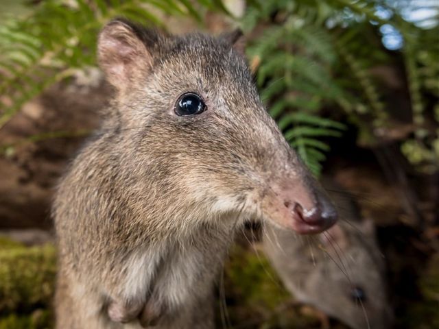
Visitors to Wilsons Prom will delight in seeing the typically reclusive wombat in the wild, and in fact, the portly marsupial can be quite bold and cheeky in its foraging for food at popular camping spot Tidal River; Parks Victoria advises storing food in your vehicle at night so as not to be woken by a furry intruder.

Whales

Tours run seasonally, typically from May to October with peak whale season usually from June to September.

Spot-tailed quoll

Part of a $23 million upgrade of the national park, a 10-kilometre predator-proof fence is being built across the isthmus at the entry to the Prom to create a 50,000-hectare sanctuary for vulnerable native species including the ground parrot, southern brown bandicoot and spot-tailed quoll.

Emu

The mighty emu is another fixture of Wilsons Prom and, while you may count yourself lucky enough to catch a glimpse of one on your travels around the park, up your chances by heading along on the short, sweet and appropriately named Prom Wildlife Walk, where you’ll also see other native wildlife including wallabies, roos and more wombats.

Access to Wilsons Prom

Wilsons Promontory is one of several national parks in Victoria that has free all-terrain wheelchairs; TrailRiders are available to hire so those with mobility limitations can enjoy and explore the wilderness including the views from the summit of Mt Oberon. The Prom, in fact, is one of three parks that offer the use of TrailRiders for going longer and steeper, and has beach wheelchairs too. See parks.vic.gov.au for more information.

Want to see more stories from Australian Traveller in your Google search results?

  1. Click here to set Australian Traveller as a preferred source.
  2. Tick the box next to "Australian Traveller". That's it.
Imogen Eveson
Imogen Eveson is Australian Traveller’s Print Editor. She was named Editor of the Year at the 2024 Mumbrella Publish Awards and in 2023, was awarded the Cruise Line Industry Association (CLIA) Australia’s Media Award. Before joining Australian Traveller Media as sub-editor in 2017, Imogen wrote for publications including Broadsheet, Russh and SilverKris. She launched her career in London, where she graduated with a BA Hons degree in fashion communication from world-renowned arts and design college Central Saint Martins. She is the author/designer of The Wapping Project on Paper, published by Black Dog Publishing in 2014. Growing up in Glastonbury, home to the largest music and performing arts festival in the world, instilled in Imogen a passion for cultural cross-pollination that finds perfect expression today in shaping Australia’s leading travel titles. Imogen regularly appears as a guest on radio travel segments, including ABC National Nightlife, and is invited to attend global travel expos such as IMM, ILTM, Further East and We Are Africa.
View profile and articles
hero media

The road trips and trails you need to experience in Victoria now

    Kellie Floyd Kellie Floyd
    Wind through fern tunnels, stop for a wine in a tram bar, or chase giant murals across the wheatbelt. These drives and rides prove Victoria’s best stories are found off the straight and narrow. 

    There’s something unmistakably Australian about a road trip: car packed, playlist on, landscapes shifting. Travelling down the highway toward Healesville, in Victoria’s Yarra Valley, the mountains rise, flanking me on both sides. I feel its embrace, a silent invitation to explore what lies beyond.  

    Moss-covered embankments rise on either side, and towering mountain ash trees form a green tunnel overhead. Road signs warn of wombats and cyclists but with giant ferns lining the roadside, the landscape feels prehistoric, as if a dinosaur might suddenly emerge. This, the Black Spur, is one of my favourite road trips. 

    The Black Spur 

    The Black Spur drive
    Through the forested canopy of The Black Spur drive that winds from Healesville to Narbethong. (Image: Neisha Breen)

    Location: Yarra Ranges
    Duration: 30 kilometres / 30 minutes 

    The Black Spur is short compared to other Victorian road trips, just 30 kilometres, stretching from Healesville to Narbethong. But what it lacks in distance, it makes up for in scenery. Just outside Healesville, Maroondah Dam offers bushwalks and scenic views. However, if pressed for time, Selover’s Lookout is an easy roadside stop offering uninterrupted views of the dam.  

    In Narbethong, close to the Marysville’s snowfield, is the Black Spur Inn, a charming double-storey brick hotel that’s been welcoming travellers since 1863. Here, diners cosy up by the roaring fire or gaze through the floor-to-ceiling windows, imagining horse-drawn coaches carrying hopeful gold seekers to the eastern goldfields.   

    Victoria’s Silo Art Trail 

    Silo Art Trail
    The Silo Art Trail in the Wimmera Mallee region. (Image: Visit Victoria/Anne Morely)

    Location: Various towns across the Wimmera Mallee region
    Duration: More than 200 kilometres / 4–5 hours but best over a minimum of three days  

    What began as a way to draw travellers back into town bypassed by highways – places such as Nullawil, Sea Lake and Patchewollock – has grown into a celebrated outdoor art movement. The Silo Art Trail now includes 23 silos, each transformed with large-scale mural portraits sharing local stories, celebrating community heroes, Indigenous history, farming life, or regional identity.  

    The Nullawil silo, for example, is a portrait of a local farmer in a chequered flannelette shirt alongside his loyal kelpie, painted by artist Sam Bates (AKA Smug). And the silos at Albacutya in the Grampians, painted by artist Kitt Bennett, depict her joyful memories of growing up in the countryside. Many of the murals sit right in the heart of small towns, such as Rochester and St Arnaud, making them perfect spots to pause for a country pub meal or something sweet from a local bakery.   

    Metung to Mallacoota  

    Gippsland lakes
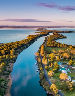
    Gippsland Lakes. (Image: Visit Victoria/Josie Withers)

    Location: Gippsland
    Duration: Approximately 220 kilometres / 4 hours  

    The Gippsland Lakes are a much-loved holiday spot in Victoria, but road-tripping further east reveals much more. Begin in Metung and time your visit with the monthly farmers’ market, or simply linger over lunch on the lawn of the Metung Hotel. Twenty minutes away is Lakes Entrance, where you can watch the fishing boats return with their catch. 

    Lakes Entrance
    Lakes Entrance. (Image: Visit Victoria/Iluminaire Pictures)

    Continue to Marlo, where the Snowy River spills into the sea, and Cape Conran for its many beaches and walks. If needing to stretch your legs, Croajingolong National Park is home to the historic Point Hicks Lighthouse and the Wilderness Coast Walk. Birdwatching and rainforest trails near Bemm River are worth a pit stop before arriving in Mallacoota, where the forest meets the sea. 

    Great Ocean Road 

    12 Apostles on the Great Ocean Road
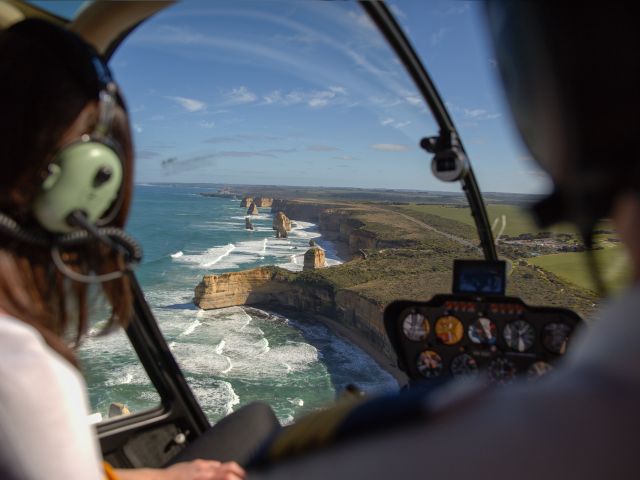
    The 12 Apostles on the Great Ocean Road. (Image: Tourism Australia/Two Palms/Harry Pope)

    Location: South-west Victoria, from Torquay to Allansford
    Duration: Approximately 250 kilometres / 4–5 hours but best over a minimum of three days  

    Victoria’s most famous road trip delivers it all: world-class surf breaks, rainforest walks, clifftop lookouts and wildlife encounters. The journey begins in Torquay, the state’s surf capital, then hugs the coast past Anglesea and Lorne to Apollo Bay, before curving inland through the lush rainforest of the Otways. Stop at Cape Otway Lightstation or take to the treetops at Otway Fly.  

    Between Cape Otway and Port Campbell lies the most photographed stretch – seven of the Twelve Apostles still standing, alongside the golden cliffs of Loch Ard Gorge. Further west, Warrnambool is a winter whale-watching hotspot, before the road winds to Port Fairy, a charming fishing village of whalers’ cottages, walking trails and offshore seal colonies further along the coast. 

    Bellarine Taste Trail 

    Terindah Estate
    Terindah Estate. (Image: Visit Victoria/Emily Godfrey)

    Location: Bellarine Peninsula
    Duration: Approximately 80 kilometres / 2–3 hours  

    The Bellarine Taste Trail is a feast for the senses, winding through coastal towns, past boutique wineries and artisan producers. It’s a choose-your-own-adventure style trail – simply grab a map and build your own delicious journey.  

    You might wander historic, seafront Queenscliff, sip wine in a converted tram bar at Terindah Estate, sample a locally distilled whisky at The Whiskery in Drydale or pick up a jar of honey at Wattle Grove in Wallington. Seafood lovers can head to Portarlington, famous for its mussels. Eat them fresh at local restaurants or head out on the water with Portarlington Mussel Tours. 

    O’Keefe Rail Trail – Bendigo to Heathcote 

    Pink Cliffs Reserve
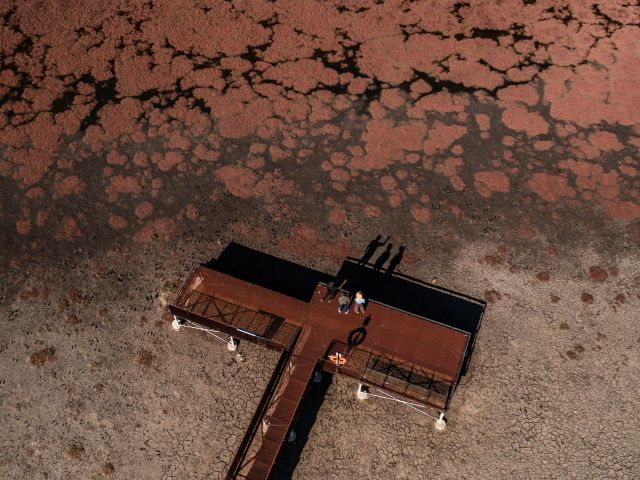
    Pink Cliffs Reserve in Heathcote can be seen on the O’Keefe Rail Trail. (Image: Visit Victoria/Emily Godfrey)

    Location: Central Victoria
    Duration: Approximately 50 kilometres / 4 hours cycling 

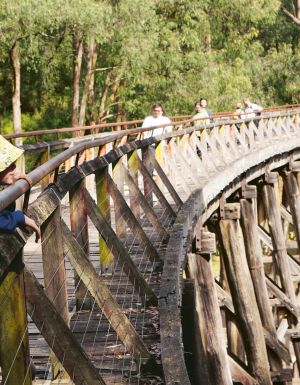
    Travellers first journeyed between Heathcote and Bendigo in 1888, when the railway line was built to link the towns. Trains stopped running in 1956, but today the route has a new life as the O’Keefe Rail Trail. The path is mostly level for easy riding, and along the way you’ll cycle past bushland, waterways and reserves. There are plenty of places to picnic, birdwatch, and if you’re lucky, spot a platypus.  

    The trail is well supported with water stations, bike repair points, shelters, and signage. Axedale makes a great halfway stop, with the pretty Campaspe River Reserve for a rest and local cafes for refuelling. Begin in Heathcote, known for its wineries and cafes, or in Bendigo, which is easily reached by train from Melbourne/Naarm. Shorter sections, such as Heathcote to Axedale, are also popular. 

    Goldfields Track – Ballarat to Bendigo 

    Location: Central Victoria
    Duration: Approximately 210 kilometres / 2–3 days cycling  

    The Goldfields Track traces a route once so rich in gold it made Melbourne one of the wealthiest cities in the world. Starting at Mt Buninyong, south of Ballarat, the trail leads mountain cyclists and walkers north through Creswick, Daylesford and Castlemaine before finishing in Bendigo. Along the way, you’ll encounter granite outcrops, eucalypt forests, rolling farmland and remnants of the region’s mining past.  

    As it passes through the lands of the Dja Dja Wurrung and Wadawurrung people, the track shares gold rush history and Indigenous stories brought to life by interpretive signs. Walk or ride the full trail or choose from one of its three distinct sections. With cosy stays, cafes and pubs, it’s easy to mix wilderness with comfort.