The entire 164km trail is walkable again for the first time since the 2024–25 season.
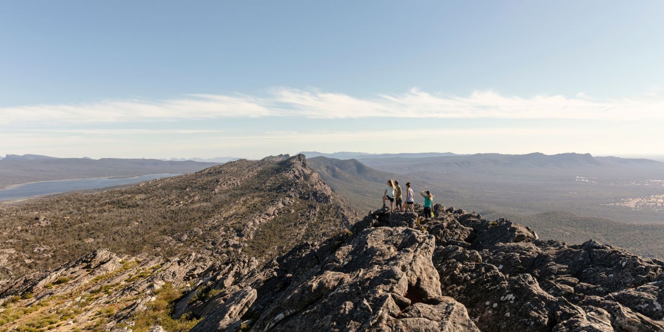
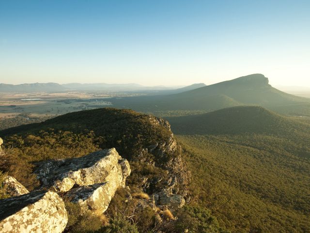
The Grampians Peaks Trail has fully reopened to hikers, marking the most significant milestone yet in the recovery of Grampians (Gariwerd) National Park following the devastating 2024–25 bushfire season.
Five hike-in campgrounds – Barri Yalug, Duwul, Durd Durd, Yarram and Wannon – reopened this month, joining the previously restored Bugiga campground to complete the Grampians Peaks Trail (GPT)’s full 164-kilometre route from Mount Zero (Mura Mura) in the north to Dunkeld in the south. It’s the first time the entire trail has been accessible since the fires swept through more than 135,000 hectares of the national park.
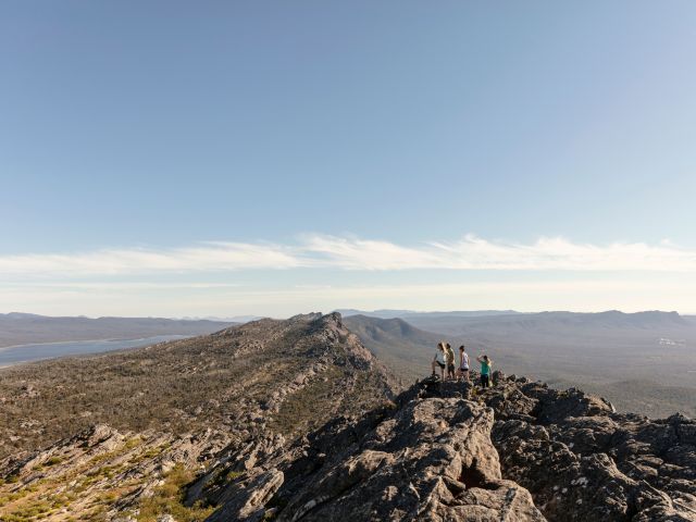
The full trail takes 13 days to complete. (Credit: Tourism Australia/Visit Victoria)
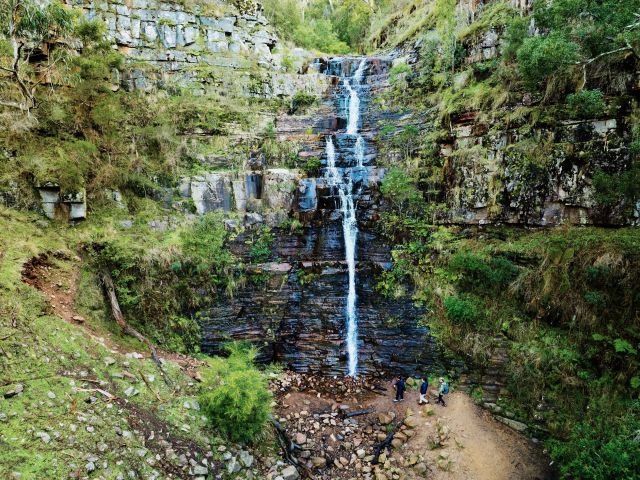
Most of the trail had reopened by July last year, but the remoteness and scale of damage to the central and southern sections meant overnight hiking remained off-limits while extensive repair works were underway. In total, six hike-in campgrounds were damaged, and large sections of track required rebuilding.
Recovery efforts have been supported by $36 million in funding from the Victorian and Commonwealth Governments.
Large sections of track required rebuilding. (Credit: Tourism Australia/Visit Victoria)
Around 100 stone steps were installed to manage steeper gradients. (Credit: Tourism Australia/Visit Victoria)
Parks Victoria recovery project officer, Kyle Hewitt, described arriving at a trail that had effectively vanished. “The post-fire inspections of the track quickly identified large sections which no longer had the cut-vegetation corridors which once guided people on their journey – it was like the track had disappeared," he said.
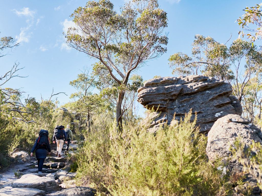
Works included stabilising and redefining approximately 20 kilometres of track, and around 100 stone steps were also installed to manage steeper gradients in what Hewitt describes as a now “fragile environment."
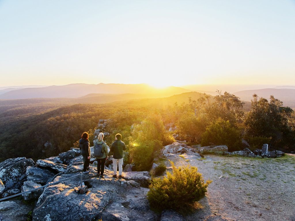
Mt Sturgeon (Wurgarri) is the final mountain of the journey. (Credit: Parks Victoria)
Of the affected campgrounds that reopened, Barri Yalug and Duwul sustained the most damage, though Hewitt noted that none were completely destroyed. Works included new timber tent pads, replacement water tanks and tank-landings, new windows at the Yarram shelter, and repairs to solar power systems. The remoteness of some sites required two helicopter sling-load operations to transport materials in and remove debris, while the Yarram shelter’s window height demanded professionally erected scaffolding reaching seven metres.
Nature, too, has been doing its own repairs. “There are lots of epicormic shoots coming back, and some of the ground cover has returned," Hewitt said – though shade remains scarce in the hardest-hit areas around Barri Yalug and Duwul.
Tick the box next to "Australian Traveller". That's it.
Emily Murphy is Australian Traveller's Email & Social Editor, and in her time at the company she has been instrumental in shaping its social media and email presence, and crafting compelling narratives that inspire others to explore Australia's vast landscapes. Her previous role was a journalist at Prime Creative Media and before that she was freelancing in publishing, content creation and digital marketing. When she's not creating scroll-stopping travel content, Em is a devoted 'bun mum' and enjoys spending her spare time by the sea, reading, binge-watching a good TV show and exploring Sydney's vibrant dining scene. Next on her Aussie travel wish list? Tasmania and The Kimberley.
A place of spectacular coastlines and rolling vineyards, the Mornington Peninsula is just an hour from Melbourne, yet feels like a world away.
Victoria’s Mornington Peninsula is often voted the number one short stay in Australia, and for good reason. From its beautiful coastline and scenic trails to exceptional food and wine, it’s the perfect escape any time of year, but especially as the weather grows cooler.
Picture afternoons relaxing in the soul-warming hot springs. Evenings by a cosy fireplace, sipping one of the region’s renowned Pinot Noirs and tucking into a delicious meal made from local produce. Now stop imagining, and start planning; here’s why the Mornington Peninsula should be your next long weekend adventure.
1. It’s easy to get to
Spend a long weekend on the Mornington Peninsula. (Image: CMcConville)
At only an hour’s drive southeast of the city, the Mornington Peninsula offers unbeatable convenience. If you’re taking the Eastlink tollway to Peninsula Link, look out for eclectic roadside artwork such as Callum Morton’s high-rise hotel (hint: you can’t check in).
2. The coastline is stunning
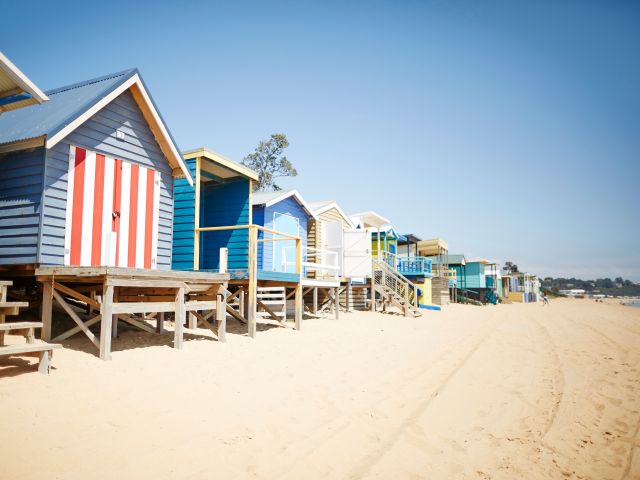
Stay in colourful, iconic beach huts along the coast.
The Mornington Peninsula separates Port Phillip Bay to its west and Western Port Bay to its east, making it the only place in Victoria you can see a sunrise over one bay and sunset over another.
Its spectacular coastline varies from sandy swimming and surf beaches to dramatic rocky cliffs. Mt Martha Beach, known for its colourful beach huts and calm clear waters, was named in Tourism Australia’s Top 10 beaches for 2026. Nearby, Arthurs Seat Eagle offers gondola rides to the peninsula’s highest point, where you can enjoy breathtaking vistas.
For a different perspective from the water, embark on a once-in-a-lifetime experience swimming with the bay’s resident dolphins, or catch a ride with Searoad Ferries from Sorrento to Queenscliff (the tip of the opposite Bellarine Peninsula). Pop into their new Sorrento terminal for sweeping views from its floor-to-ceiling windows and a bite to eat at Mediterranean restaurant ONDA.
3. Taste exceptional food and wine
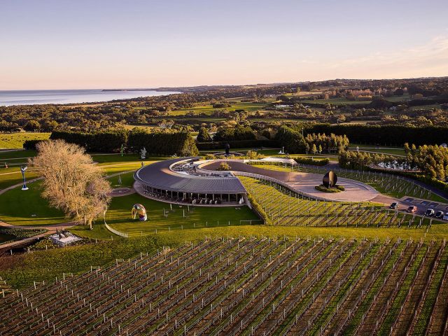
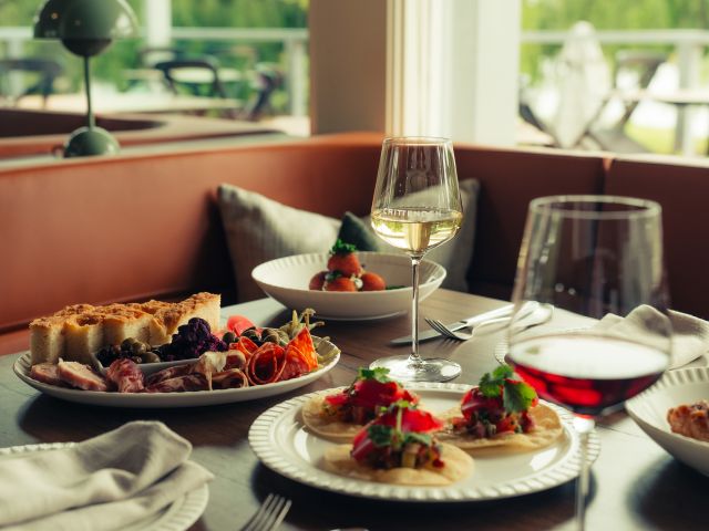
Treat yourself to the restaurant at Crittenden.
While the Mornington Peninsula is now synonymous with cool climate wines like Pinot Noir and Chardonnay, it was originally renowned for apple production. There are many orchards still in operation, like fifth-generation Mock Red Apple; taste craft ciders (the Mulled Spiced Cider is a must in winter), and don’t miss the famous apple pie.
Of course, it would almost be a sin not to dine at a winery restaurant, or at least try a local wine. Stop at Foxey’s Hangout for casual share plates and a glass of Chardonnay on the deck; or for a more formal affair, the light-filled restaurant at Paringa Estate offers a fine dining set menu on weekends, with picturesque estate views.
Pt. Leo Estate has no less than three separate dining experiences to choose from, ranging from a wine terrace to contemporary fine dining, all sourcing seasonal Victorian and local Mornington Peninsula produce, and offering stunning vistas over Western Port Bay.
And opened in 2025, the restaurant at Crittenden celebrates regional produce with a modern Australian menu that pairs beautifully with their sustainably crafted estate wines.
4. Plenty of ways to enjoy the great outdoors
Tee off at world-class golf courses with stunning coastal views.
The Red Hill Rail Trail follows the old railway line between Merricks and Red Hill, while the Bushrangers Bay Walking Track is the go-to trail for rugged coastal scenery, linking Cape Schanck and the Boneo Road picnic area (part of the longer Two Bays Trail).
The region is also home to several national parks providing plenty of opportunities to connect with nature, whether it’s a walk, picnic, or simply admiring the local flora and fauna. Golf lovers will rejoice with gorgeous courses such as the world-class Moonah Links or Flinders Golf Club, one of Victoria’s oldest golf courses.
5. Lean into wellness and relaxation
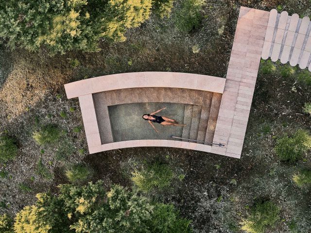
Unwind in mineral-rich hot springs and soak in total relaxation.
Soaking in one of the Mornington Peninsula’s mineral-rich hot springs is a must in the cooler months. Alba Thermal Springs and Spa is the newer addition, with 25 contemporary geothermal pools, a sauna and steam room set amongst elegant coastal landscaping. Book a Night Owl session to watch the sunset from the pools, and extend your visit with a spa treatment or dining at their restaurant.
Across the road, the Peninsula Hot Springs offers two main bathing areas, cafes and a spa in a natural bush setting. The Bath House comprises over 70 bathing and wellness experiences, including their iconic Hilltop Pool, a reflexology walk, and Nepalese mineral showers; while the Spa Dreaming Centre is a serene adults-only sanctuary.
6. Get a culture fix
Discover inspiring art across galleries and sculpture parks. (Image: Chris Conville)
Wander the Southern Hemisphere’s largest privately owned sculpture park at Pt. Leo Estate, glass of red in hand, or pop into the Mornington Peninsula Regional Gallery to view one of their seasonal exhibitions. Seawinds Garden is also home to a sculpture collection by William Ricketts, surrounded by exotic and indigenous gardens.
If you’re more of a history buff, book a tour of the Cape Schanck Lighthouse, or spend an afternoon at Point Nepean National Park. Here, you can explore walking trails through the traditional country of the Bunurong people, learn the history of the old Quarantine Station and discover military forts and tunnels.
7. Gorgeous accommodations
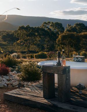
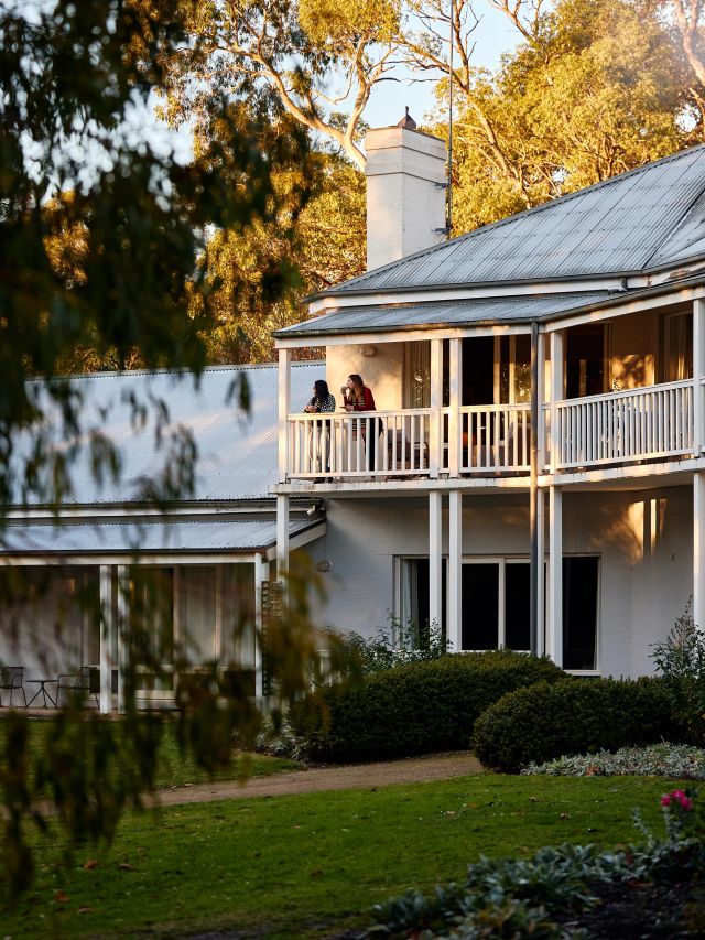
Check into Lancemore Lindenderry Red Hill.
The Mornington Peninsula’s standout accommodations are an experience in themselves. Escape to The Sanctuary at Alba Thermal Springs and Spa, a luxe retreat perched in the dunes above the springs. Or indulge in the dramatic luxury of Jackalope Hotel, home to a vine-facing pool and spa and the chef-hatted Doot Doot Doot.
For a dose of European country charm, stay at Lancemore Lindenderry Red Hill, set amongst lush gardens and vines with a cellar door and chef-hatted restaurant. Or for more contemporary, yet still charming, surroundings, the InterContinental Sorrento Mornington Peninsula is a historic hotel reimagined as a luxe coastal stay with European flair, including a pool deck and on-site bathhouse.