
Whether you’re looking for spectacular coastline or views of lush vineyards, these walking trails deliver the goods.
There is natural beauty to be found at every point on the Mornington Peninsula, and there’s no better way to enjoy it all than on a hike. Feel the mist from crashing waves on your face, discover historical landmarks and reward yourself with a glass of fine local wine when you reach your goal. These Mornington Peninsula walks vary from very easy to challenging and explore seaside towns, ocean cliffs and the interior of rolling paddocks, native bushland and undulating vineyards. So, lace up your walking shoes and hit the trail.
Mornington Peninsula’s West Coast Walks
Arthurs Seat Circuit Walk
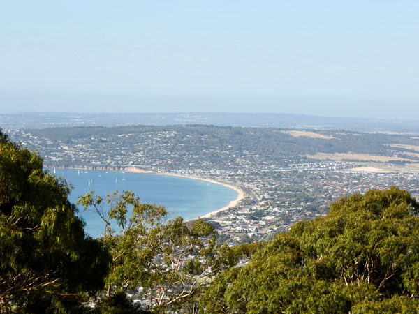
If you want to get one of the finest views on the Mornington Peninsula, this short circuit walk should be added to your itinerary. The summit of Arthurs Seat is 314 metres above sea level, but this simple stroll leaves from the Seawinds car park taking all the hard work out of it. From the various lookouts along Arthurs Seat Circuit Walk, you’ll get incredible vistas over the bay and, on a clear day, all the way back to Melbourne, the You Yangs and Mount Macedon. Bring a picnic along and find a spot in Seawinds Garden, planted by Sir Thomas and Lady Travers in the 1940s. In spring, it’s full of blooms, while the deciduous trees change colour in autumn.
Distance: 1.8km
Time: 1 hour
Difficulty: Grade 1 = all abilities, no hiking experience required
Terrain: Formed track with some steps and a short steep section.
Tips: This is part of the 26km Two Bays Trail if you want to stretch it out to a proper hike.
Must-see sights: At Seawinds Gardens, check out the William Ricketts sculptures of Indigenous people, with whom he spent a great deal of time in the 1930s and 40s.
Capel Sound Bay Trail
Even on a hot day, this walk along the shoreline from Chinamans Creek through the Capel Sound camping grounds and along the Rye foreshore is a great bet. When you hit the Capel Sound Bay Trail, strip down to your swimsuit and go for a splash or grab some lunch and find a shady picnic spot where you can enjoy the bay views. There are lots of cafes and boutiques in the shopping strips across the road, so you might want to take advantage of that on the way back.
Distance: 4km (one way)
Time: 2 hours
Difficulty: Grade 1
Terrain: Flat asphalt pathway shared by walkers and cyclists.
Tips: Make this the perfect beach walk by ordering fish and chips from Hector’s Seafoods in Rye to fuel up.
Must-see sights: You’ll see some of the peninsula’s colourful bathing boxes on this walk.
Sorrento to Portsea Bay Trail
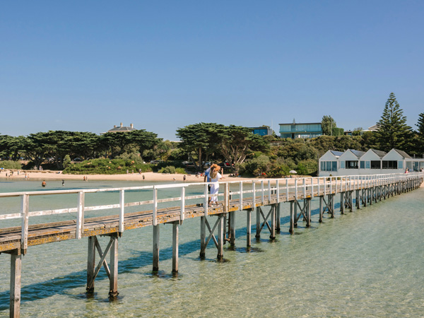
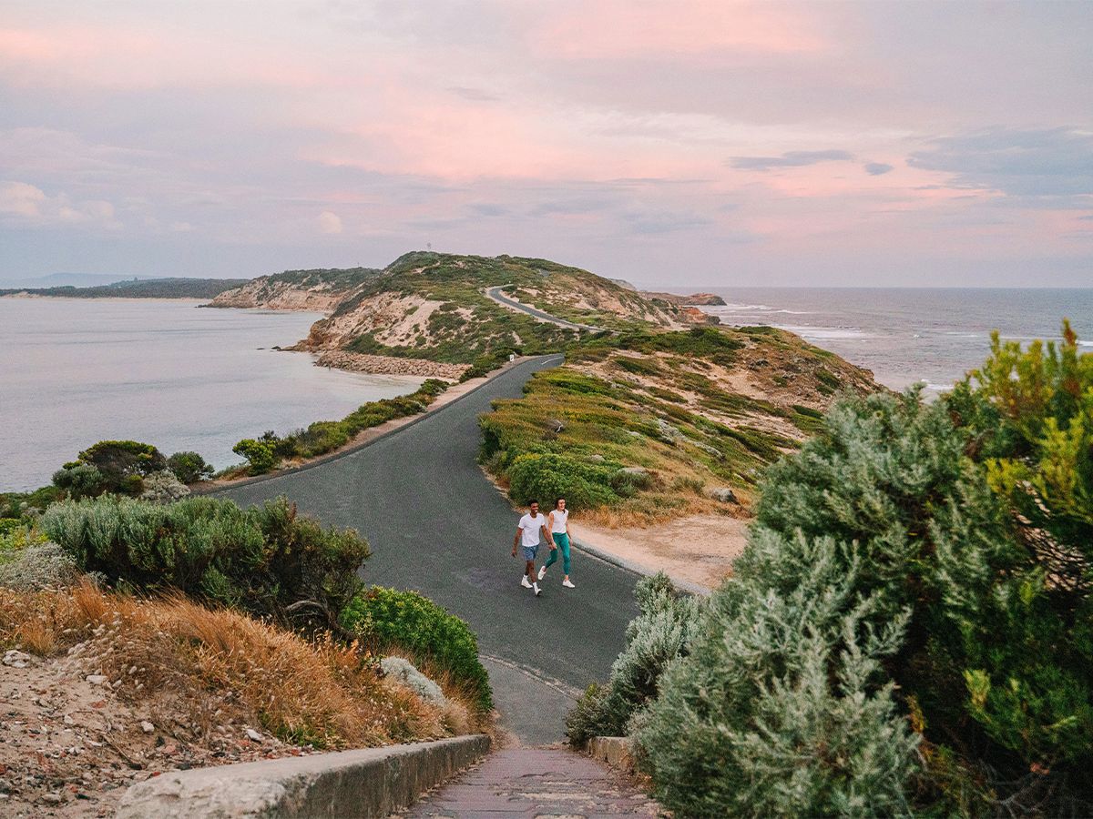
Want to see how the other half live? Just take a short diversion off the Sorrento to Portsea Bay Trail that begins at Sorrento Pier and you’ll be strolling Millionaire’s Walk, where some of the peninsula’s grandest and most expensive houses overlook the water. This is a picturesque walk that ends near the village of Portsea and the entrance of Point Nepean National Park.
Distance: 5km one way
Time: 1.5 hours
Difficulty: Grade 1
Terrain: Pathway shared with cyclists.
Tips: Extend your walk into the national park or reward yourself for your efforts with a cold beer at the Portsea Hotel.
Must-see sights: Along here is the Sorrento–Portsea Artists’ Trail, so look for the reproductions of paintings created along this coastline by famous Australian artists.
Point Nepean Walk
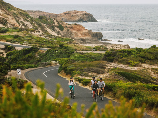
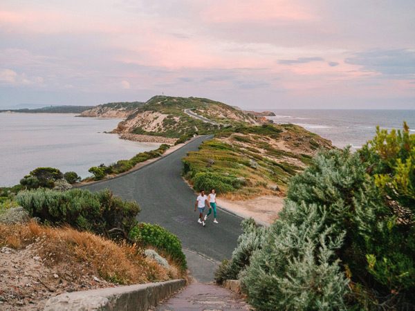
The farthest tip of the Mornington Peninsula is covered by Point Nepean National Park, and it is a great place to stretch those legs. The Point Nepean Walk explores the traditional land of the Bunurong People, who lived on this land for more than 35,000 years. When this trail, which is a circuit for much of its length, hits the coastline look for the shell middens left behind.
There’s plenty of history from early colonisation too, with a quarantine station, military defences and a cemetery to be found at various points. Many of these spots are accessible by car, but further along you’ll find yourself following bush and coastal tracks with few people around. Once you get to the end – and Point Nepean – you might see cruise ships or freighters while you look across the treacherous stretch of water to the Bellarine Peninsula.
Distance: 14.5km
Time: 4–5 hours
Difficulty: Grade 3 = suitable for most ages and fitness levels. May have short steep sections, rough surfaces and natural steps.
Terrain: A mainly formed path, although there is some road walking, sandy trails, hills and steps around the historical sites.
Tips: Make sure you give yourself plenty of time to do this walk, particularly if you’re a history buff. There are 50 preserved buildings making up the Point Nepean Quarantine Station that operated here between 1852 and 1980. It’s also been used for military training and housed Kosovar refugees in the 1990s.
Must-see sights: Take a detour along the Cheviot Hill Walking Trail and check out the beach where Prime Minister Harold Holt disappeared in 1967. Cheviot Hill is the highest point in the national park and is home to some World War II fortifications. About 500m away, there’s a memorial dedicated to Holt.
Need tips, more detail or itinerary ideas tailored to you? Ask AT.
AI Prompt
Central Mornington Peninsula Walks
Somerville Trail
The Western Port Bay Trail starts at Somerville and goes all the way through to Balnarring, 27km away. If you haven’t got the time or energy to tackle that, instead take the Somerville Trail, which starts in the town of the same name, with its cafes and shops. Follow it as it runs parallel to the old railway line through the town of Tyabb and finish up at Graydens Road in Hastings. While you pass through some Mornington Peninsula towns, there’s plenty of bush and grassland to bring you back to nature.
Distance: 8km
Time: At least 2 hours
Difficulty: Grade 1
Terrain: Mostly a concrete or bitumen trail with some gravel sections and a few road crossings.
Tips: If you’ve got your pooch with you, be sure to stop at Miss Drew’s Bakery & Dog Cafe in Tyabb, which serves up pupacinos, dog beer, pawty cakes and meat muffins.
Must-see sights: If you’re into antiques, make sure you leave enough time to explore the vintage stores clustered near the corner of Frankston–Flinders Road and Tyabb Road.
Two Bays Walk
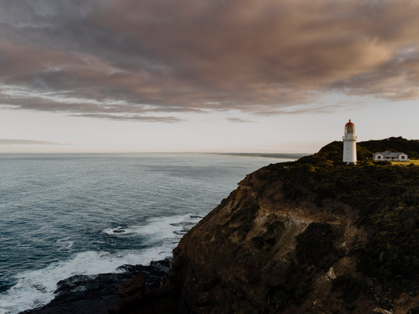
The Two Bays Walking Track might start at Dromana, on the Port Phillip Bay side of the peninsula, but it goes all the way to the Cape Schanck, overlooking Bass Strait. There is plenty of uphill action as you leave the starting point at McRae on Point Nepean Road and head to Arthurs Seat. You’ll traverse state park before arriving in the back streets of Rosebud. Then it’s on to Greens Bush before you hit the coast on the Bass Strait side of the island at Bushrangers Bay and finally make your way to the end point at Cape Schanck Lighthouse. During your day of walking, you’ll have seen the best of the Mornington Peninsula: both coasts, remnant bushland and green fields and vineyards.
Distance: 28km
Time: 8 hours
Difficulty: Grade 3
Terrain: This trail, the longest continuous walking track on the Mornington Peninsula, traverses various terrains: it’s grassy and undulating as you cross Greens Bush, but as you’re heading to Arthurs Seat it’s steep and gravelly.
Tips: Follow the signs with a blue wren on them.
Must-see sights: The basalt coastline at Bushrangers Bay is some of the most beautiful in Victoria. Waves explode on the rocky headlands, but at low tide there are incredible tidal pools, especially around the base of Elephant Rock. While the ocean can be fierce here, these pools are calm and clear and perfect for a cooling dip.
Red Hill to Merricks Trail
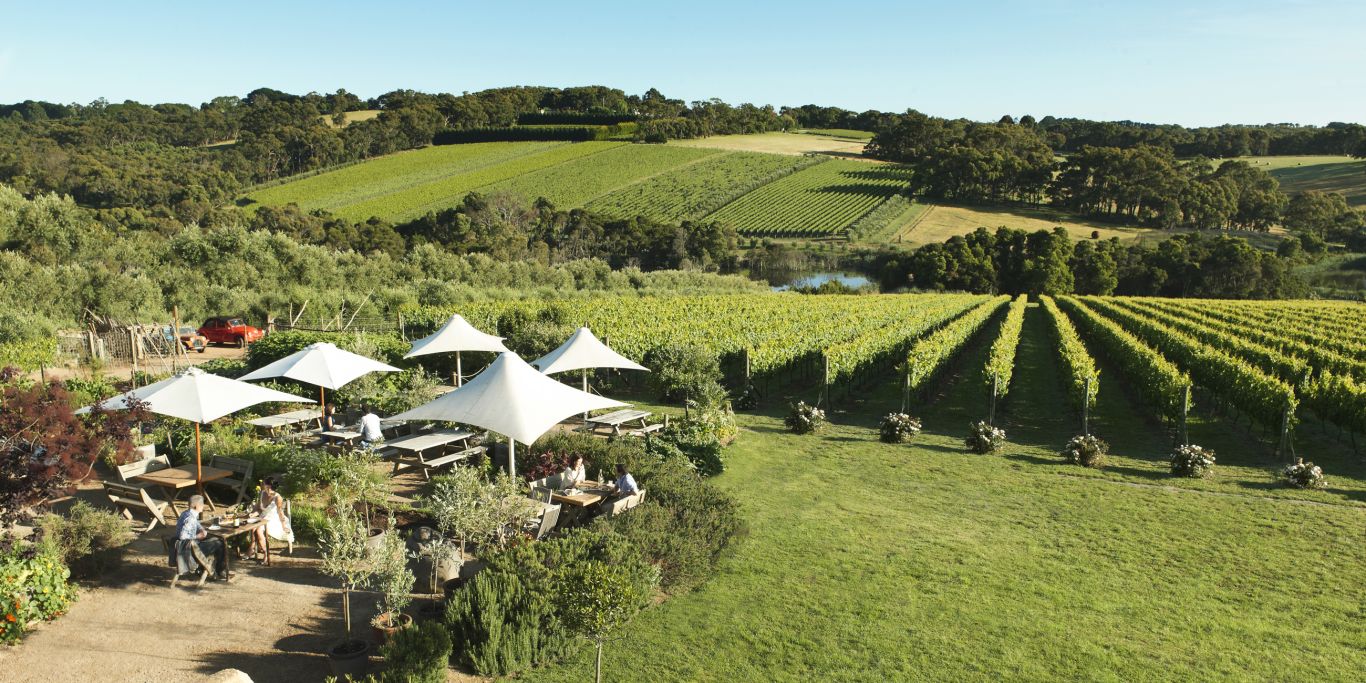
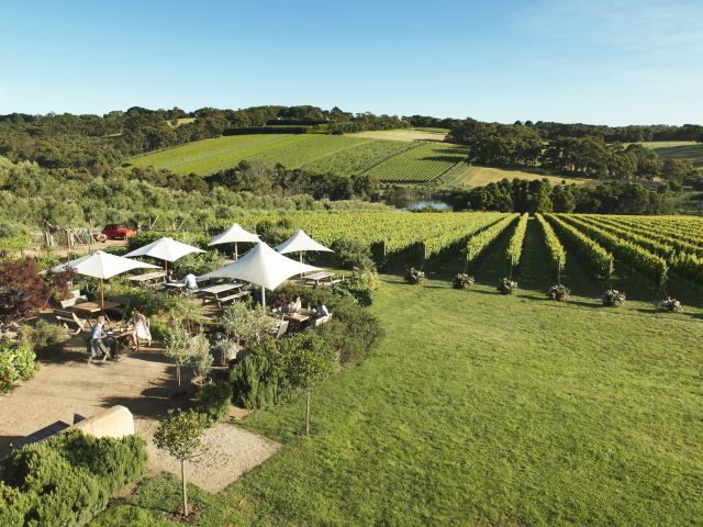
The Red Hill to Merricks Trail follows the old railway line (one of Victoria’s many popular rail trails) that once joined up the townships of the Mornington Peninsula and carried local produce, such as apples, strawberries and pears, to the markets in Melbourne. You are smack-bang in the middle of wine country here, and you’ll catch views of rolling vineyards and lush pastures as you stroll through rows of towering eucalypts and pine trees. Along the way, there are plenty of vantage points from where you can look out over Western Port Bay. The best part? Once you’re done, you can pull up a seat at Merricks General Store and replenish with a dish from the seasonal menu. It also has an excellent selection of local wines by the glass if seeing all those vineyards along the way has turned your thoughts to matters vinous.
Distance: 6km
Time: 1.5 hours
Difficulty: Grade 1 – it’s mostly flat or downhill if you start at Red Hill.
Terrain: A trail shared with other walkers (many with dogs), cyclists and horse riders.
Tips: If you want a more challenging walk, do it in the opposite direction and feel the uphill burn.
Must-see sights: Take a moment at the top of the final descent into Merricks. On a clear day, you can see all the way to Phillip Island and the Nobbies.
Baldry’s Circuit
It might be one of the lesser-known walks on the Mornington Peninsula, but a gentle stroll through the forest on Baldry’s Circuit is the perfect way to reacquaint yourself with the joys of nature. Set in Mornington Peninsula National Park, not far from the town of Main Ridge, this track follows Main Creek through an area known as Greens Bush. You’ll find yourself walking through impressive forests of peppermint, messmate and manna gum before heading deeper into the forest. Here, your constant companion will be the babbling creek that makes its way through lush fern gullies deep in the woodland.
Distance: 3.6km
Time: 1 hour
Difficulty: Grade 2 = suitable for families. May have gentle hills and occasional steps.
Terrain: A well-formed track with some steps and creek crossings.
Tips: There’s a shorter circuit of only 1.6km if you’ve got kids with you or are after a quicker walk.
Must-see sights: This is the place to see wildlife, so walk quietly and look for rosellas, kookaburras and cockatoos in the trees, kangaroos grazing, echidnas foraging in the undergrowth or a koala sitting in the fork of a tree.
Weekly travel news, experiences
insider tips, offers, and more.
Mornington Peninsula’s East Coast Walks
Flinders Blowhole Walking Track
While this walk isn’t going to improve your fitness, it’s worth checking out the Flinders Blowhole Walking Track if you want to get close to the rocky cliffs and breaking waves of Bass Strait. When you get to the end of the track, look to the right and you’ll see the sea shooting up through the blowhole at the end of Elephant Rock. To the right is Little Bird Rock, a resting place for different varieties of sea birds. If you turn your eyes to the sky, you might even see sea eagles soaring overhead. This is a great spot for photographers, whether into capturing landscapes or wildlife.
Distance: 200m
Time: 20 minutes
Difficulty: Grade 1
Terrain: Well-made track, boardwalk and stairs.
Tips: Watch out for sea swells and slippery rocks if exploring the blowhole.
Must-see sights: The blowhole, of course.
Bridgewater Bay to Diamond Bay
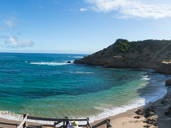
It’s all about the spectacular views of crashing waves and long stretches of sand on the Bridgewater Bay to Diamond Bay section of the much longer (30km) Coastal Walk. This part follows the old Lifesaving Track, established in the 1890s after two devastating shipwrecks to provide better access to the coast. There are 16 points along here that were used to launch rescue operations when a ship was in distress. The track veers inland for a short distance before coming back to Dimmicks Beach and heading along the clifftop track. Down on the beach, look for hooded plovers and sooty oystercatchers on the sand. Up on the clifftop, you’ll have excellent views in both directions along the coast.
Distance: 5km
Time: 1.5 hours
Difficulty: Grade 2
Terrain: You’ll walk along a path, but there are some ascents and descents from the beaches to the cliffs.
Tips: Endangered hooded plovers nest on the sand between August and April. Apart from taking great care not to disturb them, look for the tiny wooden huts where chicks hide away from predators.
Must-see sights: You’ll likely be gobsmacked by the overall majesty of the swelling ocean and rugged headlands, but bring your focus in at Pearses Beach, where low tide reveals little pockets of captured seawater perfect for rock pooling.
The Coastal Walk
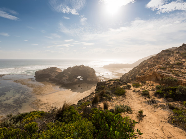
For those who want to see the best of the Mornington Peninsula in a single day, the Coastal Walk can’t be beaten. You’ll stride through bushland accompanied by the sound of twittering native birds, follow the edges of clifftops with waves crashing below, and trek across pristine beaches. If it’s a hot day and you feel like a dip, take the steps down to Diamond Bay, a protected cove that’s popular with the locals. By now, you’re right near the narrowest section of the peninsula, home to both the Sorrento and Portsea ocean beaches. If the tide is low, you can follow the beach around to London Bridge or hit the Farnsworth Track section of the walk that takes you through coastal vegetation to a couple of high points offering up final views of windswept beaches and Bass Strait.
Distance: 30km
Time: 8 hours, although some hikers do split this into a two-day walk
Difficulty: Grade 4 = suitable for experienced hikers. Trails may be long, rough and steep, with some rock scrambling or river crossings.
Terrain: The trail has some uneven surfaces, including gravel tracks and sandy beaches, and steep sections.
Tips: You can walk the track in either direction but starting at Cape Schanck offers incredible views along the length of the Bass Strait coast.
Must-see sights: When the tide is going out, the rock shelves off Number 16 Beach turn into mini waterfalls as the water rushes off them. It’s also the best time to photograph Dragon Head Rock.
Want to see more stories from Australian Traveller in your Google search results?
- Click here to set Australian Traveller as a preferred source.
- Tick the box next to "Australian Traveller". That's it.