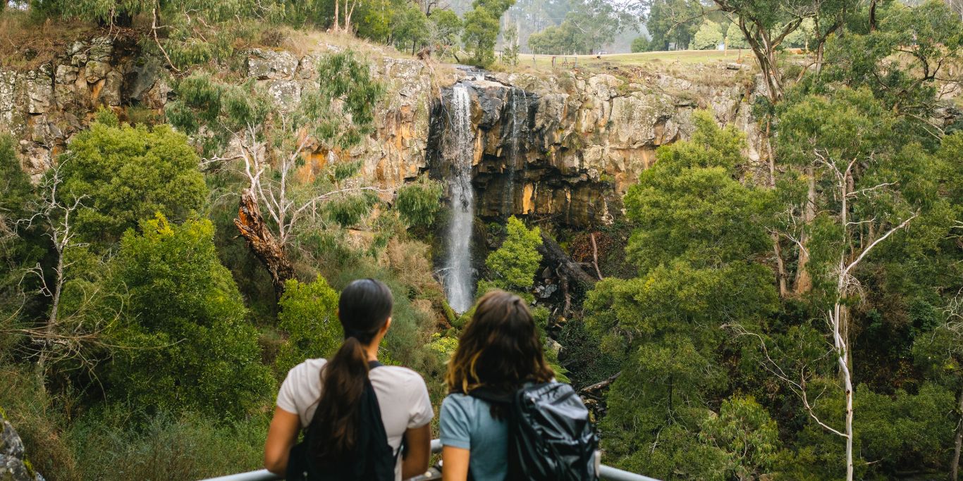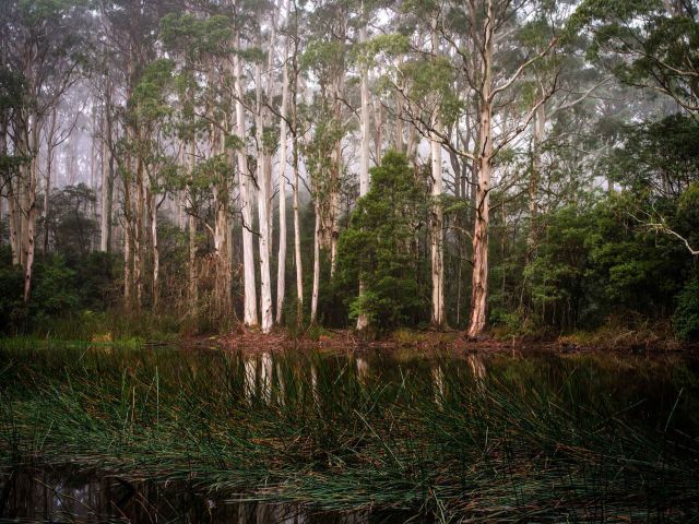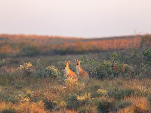
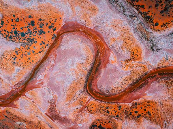
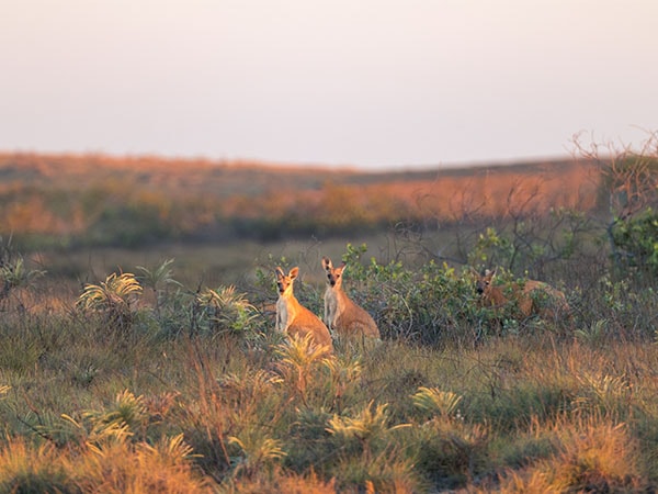
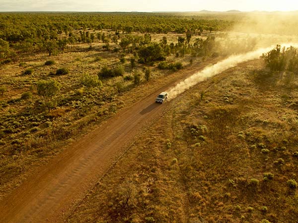
Take a journey into the vast, red heart of Australia and discover the magic of the outback.
Here are seven of Australia’s best outback road trips to inspire you from our special 100 Amazing Road Trips around Australia series.
Outback road trips
- Golden Quest Discovery Trail, WA
- Broken Hill via White Cliffs, NSW
- Kings Canyon to Uluru, NT
- The Warlu Way, WA
- The Savannah Way
- The Canning Stock Route, WA
- The Golden Pipeline Heritage Trail, WA
23. Golden Quest Discovery Trail, WA
All up, there are 25 official stops dotted along the Golden Quest Discovery Trail in Western Australia, which provides a rewarding exploration of a region rich in gold rush history.
You can complete the trail at a leisurely pace over six days and start your journey at any one of the recommended stopping points. And while the self-drive adventure can be undertaken in a 2WD vehicle, a 4WD is recommended. Note: distances are route-dependent.
Day One: Coolgardie to Menzies (180km)
Take up the trail in Coolgardie, seven hours’ drive east of Perth, which, in its heyday, was the unofficial capital of the Eastern Goldfields and where thousands of gold miners came to seek their fortune.
Visit the Goldfields Exhibition Museum, which has one of WA’s largest antique bottle collections before making your way to Menzies, passing the famous Golden Pipeline as well as old grave sites, ghost towns and mine shafts.
Day Two: Menzies to Kookynie (142km)
Start the day with a stroll around the tombstones of Menzies Cemetery, where tales of the town’s gold mining history are etched in stone before heading for the gold rush ghost town of Kookynie.
Enjoy a bevvie with some of the local characters (including Willie the horse) who congregate at the rustic Grand Hotel, and visit the Old Miner’s Cottage, said to be the town’s last timber and iron building still standing from the turn of the 20th century. It’s also worth the hour-long detour to Niagara Dam for a refreshing swim.
Day Three: Kookynie to Laverton (230km)
Experience a cultural tour around Lake Ballard with Indigenous guide Linden Brownley from Bush Ghoodhu Wongutha Tours before heading to Laverton, a region that has many sites of significance to the Wongutha or Wankatja people, the Traditional Owners of the land.
Along the way you will see the abandoned township of Malcolm, pass by landscapes of flat mulga and saltbush and the lonely graves of prospectors. When in Laverton, visit the Outback Gallery, known for its Aboriginal art, and enjoy some pub grub at the Desert Inn Hotel.
Day Four: Laverton to Leonora (124km)
The landscape from Laverton to Leonora changes from the flora of the acacia woodlands to a rugged desert landscape stubbled with tufts of spinifex and groves of marble gums.
Visit the ghost town of Gwalia, which is like a time capsule from the gold-mining era, and Malcolm Dam for its bird watching and natural beauty.
Book a room at historic Hoover House designed in 1897 by young mining manager Herbert Hoover, who went on to become the 31st president of the United States.
Day Five: Leonora to Lake Ballard (160km)
Get up before dawn to make the one-hour road trip to Granite Creek where you can watch the sky bruise purple and blue around the edges.
This ancient rocky watercourse lined with river gums is a pleasant place for a breakfast picnic before heading another 50 minutes down the road to Copperfield, which was once a major mining community.
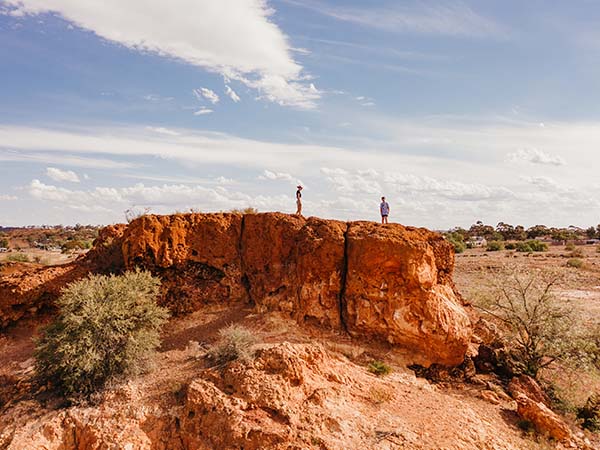
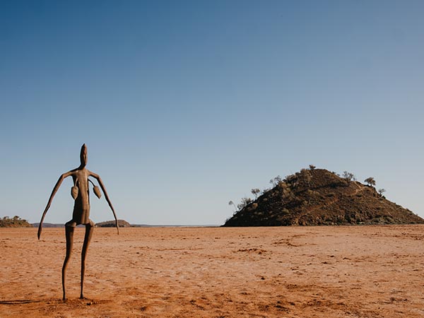
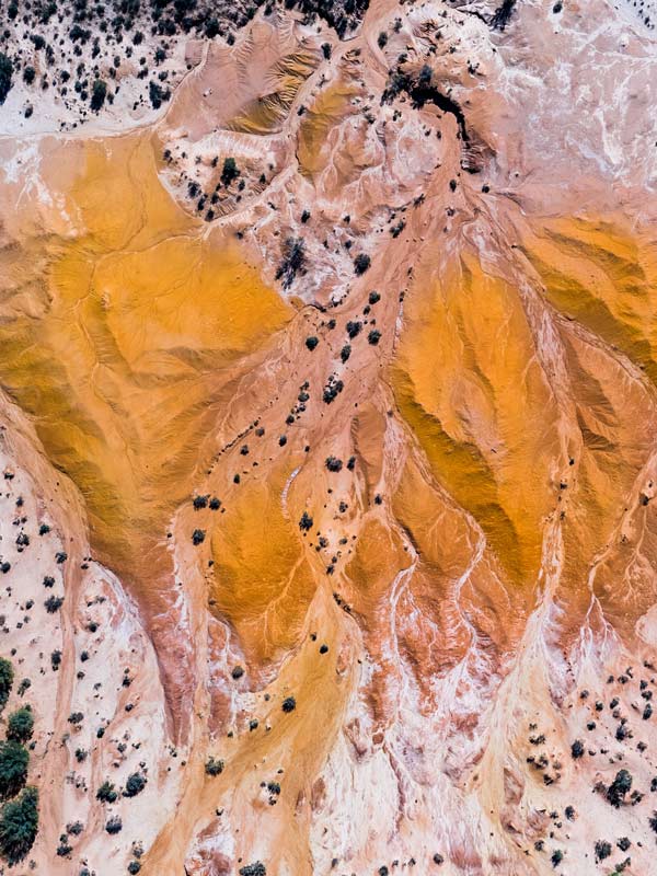
A highlight of the trail has to be Lake Ballard, where 51 metal sculptures by British artist Antony Gormley stand, dotted along the shimmering surface of the vast salt lake.
Day Six: Lake Ballard to Kalgoorlie-Boulder (253km)
From Lake Ballard, it’s about an hour and 15 minutes to Davyhurst, another abandoned mining town inhabited by ghosts of the gold rush. It will take about two more hours to get to Broad Arrow Tavern, known for its famous Broady Burger.
It’s a further 31 kilometres to Kalgoorlie-Boulder, where you will find Australia’s only legalised two-up shed and the end of the Golden Quest Discovery Trail.
Words by Carla Grossetti
24. Broken Hill via White Cliffs, NSW
The direct route between the NSW towns of White Cliffs and Broken Hill takes just under three hours along the Barrier Highway, but you can amp up the outback by packing in some diversions and going the long way round.
White Cliffs
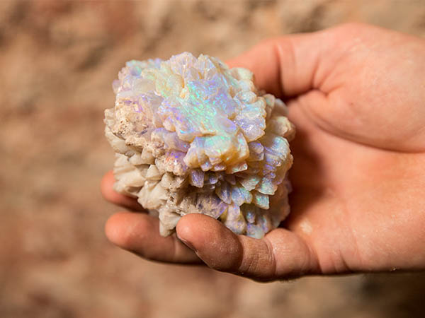
Before departing White Cliffs, you will want to take a Red Earth Opal Mine Tour to wonder at the gently shimmering hues of the opals that proliferate here (White Cliffs is Australia’s oldest commercial opal field) and learn about the ancient history of the Barkandji peoples at Mutawintji National Park (a four-hour return drive to the north-west of the town).
Wilcannia
Then set forth for Broken Hill along the Opal Miners Way via Wilcannia, another of the state’s quintessential outback outposts.
It takes less than an hour to reach this town, with its proud historic buildings and proximity to the Darling River (take the River Walk to stretch your legs).
Broken Hill
From here it’s another two hours to Broken Hill, where Broken Hill Outback Resorts’ deluxe cabins are the perfect base for exploring.
Distance:
329 kilometres via Wilcannia.
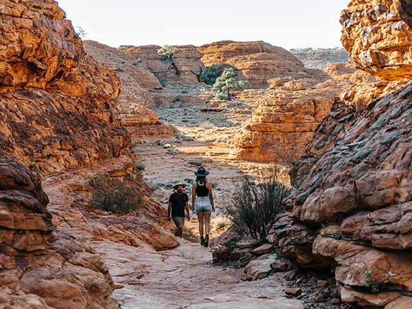
25. Kings Canyon to Uluru, NT
While flying into Kings Canyon’s red-dirt airstrip in the heart of the Northern Territory’s Red Centre affords jaw-dropping aerial views of the arid, russet-toned landscape, opt to leave the dramatic surrounds by road to take in the outback vistas – and the unique experiences it offers – at closer quarters.
The journey from Watarrka National Park to Uluru charts a roughly 325-kilometre course along Luritja Road and the Lasseter Highway, traversing a relentlessly flat landscape that is punctuated with low, tawny scrub that merges with infinite blue skies at the always-elusive horizon.
Departing Kings Canyon
If setting off from Kings Canyon Resort, take the time to visit Karrke Aboriginal Cultural Experience & Tours (34 kilometres along the Luritja Road), owned and operated by Christine Breaden and Peter Abbott who live on the land of their ancestors in the small Aboriginal Community of Wanmarra (population 10) and proudly preserve and maintain their Luritja and Pertame (Southern Aranda) language.
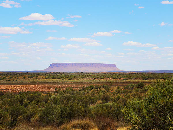
Curtain Springs Station to Mt Conner (Atila/Artilla)
Another 182 kilometres down the road, the roadhouse at the 405,000-hectare Curtain Springs Station (which narrowly avoided being called Stalin Springs in the 1940s in honour of the despotic Russian leader after the then owner’s son objected; they named it after Prime Minister John Curtin instead) is a timely stop to stock up on drinks and use the facilities (signs point out toilets for the blokes and sheilas ) before continuing on to take in the behemoth form of Mt Conner (Atila/Artilla), known as Fooluru due to its habit of foxing uninformed tourists, and the shimmering white expanse of Lake Amadeus.
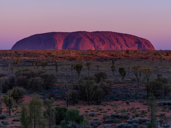
Uluru
The last leg of the drive to Uluru takes just under two hours, delivering you to one of the world’s true wonders at the end of a truly wondrous journey.
Stay:
In the Dreamtime Escarpment luxury tents at Kings Creek Station near Kings Canyon and Longitude 131° overlooking Uluru for bookended luxury.
26. The Warlu Way
The geography of the Warlu Way is as photogenic as it is diverse. And steeped in culture. Discover the Dreamtime legend of the Warlu, a sea serpent said to have snaked its way through the Pilbara region of Australia’s North West, carving out the epic landscape you’ll trace along any iteration of this magical journey.
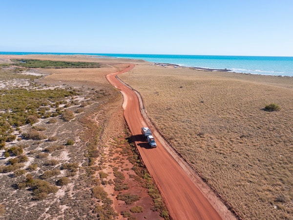
Explore the ancient landscape linking Broome with Exmouth through coastal and inland sections, and along the Manuwarra Red Dog Highway and East Pilbara Geoheritage Route, where you’ll see towering rock faces, wild coastlines, stunning sunsets, plunging gorges, soaring red ranges and sapphire seas and views that stretch on forever.
Download the free Warlu Way travel app so you can choose between one of the self-drive itineraries that allow for either a return trip or a one-way adventure.
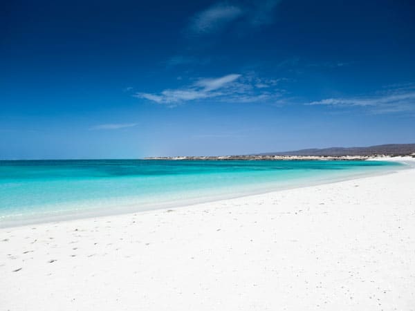
Eighty Mile Beach, Mackerel Islands & Murujuga National Park
You could spend an entire day sifting sand through your toes at Eighty Mile Beach or the Mackerel Islands, exploring the ancient Aboriginal rock art of the Pilbara region in Murujuga National Park (which has more than 1 million petroglyphs), or kayaking in the blue-green waters of Nhanggangunha (Deep Reach Pool), where the spirit serpent is said to live.
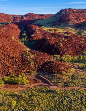
Karijini National Park
Carve off to Karijini National Park to see hidden waterholes and gorges as gnarled and weathered as time amid one of the oldest landscapes on the planet.
The park lies at the heart of the Warlu Way, where the Yindjibarndi have roamed for thousands of years. Fans of the film Red Dog should detour to Dampier to snap a selfie in front of the statue dedicated to the kelpie that travelled across the Pilbara and inspired a movie of the same name.
Distance:
The Warlu Way is almost 3000 kilometres in full and can also be explored in sections via its four interconnected routes.
Stay:
Words by Carla Grossetti
27. The Savannah Way
Perhaps the country’s ultimate adventure drive, The Savannah Way is an unparalleled opportunity to get to grips with the beauty, diversity and magnitude of northern Australia.
Beginning in Broome and ending in Cairns, this 3700-kilometre coast-to-coast route charts a course between the red sands of WA’s mystical Kimberley and the dazzling blue-greens of Queensland’s Tropical North, via majestic savannahs and the big vistas of the NT’s Top End.
To complete the whole journey in full can take upwards of three weeks, but it can also be tackled in – somewhat – more bite-sized portions, such as the 1700-kilometre leg between the Cairns and Boodjamulla (Lawn Hill) National Park near the NT border.
Stay:
Camp in some of Australia’s most magnificent national parks, such as Nitmiluk.
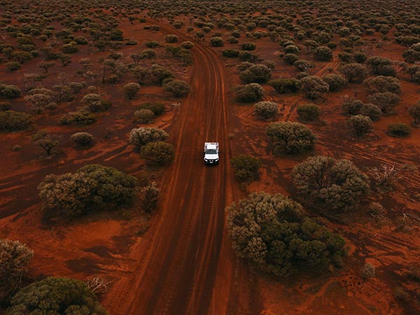
28. The Canning Stock Route, WA
The Canning Stock Route is an iconic track that extends from Halls Creek in the Kimberley region of Western Australia to Wiluna in the Mid West.
As well as being the longest historic stock route in the world, the trail offers the opportunity for an extraordinary adventure, slicing through narrow gorges, sheer cliffs, ancient Aboriginal rock art sites and engravings left by early explorers and drovers.
Built in 1910, the route is a ragged ochre ribbon that follows in the footsteps of the East Kimberley drovers for whom the track was created. The cattlemen were looking for an alternative way to move their cattle south in order to break the West Kimberley beef monopoly.
Although you can go it alone, the most comfortable way to explore the track is with Outback Spirit, an Australian company with decades of experience guiding visitors through this raw and rugged terrain.
The stock route crosses the Gibson, Great Sandy, Little Sandy and Tanami deserts and while the cattle are now long gone, the stockmen’s history has been preserved due to the extreme isolation. The track, blessed as it is with stunning landscapes, is one of the most iconic 4WD drives in the country.
Distance:
1850 kilometres one way.
Stay:
In a desert safari tent under the stars on an Outback Spirit tour.
Words by Carla Grossetti
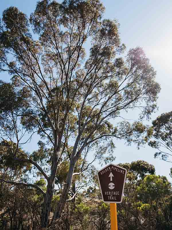
29. The Golden Pipeline Heritage Trail, WA
The Golden Pipeline is a self-guided trail that spaghettis between the Perth Hills and WA’s Eastern Goldfields.
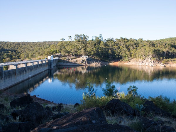
Follow the waterway as it squiggles its way from Mundaring Weir to Mt Charlotte, and from forested hills to the red dirt of the state’s goldfields, and you will learn about the ambitious scheme to pump water higher and further than had ever been done at the end of the 19th century.
As well as being historically significant, the Goldfields Water Supply Scheme is regarded as an engineering marvel. It has been pumping water through a steel pipeline to its destination some 560 kilometres east for more than a century, and it’s predicted it will continue to do so for another (golden) century.
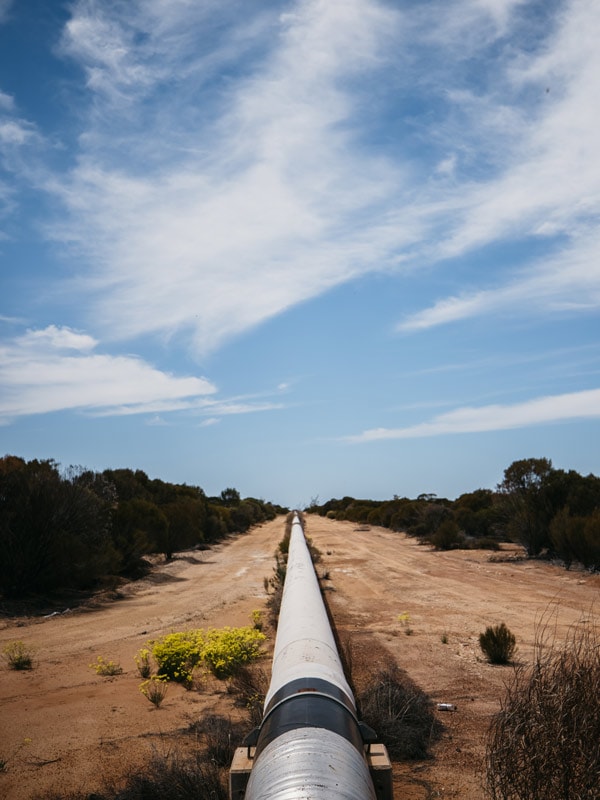
The Golden Pipeline, a National Trust WA project, honours the work of civic engineer CY O’Connor who was responsible for creating major public works during the 1890s that stimulated the development of WA. The fact that this water supply scheme still functions effectively to this day is a testament to his skills.
The scheme came about due to the fact water was scarce in the goldfields following discovery of the precious metal in Coolgardie in 1892, then Kalgoorlie in 1893.
While some of the pump stations may be closed for remediation works, others are like open museums, standing like memorials to the great engineer.
This is a journey into the wild, wild west. As well as learning about the water supply scheme, you can home-school your kids about WA’s gold-mining history, see dreamy sunsets and wildflowers as you make your way through the wheatbelt and the goldfields.
Distance:
650 kilometres
Stay:
Words by Carla Grossetti