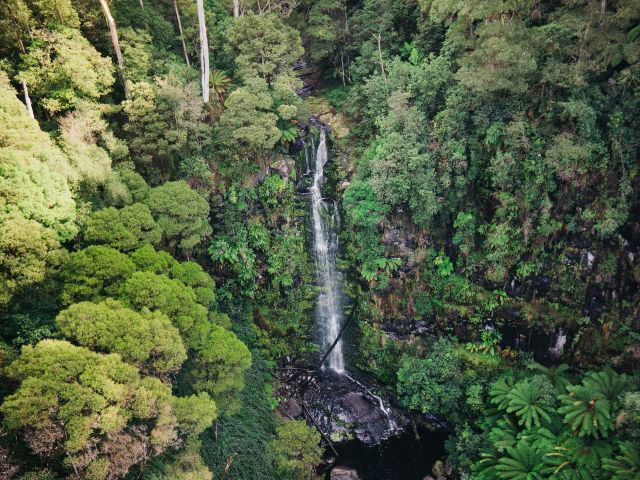

Marvel at these cascading falls.
There’s much more to Daylesford and its surrounds than spas and mineral springs; the area is also home to some of country Victoria’s most stunning waterfalls. From man-made spectacles to nature’s own display of power, have your camera ready to capture the beauty of these cascades.
Note: Check the Parks Victoria website for updates before visiting, as conditions can change quickly.
In Short
If you only visit one waterfall near Daylesford, make it Trentham Falls – the 32-metre cascade is one of the highest single drop waterfalls in Victoria.
Best time to visit waterfalls near Daylesford
To avoid viewing a waterfall when it’s just a trickle, visit in winter and spring, or after heavy rainfall. During this period, the falls are at their most powerful and impressive (just be aware tracks can be slippery, so wear sturdy footwear).
Best waterfalls to visit around Daylesford
Sailors Falls
Widely believed to be named for the sailors who jumped ship seeking gold during the gold rush, Sailors Falls is about a 20-metre drop into a beautiful fern-lined gully (it splits into twin falls when the water is flowing well). You can view the falls from the picnic area (accessible for wheelchairs and strollers), or take the stairs down to a halfway vantage point, then to the base of the falls.
While you’re here, sample the fresh mineral water from the spring adjacent to the waterfall. You can skip the stairs for this, as there’s a tap in the picnic area (it’s pumped through a 135-metre bore, the only one to feature an electric pump). BYO lemons.
Distance from Daylesford: 7-min drive
Where: Ballan-Daylesford Rd, Sailors Falls
Parking: Yes
Difficulty: Easy to moderate
Swimming: No
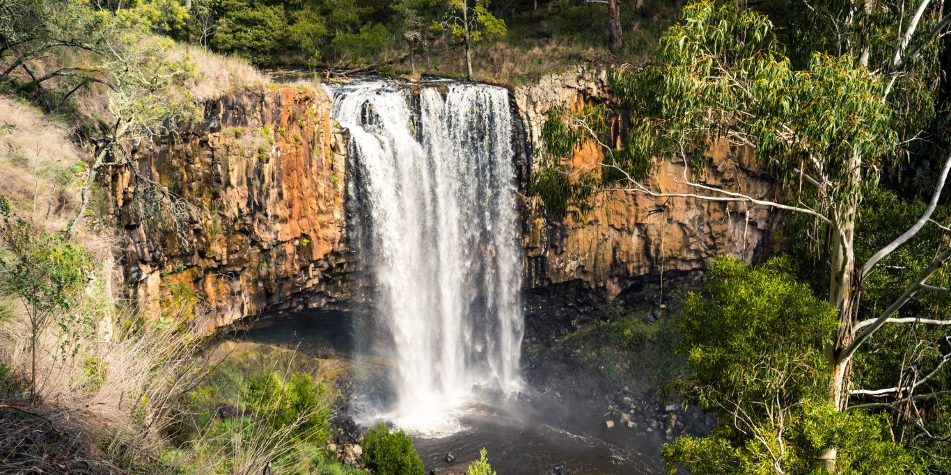
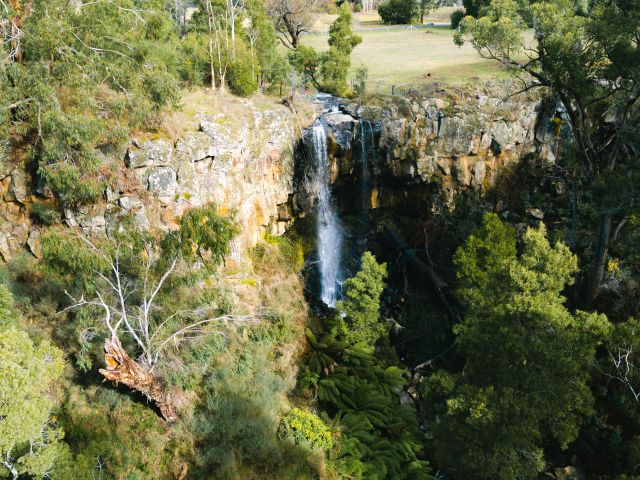
Trentham Falls
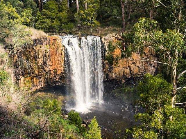
As one of the longest single drop waterfalls in Victoria, at some 32 metres cascading over sheer basalt rocks, Trentham Falls is a must-visit if you’re in the region. It’s located in the Coliban River Scenic Reserve, just outside of Trentham, set amongst native bushland.
The falls are a short walk from the car park; stick to the dedicated viewing platforms here, as the cliffs and base of the falls are unstable. Time your visit after rainfall for a truly spectacular showcase of nature’s force.
Distance from Daylesford: 18-minute drive
Where: Coliban River Scenic Reserve
Parking: Yes
Difficulty: Easy
Swimming: No
Loddon Falls
We love the dramatic setting of Loddon Falls in Glenlyon, where water plunges over a rocky gorge into a swimming hole. When there’s enough water flow, it’s a fantastic spot for a swim, surrounded by the rugged gorge walls.
To get there from the car park, head through the gate and walk 10-15 minutes to the top viewing point; but if you want to reach the base and swimming hole, you’ll need to descend a steep, unformed track, so it’s best to have someone with you. Note that there are no picnic or toilet facilities here.
Distance from Daylesford: 15-minute drive
Where: Sewells Rd, Glenlyon
Parking: Yes, but access by 4WD only in wet weather
Difficulty: Moderate to challenging
Swimming: Yes
The Blowhole
The Blowhole is actually an artificial diversion tunnel on Sailors Creek – but that doesn’t sound as cool, nor does it accurately represent the sight of water gushing through when the river level is high.
The circular tunnel was dug out in the 1870s by gold miners so they could fossick in the area. It’s a short, accessible walk from the car park to the top of the falls area, or you can take stairs down to the bottom. Come for a picnic or a swim, and when water is low in the tunnel, you can even climb through.
Distance from Daylesford: 9-min drive
Where: Blowhole Walk, Hepburn
Parking: Yes
Difficulty: Easy
Swimming: Yes, dependent on water flow
Colbrook Reservoir
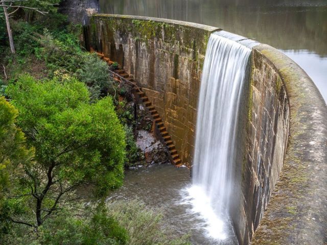
This seasonal waterfall spills over the dam wall when water levels are high, especially after recent rainfall. To view the cascade from the bottom, carefully make your way down to Korweinguboora Creek and walk back upstream to the base of the dam wall.
Colbrook Reservoir is considered one of the most scenic reservoirs in the region and is also worth a visit for its bushwalking, fishing and camping, along with swimming in the summer months (best for more experienced swimmers). You’ll need a 4WD to get here, and there are no facilities, so bring in whatever you need.
Distance from Daylesford: 34-minute drive
Where: Wombat State Forest, Colbrook
Parking: Yes, 4WD only
Difficulty: Moderate
Swimming: Yes
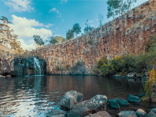
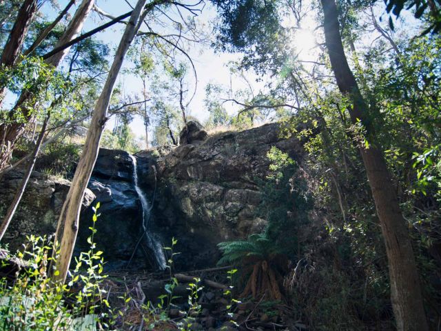
The Cascades
This pretty-as-a-postcard cascade flows over layers of bedrock, creating small rockpools, and the swimming holes are perfect for hot weather if the water isn’t too stagnant. Just be careful climbing the rocks as they can be slippery!
You’ll find this peaceful hidden gem in a small reserve off Cascades Rd, surrounded by bushland. It’s an easy walk from the car park, however it’s on uneven and unsealed ground, so not pram or wheelchair friendly.
Distance from Daylesford: 38-minute drive
Where: Cascades Rd, Metcalfe
Parking: Yes
Difficulty: Easy
Swimming: Yes, dependent on water flow
Stanley Park Falls
This small hidden waterfall is tucked away in the Stanley Park reserve, where you’ll also find picnic areas, a playground, BBQ facilities, toilets and walking tracks (keep an eye out for koalas!).
Fed by Turitable Creek, the cascade flows over rocky ledges into a small, fern-lined gully. Check it out from the platform right by the top of the falls, or take the stony steps down to the gully, then follow the walking track to the base of the falls. With all of the park’s facilities, this is a top spot to set up picnic for the afternoon.
Distance from Daylesford: 48-minute drive
Where: Stanley Park, 15 Salisbury Rd, Mount Macedon
Parking: Yes
Difficulty: Easy to moderate
Swimming: No