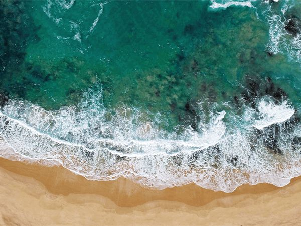
Dive into the waters of these sandy bay inlets, traverse the heights of clifftops and ride the waves at the wild surf beaches of the Mornington Peninsula.
Each year, Melbourne residents flock to the Mornington Peninsula in the thousands for its stunning coastline and collection of seaside towns. A holiday here will transport you a million miles away from city life, and the best way to ease yourself into the slower pace of life is to find a sandy spot to park yourself on one of its many beaches for the day. Here, find a handy overview of the Mornington Peninsula’s best beaches to help you narrow down your beach hitlist.
Point King, Portsea
Few people spot it, but tucked below Portsea’s mansions is a pretty sandy beach known as Point King. To find it, walk to the end of Point King Road until you reach the hidden path that leads to a set of wooden stairs and make your descent to the beach. On your way back up the stairs you’ll spot a monument commemorating the first hoisting of the Union Jack in 1802. This marks the date when the British first took possession of Port Phillip Bay, originally known as Boon Wurrung/Bunurong country to the traditional owners of the land. Don’t miss the cliff-top Millionaires Walk for a peek at the better homes and gardens of the Portsea Mansions above the beach.
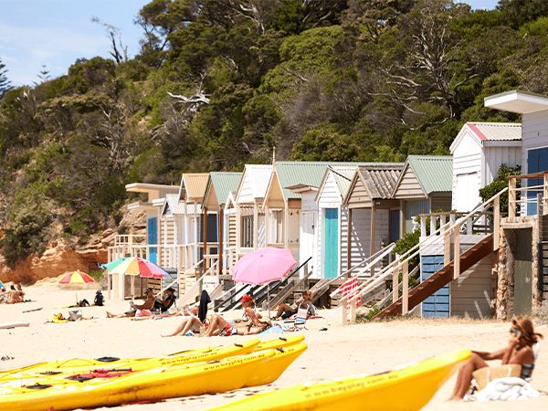
Mount Martha and The Pillars
The white sands of Mount Martha mark the beginning of the Mornington Peninsula beaches. Lined with multi-coloured bathing boxes (and price tags that would make you wince) take a stroll along the calm, protected shores under the backdrop of Martha Cliff. At two kilometres in length, this is one of the longer beaches in the ‘ninch – divided into two halves by Balcombe Creek mouth. On colder days, the beach is just as marvellous to enjoy from the car thanks to the stunning views out over the water, and a drive that is reminiscent of the Great Pacific Drive’s twists and turns. The Pillars of Mount Martha have become an Instagram hotspot over the years; reminiscent of a tiny Italian beach with clifftop rocks jutting out over the bay. Unfortunately, clifftop erosion has made it unsafe to venture down to the cliffs and warning signs have since been erected. Play it safe and visit the Pillars via boat to soak up those Italian beach vibes from the water.
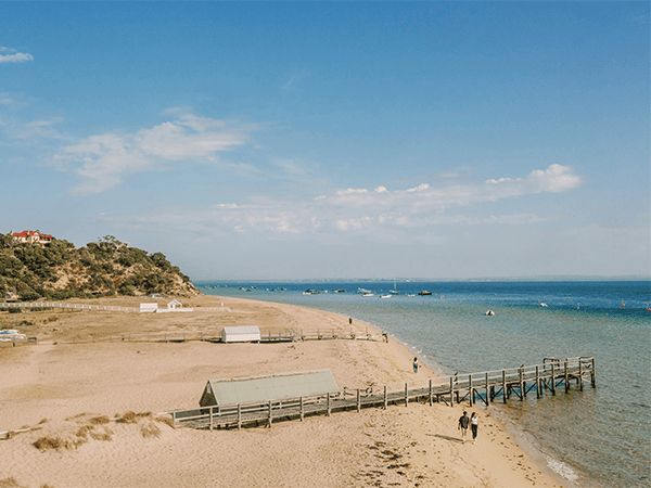
Mothers Beach, Mornington
There are many lovely beaches to choose from within the sheltered waters of Port Phillip Bay, but Mother’s Beach in Mornington is definitely one where you can avoid large crowds. The tranquil, calm waters can be accessed via a long pathway from Schnapper Point Drive, or via Shire Hall Beach which is at the eastern end. Once you arrive the day is yours to swim, walk the shores and enjoy a picnic if you’re so inclined. There are rows of colourful beach boxes to marvel at, as well as kayaks, canoes and stand-up paddle boards available for hire.
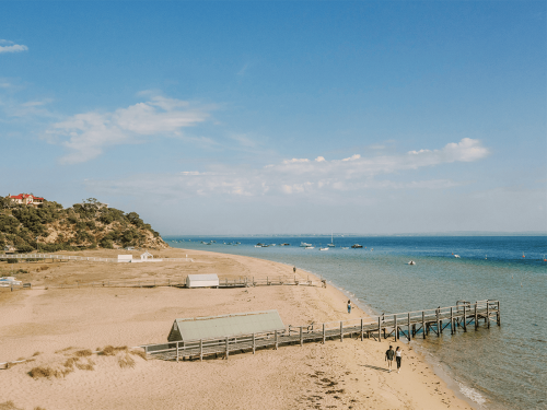
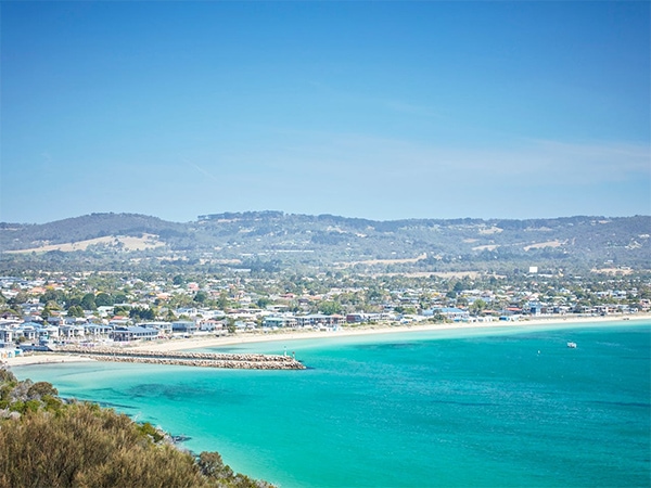
Safety Beach
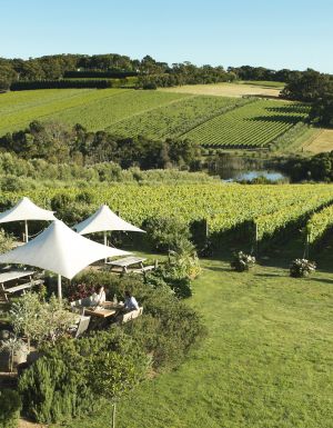
Safety Beach is so named for its calm and shallow waters, thanks to its position within a protected cove. I’m a big fan of Safety Beach," confided George Calombaris to us in 2015. “It’s a little gem. I reckon it’s one of the safest and cleanest beaches in the country." In fact, he put his money where his mouth is, too, with the spot also home to his family’s beach house. “If you’re standing on the beach, to your right are the picturesque hills of Mt Martha and if you look south, you look into Red Hill and its beautiful wineries. I love it dearly – the whole area also has great energy because there are a lot of artisans and a creative community. “And only an hour from Melbourne with the Peninsula link," he adds.
Sorrento and Portsea Back Beaches
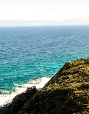
For wilder ocean beaches along the rugged, southern coastline of the peninsula, check out Sorrento and/or Portsea Back Beaches for bodyboarding, surfing and coastal walking. Both beaches are patrolled on summer weekends and holidays. They are about 10 minutes’ drive from each other, and surfing conditions vary based on the winds of the day. On high-wind days, precarious environments can make the water a bit how ya goin’ for novices. If you aren’t sure where you stand, wait in line at a local café and listen for someone to confirm that “it’s a back beach day". Facilities at Sorrento Back are minimal, however a recent refurbishment has made the Portsea SLSC the place to be on long summer days. The multi-million dollar clubhouse is perched on a clifftop overlooking the sand; stop for a burger and a sundowner.
Number 16, Rye
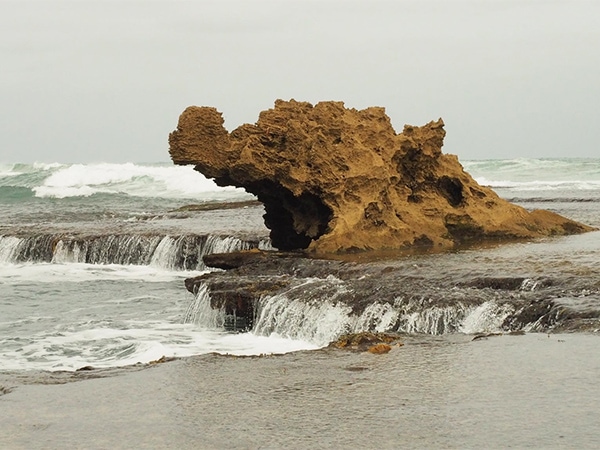
We are hoping we don’t get any locals coming after us for including Number 16 in this list. The beach is delightfully secluded; find it sandwiched between Diamond Bay and Rye Back Beach. Alongside barrelled waters primed for surfing, Number 16 is full of rock pools to swim in, hidden caves to explore and trickling waterfalls fed by the waves. Make sure you stop to take a photo of “Dragon Head Rock" if you’re a budding photographer.
Fossil Beach, Mornington
This is not the sandy stretch paradise you might expect from the Mornington Peninsula. Instead, Fossil Beach offers budding geologists a picturesque limestone cliff-lined walk packed with history and natural wonderment. In 1845, geologist A.R.C. Selwyn reported a multitude of fossils in the limestone cliffs along a stretch of Rocky Bay Beach between Mornington and Mount Martha. They showed evidence of Australian sea life from 10-15 million years ago and have since attracted a multitude of aficionados. Visitors are encouraged to complete a sign-posted walk that indicates sites of significance regarding the original Aboriginal inhabitants and the first European settlers. The beach is located within the Fossil Beach Geological Reserve.
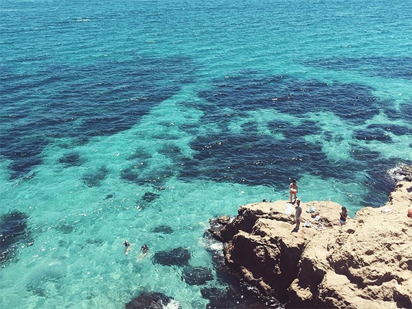
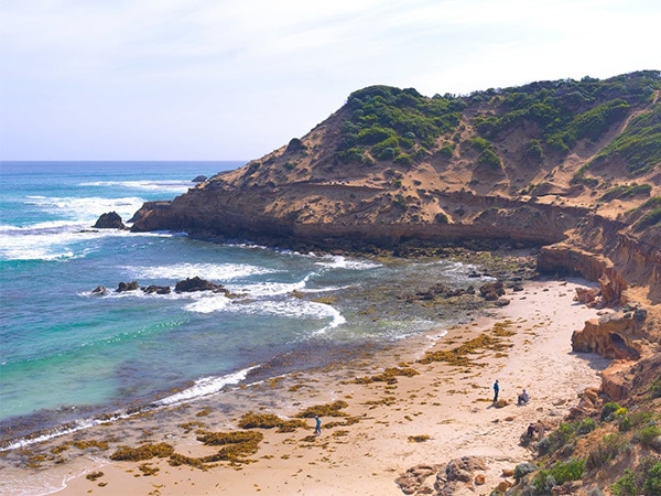
Bridgewater Bay and Blairgowrie Jumping Rock
On the ocean side of the peninsula, the natural amphitheatre of Bridgewater Bay provides a sheltered solace from the neighbouring back beach winds. Additionally, the limestone rock formations and the countless rockpools provide another main drawcard. The most popular of the bunch is known as the Blairworie Jumping Rock. This tiered rock features three jump spots increasing in height up to seven metres. Daredevils will line up to complete this freefall jump, landing into a three-metre deep rockpool, which stays full regardless of the tide. Enter at your own risk.
Read our guide to the best places to stay on the Mornington Peninsula.