Take a diversion away from the Great Ocean Road to the World Heritage Site of Budj Bim Cultural Landscape, where the Gunditjmara community is sharing its remarkable story of ancient enterprise with the world.
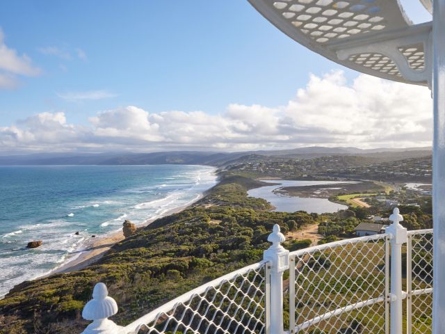
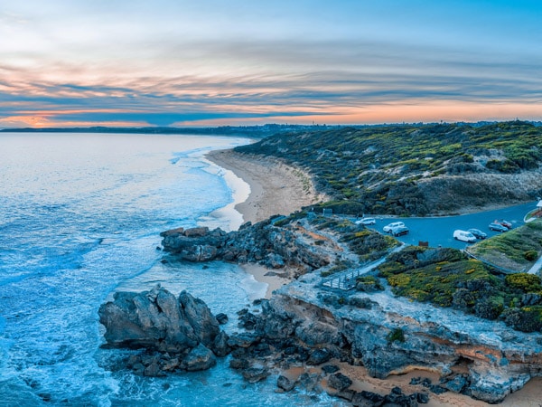
With eyes closed and face directed to the barely fathomable beyond, there comes a tremendous awareness of the firm stone beneath my feet. This rock has been relentlessly pummelled by saltwater for millennia. Yet, even after all those thousands of years colliding with ocean and wind, it remains steadfast.
The brisk coastal wind makes landfall from its journey beyond the horizon, whipping windcheaters into sails and tussling untethered hairs with the same stoicism. And the ocean itself, bridled by lunar whims, carries on with its undeviating rhythm, in and out, in and out.
It’s a cathartic reminder of just how insignificant our impression here is. None of us will outlive this stone, but some of us do leave a scarce but meaningful trace within it. Eyes open now, my brain plunges into overdrive as it processes the beauty funnelled from retina to optic nerve.
Tracing the ancient aboriginal site Moyjil
The information returns as sapphire-blue waters, clear and contrasted by rich, gold sands. A gently rippled, lagoon-like river patiently ebbs to embrace the Bass Strait, sidestepping the craggy yet dignified rock formations.
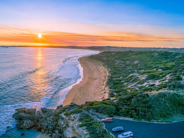
This is Moyjil, located in Victoria’s south-west, which you may have heard of by its European moniker, Point Ritchie. But if anyone has naming rights at this incredible junction of river and sea, it’s the Gunditjmara people. They have been here for around 60,000, possibly even 80,000, years.
The scientific evidence gathered from their scarce trace of shell middens embedded in that steadfast rock, and other indicators of human activity, is still percolating on that larger figure. However, some of Australia’s top geologists are quietly confident Moyjil could be the country’s oldest site of Aboriginal occupation.
Preserving the cultural heritage of the Gunditjmara people
As such, this bracingly beautiful point is of gargantuan importance to the Gunditjmara people and, indeed, all people. It’s a visitable window to their ancestors and a reminder of how they lived in a mutually beneficial accord with nature.
A promise of protection in return for the gift of sustenance. This sustainable way of life is both fundamental and non-negotiable to Indigenous Australians and it’s through this looking glass I have clamoured to discover this incredible region.
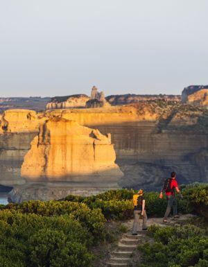
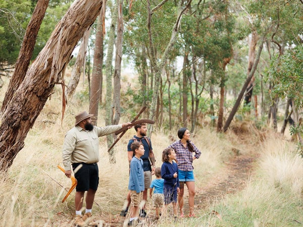
Moyjil is a punctuation mark on the Great Ocean Road, but by touring south-western Victoria through Gunditjmara Country, I’m leaving the ogling of the 12 Apostles and craggy coastline to others. Instead, I’m straining to learn more about the ancestral guardianship of Country here. In fact, it’s National Sorry Day as I stand in reverie at Moyjil as an Indigenous woman and travel companion Ash Bartley invites our small group to remember and question the Stolen Generation.
Listening to the wind and sea, you can almost sense the presence of ancient humans gathering on the rocks below to share a degustation of shellfish. It’s staggering to realise that six millennia of cultural practice was virtually obliterated in the space of a hundred years, and this sun-drenched holiday idyll that once sustained generations of families, now provides quick photo ops and toilet stops for busloads of tourists.
Indeed, we surely could have skipped a lot of unnecessary environmental and emotional scarring if we could bend time onto itself, folding up centuries of heartache and destruction to arrive at a place of deep appreciation for our First Peoples and their connection to Country. But the good news is that a generation of Gunditjmara people guided by Elders here in south-west Victoria are leading a restoration of the continuity of connection to Country and embarking on a sharing and teaching of long-held wisdom.
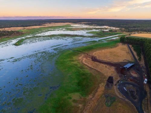
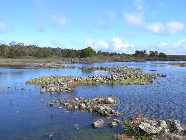
“We never say knowledge is lost," says Ash, “we say it’s dormant." Moving inland from Moyjil, a crystalised example of this can be experienced at the World Heritage Site of Budj Bim Cultural Landscape, which comprises three main components: Budj Bim National Park (north), which includes the long-extinct volcano formerly known as Mt Eccles; Kurtonitj (central), which means ‘crossing place’; and the ceremonial wetlands of Tyrendarra (south), all of which show extensive evidence of the largest and oldest-known aquaculture system in the world.

How the Budj Bim story is tied to Mt Eccles
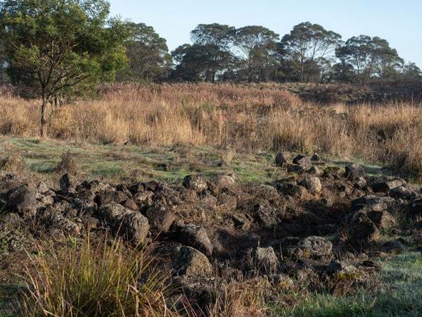
The Budj Bim lava flows are the spindly fingers that connect these components. It’s here, in the 5470-hectare area, the Gunditjmara created channels, dams and weirs in the pursuit of the kooyang (eel). For at least 6600 years, those slippery little fish sustained enterprising humans who coaxed and engineered the natural topography to ensnare them.
Proof of the antiquity of this aquaculture system and the knowledge carried with it has firmly sealed the landscape’s World Heritage criteria and, with it, the preservation of an endlessly important cultural archive. It’s been a decades-long journey to find a way to bring history back from the brink.
“For the past 40 years, the Gunditjmara community has worked on how best to share the Budj Bim story with the world," explains Budj Bim managing director Damein Bell. “Through that time, particularly the past 20 years, it’s been a process of deciding how we best share the story to protect the story."
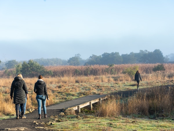
Tyrendarra Indigenous Protected Area
Part of that sharing is taking shape southwards, at the volcanic landscape of Tyrendarra, which came into existence following a guttural hiccup from Budj Bim some 27,000 years ago. When I visit, morning has only just peeped out from behind the cold dawn and my breath is as visible as a car’s exhaust.
The beauty such coolness wreaks on these wetlands is exquisite. Heavy mist veils the sun’s radiance turning the atmosphere opaque, as if the world ceases to exist beyond its thick cloak.
In places where its weakened beams penetrate, intricate spider webs are bejewelled with crystal droplets, so elegant they look like adornments for fairy queens.
Dreaming trails and cultural sites
Slender reeds dance under the rippling channels and birdsong drifts on the breeze, harmonising with the soft shushing of grasses.
As beautiful as this scene is, it’s not what it once was. Years of farming has desecrated the area, repurposing rocks once used to make stone-based huts into low walls to corral livestock who nonchalantly trampled history under hoof.
Still, enough of the evidence remains to cement these wetlands as integral to the aquaculture complex and it continues, as it has for millennia, to be an important cultural site and part of Dreaming trails for the Gunditjmara people.
Soon, visitors will be able to observe the fascinating enterprise of the interconnected channels and strategically placed dams designed to store eels “like a fridge," says guide coordinator Braydon Saunders. The site will also include re-creations of traditional huts that sheltered families as they settled into this eel-farming and trading community.
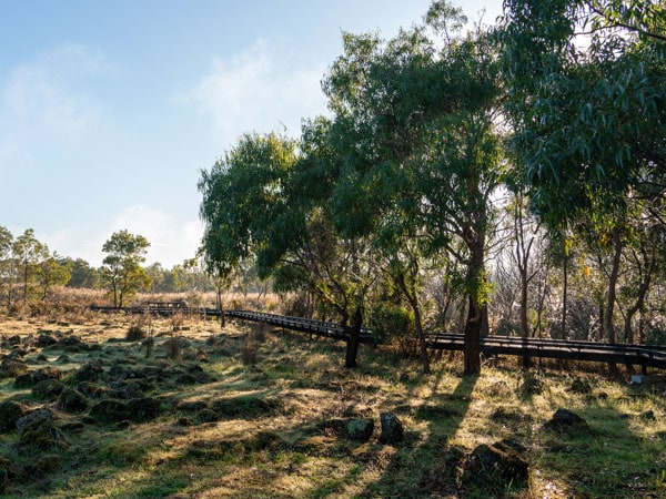
Pathways and boardwalks for visitors
Tyrendarra is co-owned by Parks Victoria and the Gunditj Mirring Traditional Owners Aboriginal Corporation, which have worked to prepare the site for visitors. Braydon says Covid enabled the corporation time to involve the community on how best to present Tyrendarra and, once open, you’ll be able to follow interpretation pathways and boardwalks to truly immerse in what Tyrendarra was and remains to be for the Gunditjmara people.
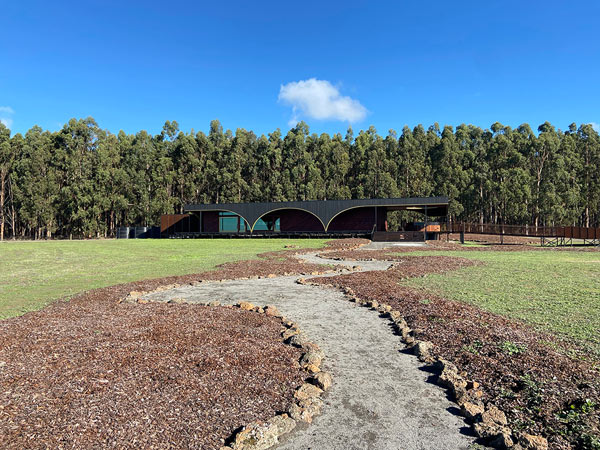
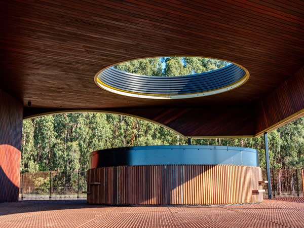
Another of Budj Bim’s northern components, Tae Rak (Lake Condah) is welcoming all with the aroma of gently smoked eel at the new lakeside Aquaculture Centre and Cafe. Designed by Cooper Scaife Architects, the ultra-sleek building blends smoothly into the environment and houses a bush tucker cafe where you can enjoy coffee and cake, sample a kooyang tasting plate, or tuck into dishes such as gnocchi with native mint pesto.
Swampy depressions with eel traps
Visitors can also view aquaculture tanks where those life-sustaining short-fin eels dart about, unaware of their future as an arancini ball at the cafe. The centre has been open for less than a year, but Damein is impressed with how both visitors to the area and the local community have embraced it.
“For the amount of time it has taken to get ready, it has been generational," he says. “So it’s wonderful to see our Elders sitting on the verandah here enjoying a coffee." The 1700 hectares of wetlands and stony rises surrounding Tae Rak were formed an estimated 8000 years ago and have since been in service to local wildlife as a utopian sanctuary.
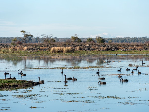
Follow the walkway to the lake’s edge where black swans glide with stealth and watch the sun hover just above the surface. Or better yet, join a guided tour, as Damein says, “to yarkeen Gunditjmara" (‘to see Country’) and learn of the stories held within the stones here and about the restoration of Tae Rak.
A relaxing spot to reflect and unwind
The lake provides a serene spot to pause in reverie, marvelling at how human memory extends back thousands of years through the oral traditions of the Gunditjmara. Ancient narrations from those who witnessed Budj Bim’s explosion and its subsequent significance have been carefully tended, wrapped in ceremony, and presented to each new generation.
They are as real as the imprint embedded in rock at Moyjil and the altered landscape of Budj Bim. And finally, under the custodianship of modern-day Gunditjmara, who have drawn the world’s attention to this place with their desire to nourish a continual connection to Country, the buds of this ancestral knowledge are once again opening towards the sun. “We wanted the world to know what we’ve got here," says Damein, “so they can help protect it."
Getting there
Budj Bim Cultural Landscape is a four-hour drive west (326 kilometres) of Melbourne via Geelong, two hours (167 kilometres) from the 12 Apostles along the Great Ocean Road via Warrnambool and less than an hour’s drive (68 kilometres) north-west of Port Fairy.
Eating there
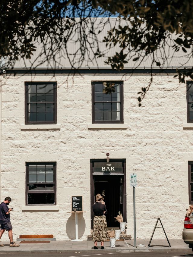
Noodledoof Brewing and Distilling Co
Not far from the beguiling Tower Hill is the town of Koroit, where you can replenish energy with a fortifying drink and meal at Noodledoof . Try a tipple that makes excellent use of native ingredients informed by local Indigenous social enterprise Worn Gundidj.
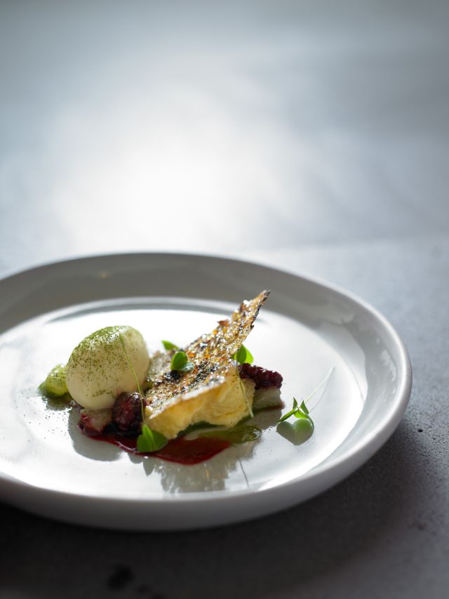
Wickens at Royal Mail Hotel
With diners’ eyes transfixed on Wurgarri (Mt Sturgeon), chef Robin Wickens has his work cut out for him diverting their attention to the plate. But he does so with an impeccable degustation in the elegant, timber-hued dining room. For a more casual experience, head to the hotel’s Parker Street Project.
Staying there
Oak and Anchor
This boutique accommodation is housed in an elegant, refurbished heritage hotel in Port Fairy . The lodging is the perfect base for day trips to Tae Rak, Kurtonitj and, eventually, Tyrendarra.
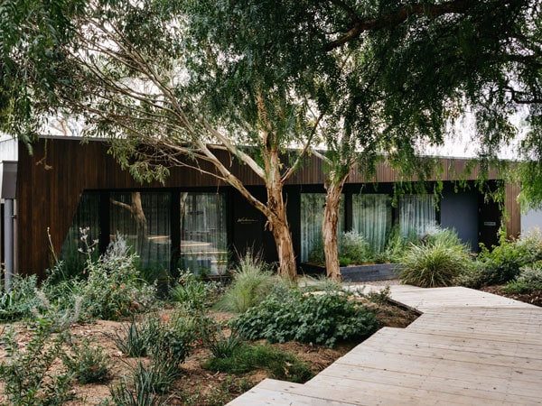
Alkina Lodge
With lawns populated by kangaroos, these four-bedroom architecturally designed luxe lodges are a serene expression of minimalism, allowing complete immersion in the stunning landscape beyond.
Things to do there
Narana Aboriginal Cultural Centre
There’s no better way to embark on an excursion of cultural learning than with a visit to Narana (meaning a ‘place of deep understanding’ in language). Meet native animals, explore the art gallery and enjoy a coffee in the cafe.
Worn Gundidj at Tower Hill
The site of Victoria’s largest dormant volcano, Tower Hill is a must-stop on any south-western Victorian itinerary. Layer its beauty and geological significance with its importance to First Peoples on an Indigenous culture tour.
Wildlife Wonders
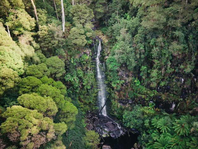
Not far from Apollo Bay, this convergence of forest and sea is also home to an Australian wildlife sanctuary where you can glimpse a hot list of native fauna, such as wallabies, bandicoots and koalas.
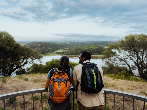
Tae Rak Guided Culture Walk
Learn about local lore, eel harvesting and the far-reaching history of the lake and surrounding wetlands on a two-hour tour with a Gunditjmara guide.