Victoria is favoured among Aussies for many reasons – from its cool capital city to its incredible coastline. But the state’s biggest drawcard has to be its famed wine regions, from the Yarra Valley to the Pinot Coast.
Venture a little further and you’ll stumble upon the Rutherglen, home to historic towns and rolling vineyards boasting crisp whites and robust reds. It’s a remarkable region that has been flying relatively under the radar – until now, thanks to a series of new nature trails with a twist.
Introducing the Rutherglen Loops
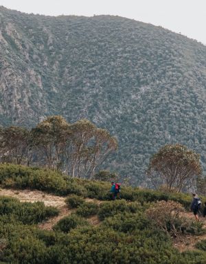
Sprawling across 48 kilometres in northeast Victoria, the new Rutherglen Loops is a network of tracks connecting the region’s namesake with nearby landmarks like Wahgunyah and Lake Moodemere. Passing through bucolic countryside, the journey offers visitors a fresh perspective on Victoria’s pastoral heartland. But that’s just the beginning.
The Rutherglen Loops trace 48 kilometres of northeast Victoria. (Image: Karen Webb)
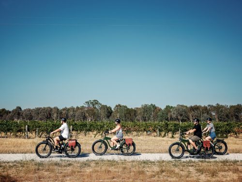
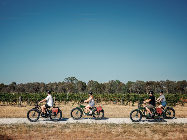
Much to the delight of oenophiles, the Rutherglen Loops also incorporate a variety of local wineries and vineyards. In fact, 14 cellar doors feature on its map, transforming this seemingly ordinary series of nature tracks into a dreamy local wine trail. Accessible for both bikers and hikers, the Rutherglen Loops can be enjoyed as a multi-day adventure or broken down into four separate tracks.
The four-kilometre Town Loop winds through Rutherglen’s charming streetscapes and past local coffee shops. It’s perfect for an evening stroll, stopping in at Jones Winery & Vineyard and Anderson Winery along the way.
See the best of the region on a bike. (Image: Karen Webb)
And while the River Loop covers the same distance, it’s geared more towards nature lovers keen to explore the Murray River shoreline. It’s the only track that doesn’t include a winery pit stop, so enjoy it in the morning before checking out the rest of Rutherglen’s offerings.
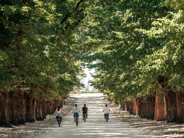
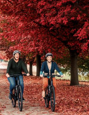
The Lake Loop can be completed by foot or on wheels. But at 14 kilometres long, it’s more of a trek than a walk, so jump on a bike if you’re short on time. The track makes for a great day out, circling Lake Moodemere and passing Cofield Wines, Dinah Wines, Pfeiffer Wines and Lake Moodemere Estate.
The Lake Loop is great for a hot day. (Image: Karen Webb)
Aptly titled the Wine Loop, the fourth and final track offers an unrivalled wine country experience. The picturesque loop takes visitors to 12 cellar doors across 23 kilometres, from All Saints Estate in Wahgunyah down to Rutherglen’s own Buller Wines. Similar to many of Australia’s great rail trails, it truly showcases the best of the region.
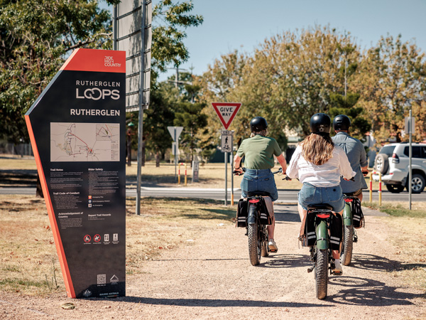
All trails are accessible year-round and feature toilets, water stations and repair posts along the way. Bikes are available for hire at the Visitor Information Centre, which offers onsite parking as well.
Stop in at local wineries along the way. (Image: Karen Webb)
Want to see more stories from Australian Traveller in your Google search results?
Tick the box next to "Australian Traveller". That's it.
Taylah Darnell is Australian Traveller's Writer & Producer. She has been passionate about writing since she learnt to read, spending many hours either lost in the pages of books or attempting to write her own. This life-long love of words inspired her to study a Bachelor of Communication majoring in Creative Writing at the University of Technology Sydney, where she completed two editorial internships. She began her full-time career in publishing at Ocean Media before scoring her dream job with Australian Traveller. Now as Writer & Producer, Taylah passionately works across both digital platforms and print titles. When she's not wielding a red pen over magazine proofs, you can find Taylah among the aisles of a second-hand bookshop, following a good nature trail or cheering on her EPL team at 3am. While she's keen to check out places like Scotland and North America, her favourite place to explore will always be her homeland.
From cabins to canvas, craft distillers to destination dining, Heathcote locals reveal their eco-savvy passions in ways that resonate with those seeking to travel lightly.
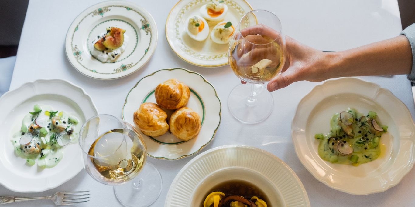
Heathcote, on traditional Taungurung Country in Central Victoria, is synonymous with its garnet-hued shiraz, but wine isn’t the only string to its bow. The town itself is sprinkled with heritage buildings from the gold rush era, and beyond that a growing collection of sustainable gastronomy and eco-friendly escapes. Nearby Bendigo, one of only 65 cities in the world recognised as a UNESCO Creative City and Region of Gastronomy, plates up an astonishing calibre of produce, wine and food for its size. Increasingly the entire region is taking up the challenge, though Heathcote in particular shines with its focus on sustainability.
The dramatic landscape of Heathcote’s Pink Cliffs Geological Reserve. (Image: Visit Victoria/Emily Goodfrey)
The eco-stays bringing sustainability to Heathcote
Yellow Box Wood’s safari-style tents are nestled on 40 hectares of bushland. (Image: Emily Goodfrey)
Andee and Lisa Davidson spent years working in southern Africa before settling in Heathcote. “We had a vision of how this could be,” explains Andee. “We wanted a retreat, but one that was off-grid and environmentally sustainable.” Now, at Yellow Box Wood, two luxury safari-style tents are at the heart of 40 hectares of rolling hills and native bush, with kangaroos, wallabies, echidnas, goanna and birdlife aplenty. It’s all solar-powered, wood for the fire is mainly fallen timber, and water is collected on the carport roof. No lack of creature comforts though – en suite with rain shower, espresso coffee maker, comfy seating, wood-burning fire all set to go. There’s also a solar-heated, mineral salt pool in a bush setting, walking tracks, and even a mini bush golf course. On my visit, I put the vision to the test. Cocooned in the plush four-poster bed I can glimpse the stars, while the heater casts a golden glow on the canvas. In the morning, I wake to a blush-pink sunrise, kangaroos feeding and a soundtrack of magpies.
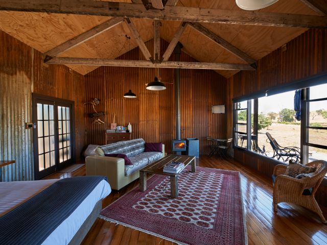
Mt Ida Eco Cabin is rustic and simple but oozes comfort. (Image: Graham Hosking)
If a tent is not your style, Stephen and Cally Trompp’s carbon-neutral Mt Ida Eco Cabin might entice with its generous deck and farmland views. Inside the cabin, corrugated iron walls as rusty as a shearing shed, gleaming (recycled) floorboards, timber truss ceiling (crafted by Stephen), wood-fired heater and an old-school turntable with a pile of vinyls to spin. It’s fun, and a little boho.“Everything is recycled. The cabin takes maximum advantage of the sun in winter. It’s all solar-powered. Don’t panic, though,” says Stephen, “you can still charge your phone and get 4G reception!” Settle into an Adirondack chair on the deck or pedal off on a mountain bike to suss out the wineries.
A taste of Spain in Central Victoria
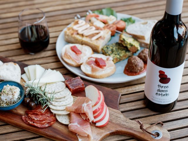
Three Dams Estate make Spanish-style wine.
Another person with a vision is Evan Pritchard at his Three Dams Estate where the wines reflect his deep love of Spain and of Spanish-style grapes, such as tempranillo. Afternoons in the ‘wine shed’ or cantina are matched with music (flamenco is a favourite), Spanish bites from tapas to paella (with Evan on the pans!) and views to Mount Alexander. Sustainability is also a passion. “You don’t need to buy anything. We decided to be off-grid from the start, but it is a lifestyle change,” he says. “You need to think about it and be careful.” Everything here is recycled, reassembled, refurbished. Evan has an electric car (with solar-powered charger), solar-power for the winery, and even a jaunty little electric tractor/forklift. “I love the idea of all the things you can do using the sun.” Sipping a crisp rosado (a Spanish rosé) with Evan in the sunshine, I couldn’t agree more.
The vineyard redefining sustainable winemaking
The Silverspoon Estate winery is completely off-grid. (Image: Graham Hosking)
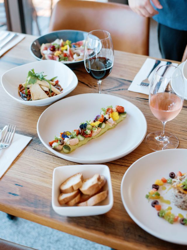
On the other side of Heathcote, Silver Spoon Estate demonstrates sustainability on a more extensive scale. Tracie and Peter Young’s winery, cellar door, award-winning restaurant and their own house are all solar-powered and off the grid. Sustainability is intrinsic to everything they do. The property sprawls across 100 hectares, with 20 hectares under vine – shiraz, viognier, grenache, tempranillo. As the climate has changed, so too has the approach. These are dry-grown vineyards. “We prune for drought. That means lower yields but more intense flavours,” says Peter. The fine-dining restaurant offers sweeping views, a wood-burning fire and a deck for languid lunches. Head chef Ben Hong sources regional, sustainable ingredients and weaves estate wines into the menu – think crispy wild mushroom arancini, viognier-infused chicken breast.
Silver Spoon’s award-winning restaurant.
Heathcote’s other hidden gems
Heathcote Wine Hub is housed in a 1855-built timber church.
Not all local wineries have a cellar door, but I find local treasures at the Heathcote Wine Hub, a petite 1855 timber church in the main street, lovingly returned to life by Karen Robertson and Carey Moncrieff. “Carey is a scrounger,” says Karen. “He doesn’t throw a single thing away.” He does, however, craft things into something quite special. Heritage floors, light-filtering lancet windows and shelves of regional wines create the perfect ambience for wine tasting. Or order a glass and linger over a cheese platter.
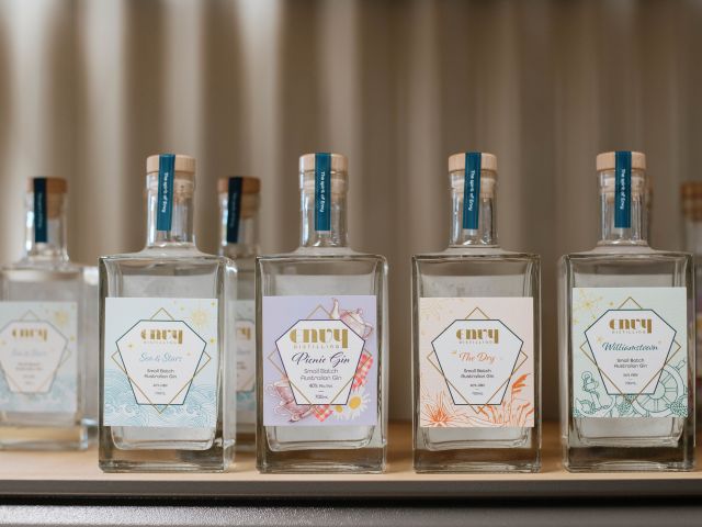
Heathcote is not all wine, of course. Nathan Wheat and partner Vanessa Curtis run Envy Distilling with a committed sustainable ethic – and a serious love of gin. Their small-batch distillery produces grape-based gin, and soon brandy. Distilled water is reused in an ingenious cooling system. All waste is treated on site. They buy excess wine from winemakers to distil and buy recycled barrels. “Distilling with the sun,” as Nathan says. Each Envy gin has its own story. Spicy, award-winning The Dry, is designed to capture the region’s dry, rugged nature. Pull up a stool at the bar (reclaimed timbers and tiles, of course), order a Gin Flight, or kick back with a cocktail and let Nathan share his eco journey.
Sample gins at small-batch distillery Envy.
A traveller’s checklist
Getting there
It’s less than two hours’ drive from Melbourne. The scenic route we take goes past Sunbury, then along a splendid country road through Romsey and the magic, boulder-strewn landscape of Lancefield. Watch for kangaroos on the road!
Staying there
Go off-grid in style at Yellow Box Wood for glamping or try Mt Ida Eco Cabin for a couple’s weekend hideaway.
Eating there
Award-winning French restaurant Chauncy.
At award-winning Chauncy, French chef Louis Naepels and sommelier wife Tess Murray have created a tiny, elegant pocket of rural France. Meticulously restored 1850s sandstone building, sun-drenched dining room, impeccable service, a menu suffused with local flavours and thoughtful wine pairings.
Fodder is both cafe and social hub. Chef Mo Pun and sister Lalita serve classic Aussie breakfast-to-lunch fare, though their Nepalese heritage sneaks through.
Playing there
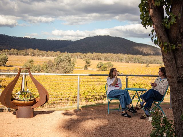
Sip on wines among the vines at Sanguine Estate. (Image: Visit Victoria/Emily Godfrey)
Sanguine Estate’s cellar door and terrace overlook bucolic vineyards. Its award-winning, dry-grown wines include the distinctive D’Orsa Blanc dessert wine, reflecting the family’s Swiss-Italian heritage. Order a charcuterie board and stay a while. Keep it carbon neutral by cycling some (or all) of the 50-kilometre O’Keefe Rail Trail to Bendigo.
At Bridgeward Grove, learn about the property’s Old Mission Grove heritage olive trees, do a sommelier olive oil tasting, and stock up on sustainably grown olives and oil. Explore the unique landscape, wildflowers and wildlife of pink cliffs geological reserve.