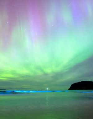
Autumn sees the start of prime stargazing season in Australia. The colder weather brings with it crisper air and clearer skies, conditions that make for prime constellation viewing. And while seeing the Milky Way in all its glory is always magical, catching a meteor shower is truly unforgettable – especially one like the Lyrids .
Over the decades, it has gained a large fanbase, with millions of people gathering to view it each year. And in 2025, your highest chance of catching a glimpse is between 16 and 25 April.
What is so special about the Lyrids?
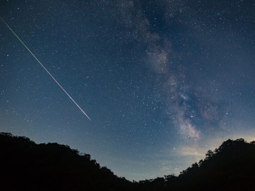
Known as one of the world’s oldest meteor showers, the Lyrids has been observed for 2700 years, with its earliest recorded sighting dating back to 687 BCE. It’s characterised by its especially bright and fast meteors, which produce occasional dazzling flashes called fireballs. From Earth, the celestial phenomenon is breathtaking.
Catching the Lyrids is an unforgettable experience. (Image: Getty Images/bjdlzx)
It all originates from C/1861 G1 – more commonly known as Comet Thatcher – discovered by amateur astronomer A.E Thatcher in 1861. As Thatcher makes its 416-year-long orbit around the sun, it leaves a long dusty trail behind it – the Lyrids meteor shower – which the Earth then passes through on its own orbit. When it does, the meteors collide with our atmosphere and disintegrate into fiery, colourful streaks in the sky.
What’s incredible about the Lyrids is that it has been known to produce up to 100 meteors during one shower alone. And while seeing that many is more of a rare occurrence, stargazers can expect up to 20 sightings during the Lyrids’ peak this year. Be sure to have your eyes peeled though – these fireballs travel at 47 kilometres per second!
Sleep in Australia’s first Dark Sky Park at Warrumbungle National Park. (Image: Destination NSW)
It’s also important to know that the meteor shower’s radiant – the point in the sky from which it appears – is near the constellation Lyra. While Lyra is a relatively small constellation, it contains a very bright star called Vega – which makes it easy to spot. Vega is located low in the northern part of the sky, roughly a hand-span to the left of the Milky Way.
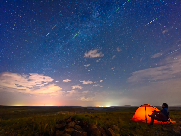
Another handy hint is to head outside roughly half an hour before you actually plan on witnessing the Lyrids – preferably away from big cities and light pollution. This is how long it takes for your eyes to adjust properly. Bring a blanket for the cold and binoculars if you have them and lie flat on your back in an area that has unobstructed views of the sky.
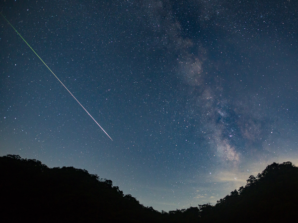
The key to it all? Patience. No matter how much you prepare, there’s no rhyme or reason to these things – making it all the more special if you manage to catch a glimpse.
Be patient and you may just witness the meteor shower. (Image: Getty Images/TDub303)
Taylah Darnell is Australian Traveller's Writer & Producer. She has been passionate about writing since she learnt to read, spending many hours either lost in the pages of books or attempting to write her own. This life-long love of words inspired her to study a Bachelor of Communication majoring in Creative Writing at the University of Technology Sydney, where she completed two editorial internships. She began her full-time career in publishing at Ocean Media before scoring her dream job with Australian Traveller. Now as Writer & Producer, Taylah passionately works across both digital platforms and print titles. When she's not wielding a red pen over magazine proofs, you can find Taylah among the aisles of a second-hand bookshop, following a good nature trail or cheering on her EPL team at 3am. While she's keen to visit places like Norway and New Zealand, her favourite place to explore will forever be her homeland.
Big skies and otherworldly landscapes are the hallmarks of Australia. Discovering them in-depth becomes easier with the experts.
Australia’s extraordinary landscapes make this vast continent like no other place on Earth, offering an unforgettable feast for the senses as you traverse deserts, cruise on vast inland lakes and dine under star-studded skies. What makes this land special is the people you’ll meet along the way, and the chance to forge a deep connection with the country and its people. The new AAT Kings small-group tours focus on the incredible experiences available in remote places that might otherwise seem daunting.
With an average of 16 guests and a maximum of 24, the tours offer intimate access to the best Australia has to offer, with special behind-the-scenes encounters led by knowledgeable experts.
1. Tasmania and Flinders Island Explorer
Fly over beautiful Flinders Island as part of a tour of Tasmania. (Image: Luke Tscharke)
Escape the tourist trail in north-eastern Tasmania while still seeing everything the island state has to offer. From coastal villages to bucolic rural scenery, the six-day Tasmania and Flinders Island Explorer tour offers world-class food and wine, with the bonus of a flight to Flinders Island.
From Launceston, the tour winds through the verdant Tamar Valley and includes a stop at Fork It Farm , where guests are given insight into sustainable farming while snacking on a house-made charcuterie platter paired with Tasmanian wines.
Fly by private plane to secluded Flinders Island, uncovering pristine beaches and savouring local seafood and wine. Explore the main settlement and learn about the history of Settlement Point and Wybalenna before soaking up views of the island and Bass Strait and exploring part of Strzelecki National Park . From there, it’s another scenic flight to Bicheno, flying down the east coast of Tasmania and across the stunning Bay of Fires and Wineglass Bay (a taste of what’s to come by land).
Other highlights include the UNESCO World Heritage-listed Brickendon Estate , still run by the same family since its founding in 1824, where the property’s convict history will be revealed.
In Devonport, a heritage train ride will track alongside the Don River to Coles Beach before returning to learn more about Tasmania’s railway history and vintage locomotives at Don River Railway .
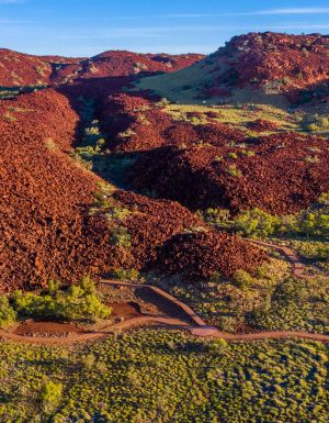
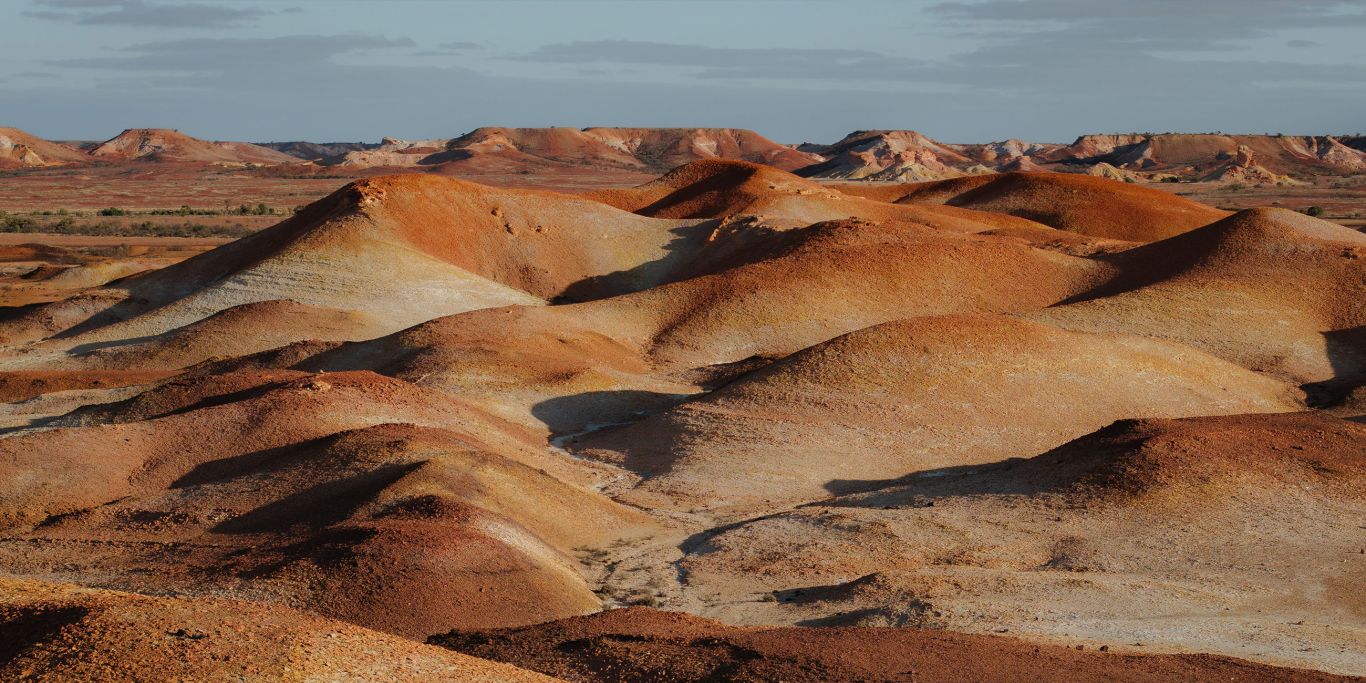
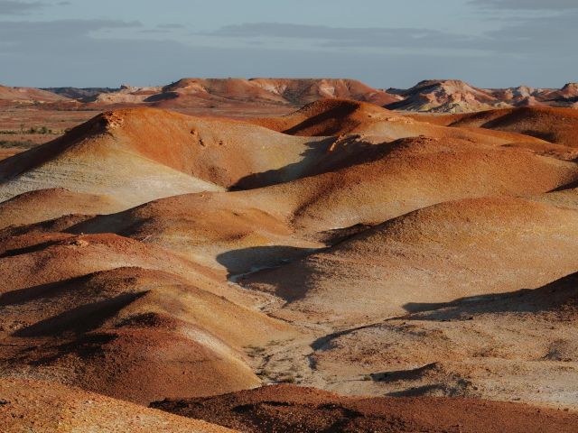
2. South Australian Outback Adventure
Fly over the Anna Creek Painted Hills. (Image: Emile Ristevski)
From Adelaide, the highlights of the eight-day South Australian Outback Adventure tour open up the rugged grandeur of the Flinders Ranges, Wilpena Pound and Arkaroola. Home to the Adnyamathanha people for tens of thousands of years, the natural beauty and wide open spaces of this remote region unfold as you explore from both land and air.
Looking to the skies for a new way to experience South Australia’s outback, a scenic flight over the striking outcrops of the colourful Anna Creek Painted Hills and the shimmering saltpan of Kati Thanda-Lake Eyre is an eye-opener like no other.
Wilpena Pound Resort, owned and managed by the Indigenous community, is a haven in the midst of Ikara-Flinders Ranges National Park . It’s worth the hike to enjoy sweeping views over the natural amphitheatre before your journey continues through dramatic gorges, where you may spot endangered yellow-footed rock-wallabies.
At the award-winning Arkaroola Wilderness Sanctuary, dive deep into the region’s billion-year-old geological history with an expert guide as you tackle the steep ascent of the Ridgetop Track in an open-air 4WD. When the sun goes down, look up at the dazzling wonders of the Milky Way in this International Dark Sky Sanctuary.
3. Broome and the Kimberley Highlights
See the iconic Bungle Bungle Ranges from the air. (Image: Tourism WA)
From Broome’s sparkling beaches to the red dirt of Kununurra, the Kimberley region is one of Australia’s most extraordinary and unforgettable places. It’s a region of contrasts, beginning with multicultural Broome and the history of pearl divers.
Kick off your Broome and the Kimberley Highlights experience with a tour of Broome led by a local Aboriginal guide. You’ll learn about 40,000 years of culture as you explore historic landmarks, discover bush foods and medicinal plants and enjoy a private didgeridoo performance.
Learn about Broome’s rich pearling history at Willie Creek Pearl Farm , on the banks of a turquoise tidal estuary that provides the perfect environment for growing the South Sea pearls for which Broome is world-renowned. Then cruise the calm waters to see the oyster farm before a masterclass that reveals the secrets of the pearl industry.
As you continue your discovery of the Kimberley, fly over the dramatic striped domes of the Bungle Bungle Range, the Argyle Diamond Mine and gorgeous Lake Argyle, Western Australia’s largest freshwater body of water. Take a sunset cruise on the lake, which is dotted with more than 70 islands and is a birdwatcher’s paradise. The water teems with freshwater crocodiles, barramundi, bream and cod.
Complete your seven-day exploration of the Kimberley in Kununurra with a local Aboriginal guide to hear Dreamtime stories and wander through the ‘mini bungles’ of Mirima National Park.
4. Outback Contrasts
Expand your knowledge at Karrke Aboriginal Cultural Experience. (Image: Tourism NT/ ArchieSartracom)
From Alice Springs, the six-day Outback Contrasts adventure includes the wonders of Uluru, Kata Tjuta and Kings Canyon, offering premium accommodation and exceptional experiences. Ancient rock art, creation stories and the spiritual essence of the land will be revealed as you discover some of Australia’s most iconic landmarks.
A highlight of your stay in Alice Springs will be meeting chef Rayleen Brown, who shares her knowledge of Aboriginal native foods with a tasting of the many flavours of Central Australia’s wild harvest bush tucker. More culinary indulgence will follow at Discovery Resorts – Kings Canyon in the heart of Watarrka National Park, where you’ll enjoy a degustation menu and paired fine wines under the desert moon.
After a sunrise walk on the rim of Kings Canyon, head off to the Wanmarra community to learn about the Luritja and Pertame people’s spiritual connection to the land at Karrke Aboriginal Cultural Experience. Crossing desert scenes, you’ll arrive at Uluru and end the day watching the setting sun’s changing palette on the ancient landscape.
More awe-inspiring landscapes will be revealed as you wander between Kata Tjuta’s tallest domes in Walpa Gorge and explore the rugged beauty of Simpsons Gap in the West MacDonnell Ranges.