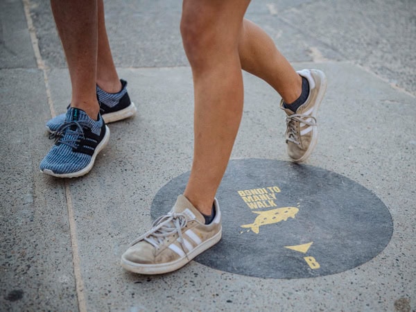
Stretching between bustling Bondi and the natural beauty of Manly’s North Head, the Bondi to Manly walk is one of the best coastal walking tracks in the world.
The epic Bondi to Manly Coastal Walk is a legendary experience that captures the essence of Sydney’s laid-back coastal lifestyle. Sydney’s longest coastal track is a must-do for locals and visitors alike, offering the perfect blend of beach adventures, striking nature, cultural exploration, and city delights. Sydney beaches really are in a league of their own and this walk delivers the best of the best. Here is your ultimate guide to the Bondi to Manly Walk.
What to know about the Bondi to Manly Walk
- It connects pre-existing tracks on public land across six councils and was years in the making. It required the collaboration of these Councils alongside the Sydney Harbour Federation Trust, state agencies, the La Perouse and Metropolitan local Aboriginal land councils and the Bondi to Manly Walk Supporters.
- This partnership resulted in the creation of the Bondi to Manly app , which contains important information, itineraries, and maps, and walkers are encouraged to download this before undertaking the walk.
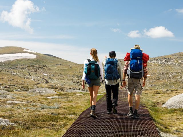
- This multi-day hike allows walkers to determine how long to take, with suggested itineraries taking between three to eight days.
- It is Grade 5 due to the vast distance covered, although don’t let this alarm you – it’s suitable for moderate fitness levels, with occasional challenging stairs.
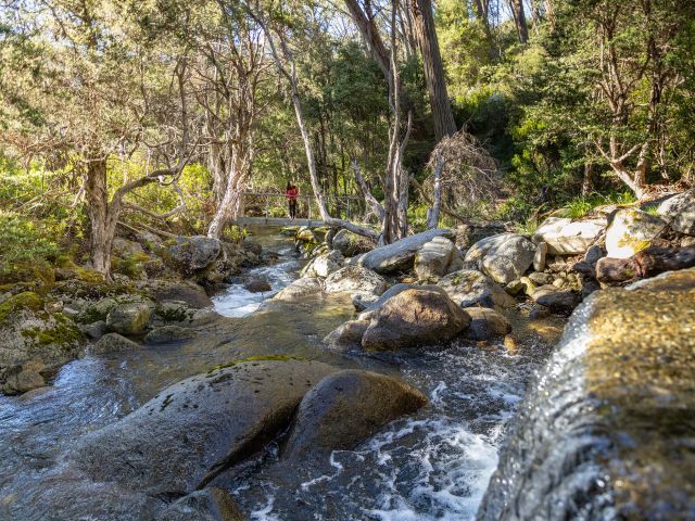
- The track interchanges from bush path, boardwalk, and raised platform, and is not suitable for wheelchair users or prams.
Sydney is no stranger to magical, coastal walks, however, at 80 kilometres long, prior planning is required:
- Visitors should consider Sydney’s accommodation options, while Sydneysiders can travel to and from the track daily.
- Bring plenty of sun protection and avoid walking in the summer heat where possible or organise your schedule to avoid the heat of the day.
- Different sections of the walk have varying levels of shade and water availability. While there are usually places to buy water or fill up bottles, some areas lack water stations, so be vigilant with your water supply.
- There are multiple swimming opportunities along the way, including at some of Sydney’s best secret swimming spots, so pack swimmers and a lightweight towel.
The information below contains an eight-part breakdown of the route.
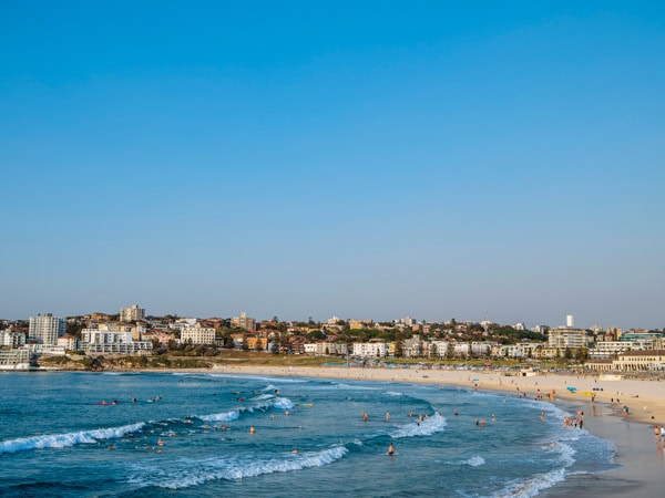
Bondi Beach to Watsons Bay
Distance: 9.9 kilometres
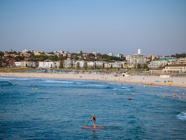
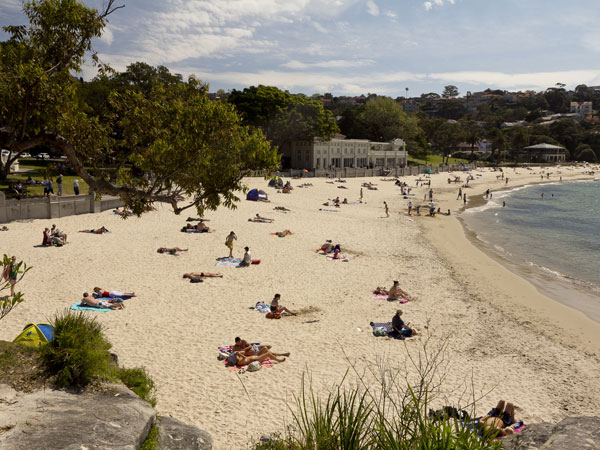
This epic walk begins on Bondi Beach, known for being one of the best beaches in Australia, and this section takes between two to three hours. Once you’ve captured classic Bondi Icebergs on camera, appreciate the incredible murals that decorate the Bondi Beach promenade as you head towards North Bondi. Stop in for a coffee and breakfast at crowd-favourites The Depot , or Harry’s Bondi , then follow the path alongside the popular rockpool and look back to take in the stunning Bondi shoreline.
This coastal walk continues through residential streets, which might sound disappointing, but good things come to those who wait. Ancient Aboriginal rock engravings can be found on Bondi Golf Course, depicting fish and possibly the first recorded shark attack, and the panoramic ocean views at Dudley Page Reserve are worth stopping for. Soon you’ll see the lantern room atop the white tower of Macquarie Lighthouse appear.
Located on the Federation cliff walk, it’s the first and longest-serving lighthouse in Australia, and there’s a sense of respectful reverence about it. A further kilometre along is The Gap, a well-known sandstone cliff face. Your journey ends in Watsons Bay, and, if timed right, just in time for lunch. Choose between a drink at one of Australia’s best beachfront bars for summer, the Watsons Bay Boutique Hotel , or fish and chips from the famous Doyles .
Watsons Bay to Rose Bay
Distance: 10.7 kilometres
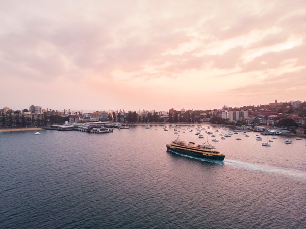
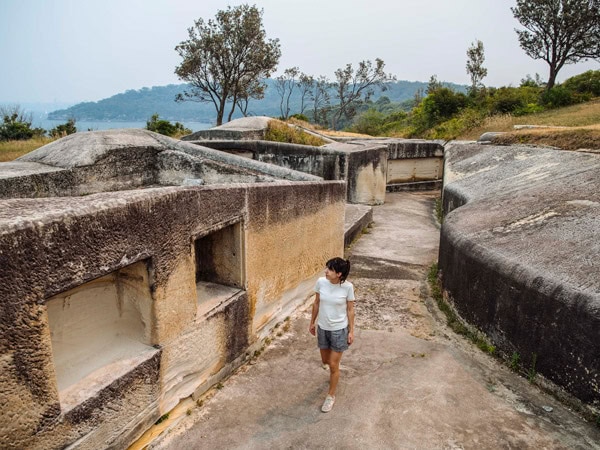
Sydney’s ferries operate between Watsons Bay and Circular Quay, so jump aboard the F4 ferry service to start your day, with an anticipated walking time of two to three hours. Beginning back to Watsons Bay, make your way to South Head. You’ll pass by peaceful Camp Cove (where you’ll also find a kiosk if you need sustenance to start your day), cannons, and gun batteries at the military fortifications built in response to a perceived Russian threat during the colonial era, and dramatic sandstone cliffs that showcase incredible views of the ocean. You’ll know you’ve arrived when you see the red heritage-listed Hornby Lighthouse, built in response to the tragic Dunbar boat accident of 1857, which is still operational today. At certain times of the year, this spot is perfect for whale-watching.
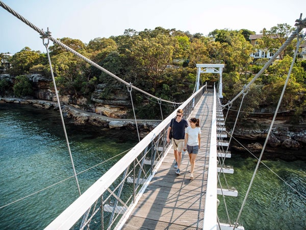
After enjoying the views of South Head, make your way back past Watsons Bay and towards secluded Parsley Bay Beach, known for its charming white timber pedestrian suspension bridge. Keep your eyes peeled for an eastern water dragon sighting along the way.
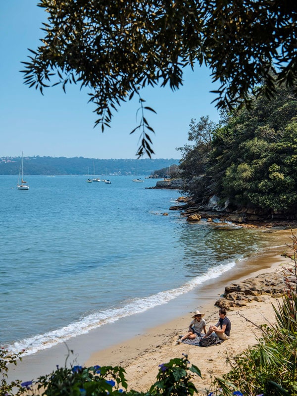
While popular Neilson Park is next on the route, be aware Shark Beach was closed at the time of writing, with extensive construction taking place to repair a damaged 100-year-old sea wall. It is anticipated to reopen in June 2024. See if you can spy the historic 1930s Pavilion change rooms as you go past. The Hermitage Foreshore Walk rounds out this section. Often done as a standalone walk, this track consistently shines. You’ll pass by lush bushland, historic houses, and incredible views. Stop for a swim at the secret Milk Beach, and enjoy unobstructed direct views of the Sydney Harbour Bridge whilst floating in the water. Continue to Rose Bay to catch a ferry back to Circular Quay if you want to end your walk here.
Rose Bay to Darling Point
Distance: 7.6 kilometres
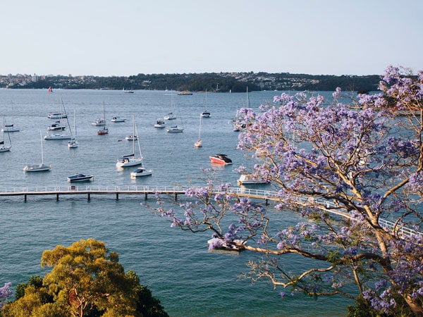
At Rose Bay Wharf you’ll find two cafes to give you the coffee fix needed to embrace the track today: Jezve Coffee , and Sugar + Spoon. With a caffeinated spring in your step, enjoy the harbour views as you make your way along New South Head Road.
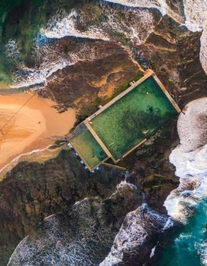
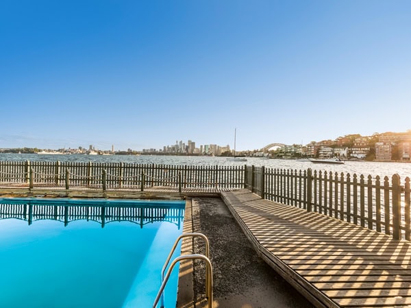
Today’s section takes approximately one to two hours and traverses through residential areas. It’s important to avoid getting too distracted by the Point Piper mansions and pay close attention to the map in the Bondi to Manly app to ensure you walk down the correct streets and avoid getting lost. The highlight is visiting the calm and peaceful Murray Rose Pool, the harbourside tidal pool formerly known as Redleaf Pool. The name pays homage to Australian Olympic swimmer Murray Rose, a triple gold medallist at the 1956 Melbourne Olympics. Bring along a picnic and enjoy the shaded area and facilities. Continue along more residential streets through glamorous Double Bay and Darling Point and opt to end your day here by catching a ferry back to Circular Quay.
Darling Point to Kirribilli
Distance: 9.9 kilometres
Taking two to three hours, this part of the Bondi to Manly walk feels like you’ve stepped straight into a postcard, and we recommend starting early to allow enough time to take it all in. There are certain attractions everyone visiting Sydney has to see at least once, and this section passes by many of them.
Swapping residential walking for water views, walk along from Darling Point to Rushcutters Bay. You’ll pass by Arthur McElhone Reserve and fish pond, and the majestic Elizabeth Bay House can be found on the other side. A jewel in the Museums of NSW collection, this heritage-listed colonial-style regency house is well worth the short detour and visit. Continue through trendy Potts Point, appreciating the art deco buildings and stylish boutiques, and stop off for brunch at La Bomba or one of the cafes on Llankelly Place.
The Bondi to Manly app map will suggest turning right at Woolloomooloo Finger Wharf towards Andrew Boy Charlton Pool. However, turning left instead will take you on a detour to the NSW Art Gallery, which is always worth a visit. When you’re back on the official track, prepare yourself for the quick succession of Sydney icons to come. To begin, spot the navy ships docked across the water at Garden Island. Next, the historic Mrs Macquarie’s Chair which was carved out of sandstone by convicts in 1810 for Elizabeth Macquarie. Enjoy a walk through the Royal Botanic Gardens, and if you’re there on a Thursday, Friday, or Saturday, consider booking a spot on an Aboriginal Harbour heritage tour.
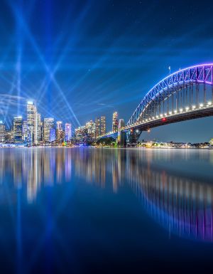
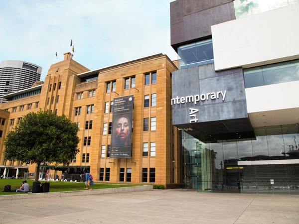
The walking track takes you right around the distinctive sails of the world-famous Sydney Opera House, the perfect location to completely immerse yourself in panoramic views of Sydney Harbour. Be mindful of the crowds at busy Circular Quay, and consider popping into either the Museum of Contemporary Art or Susannah Place Museum, two Sydney museums that make for a great day out. The Rocks precinct is rich in history, and it’s easy to linger here – if you fancy celebrating your day’s achievement early, why not try one of the many excellent pubs and breweries?
Alternatively, return here once the walking part of the day is completed. The final step is crossing the iconic Sydney Harbour Bridge, one of Sydney’s most famous landmarks since the early 1930s. Read up on the history of the Sydney Harbour Bridge before crossing, so you can focus on the stunning panoramic harbour views while you’re up there instead. Once you’re on the north side, you can choose between a train from Milsons Point station, or a ferry from Milsons Point to return to your accommodation.
Kirribilli to Taronga Zoo
Distance: 10.4 kilometres
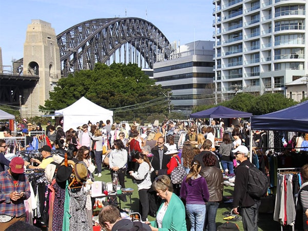
If you find yourself starting this leg on the fourth Saturday of the month, consider beginning your day with a quick browse at Kirribilli Markets, one of the oldest and most popular markets in Sydney. Otherwise, allow enough time for breakfast at one of Kirribilli’s cafes – coffee enthusiasts will enjoy getting a drink from BTB, or Cool Mac. Beginning down by the water’s edge, this section takes three to four hours. While it’s tempting to try a ride or three at Sydney’s Luna Park, you’ll need to head in the other direction towards Captain Henry Waterhouse Reserve. The decision is worth it because this spot arguably has the best views for looking out across the harbour, under the shadow of the Sydney Harbour Bridge. Walk on towards Admiralty House, keeping an eye out for the Prime Minister and Governor-General, to give them a wave.
Today’s section of the track is a mix of coastal and residential. You’ll find more military history by the Sub Base Platypus , a recently opened community recreation and work hub. Further on, you’ll pass nearby enchanting Nutcote Cottage , the heritage-listed artist studio of May Gibbs. The museum is open daily from 11am-3pm, if you fancy a visit. The cafe Thelma & Louise is just around the corner, and while you’re there you can check out Hayes Street Beach, a small harbourside swimming section tucked away and accessible via a walkway.
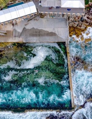
Make your way towards the popular Cremorne Point walk and imagine Snugglepot and Cuddlepie as you enjoy the uninterrupted harbour views. A particular highlight of this walk is stumbling across Maccallum Seawater Pool. This 1920s heritage harbourside pool has delighted residents for decades. At the end of the Cremorne Point Walk is a popular Café Monstera , located in the Mosman ferry wharf terminal.
To round off the walk, make your way towards dog-friendly Sirius Cove, and see if you can recognise the area. If it reminds you of an Arthur Streeton painting, you’d be correct. Streeton frequently painted the landscape by Little Sirius Cove and was a proud member of the artists’ painting camp located here in the late 1890s. The day ends at the ferry wharf by the must-see Taronga Zoo, where there are regular ferries back to Circular Quay.
Taronga Zoo to Spit Bridge
Distance: 9.1 kilometres
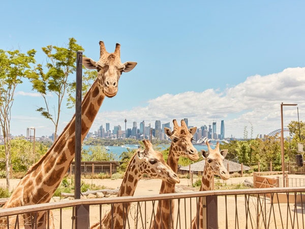
Great news! You’ve finished 48 kilometres and only have 32.5 kilometres to go. This next section takes about two to three hours and begins at Taronga Zoo. Opening in 1916, it has been a Sydney favourite for over 100 years. Known for its conservation work, Taronga Zoo also has accommodation experiences that make it stand out – the ‘Roar and Snore ’ safari-style tents or their luxe Wildlife Retreat. It’s possible to spend a day here learning about the wildlife, so it’s best to continue along the track and save this adventure for another day.
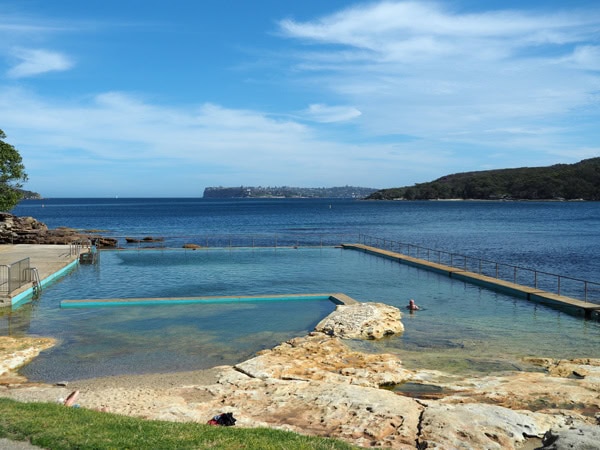
While it is hard to have favourite sections on the Bondi to Manly walk, people often say this part of the track, with its lush greenery and breathtaking views, is a real winner. There are multiple lookouts along the way, and just when you think you’ve found the perfect photo spot, you walk further along and find an even better one. There is an enclosed swimming tidal pool at Clifton Gardens, and shady picnic areas and bathrooms for a pit stop. You’ll find more military fortifications as you make your way to Balmoral Beach, with a stop-off at Middle Harbour Outer Fort. The area is open, and you’re able to walk through the different exposed tunnels.
If you time things right, you’ll get to Balmoral Beach just in time to enjoy fish and chips from Bottom of the Harbour for lunch, and a refreshing swim afterwards. Alternatively, there are wraps available from Kazzi Beach Greek . Our suggestion is to take your food, or a packed picnic, across to Rocky Point Island. Although technically still attached to land, this island is perfect for uninterrupted views of the Sydney Heads.
The final section of the day involves walking through residential areas to get to Chinamans Beach in northern Mosman. This beach here is often quieter, as it is more difficult to access. A walk down Pirriwi Road to the Spit Bridge means you avoid the fumes from the traffic congestion through the Spit. Make your way to the bus stop on the Spit Bridge and jump on one of the many buses heading straight for the city.
Spit Bridge to Manly
Distance: 9.8 kilometres
The Spit Bridge to Manly Walk is a popular day hike, attracting locals and travellers. There’s something for everyone on this track – wildlife spotting, swimming at secret beaches, relaxing and sunbaking, and marvelling at the incredible views along the way. Be mindful that this section of the Bondi to Manly walk has the least number of facilities, including toilets and water stations, so it is important to be prepared. It also features multiple steps, and is considered moderate to challenging, taking between 3.5 to four hours to finish. Choose from the Grumpy’s Wharf Cafe or Plonk Beach Cafe at the Spit to grab breakfast before starting or wait until you reach Clontarf for another two options: Bosk Kiosk, or Sandy Bar Cafe . Clontarf has toilets, water refills, shady picnic areas and an enticing tidal pool.
Further along, you’ll find secluded Isoldes Beach and beautiful Castle Rock Beach. Be mindful of where you leave your belongings, as the tide is likely to quietly wash them away. Keep your eyes open too, for the sound of a ringing bell. That’s the cry of the ice cream boat, a vendor that visits the beaches of Middle Harbour selling a range of ice-creams. Credit cards are accepted, so do yourself a favour, and buy an ice cream to enjoy while floating gently on your back. A highlight of this section is at Dobroyd Head, where you’re able to see rock engravings at the Grotto Point Aboriginal engraving site. See if you can make out a giant kangaroo, several small fish, boomerangs, and a whale. The area is protected with a boardwalk, so don’t stray off the path.
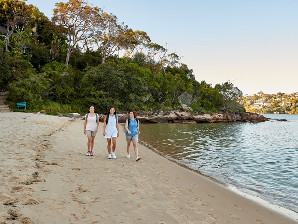
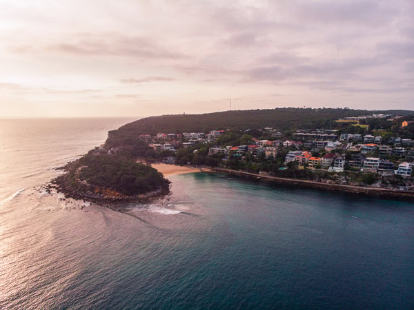
Of all the sections of the Bondi to Manly walk, this one has the most hidden swimming spots. There’s Reef Beach, Forty Baskets Beach, beautiful Fairlight Beach, one of the best snorkelling spots in Sydney, and Delwood Beach. When you get to Delwood, you’ll notice signs for fairy penguins. While international travellers often wonder if this is a joke (A penguin? In the Australian heat?), it is most certainly true – there is a small colony of fairy penguins that call Delwood Beach and Manly home and visit the area between May and February for breeding. The day finishes at Manly Beach, where you’re able to catch the ferry back to Circular Quay.
Manly to Manly
Distance: 10 kilometres
At first glance, it might seem odd to have Manly to Manly as the last section, however, Manly’s North Head is a wonder and worthy of a proper exploration. To get there, you have to first pass through Little Manly Beach, one of Manly’s best-kept secrets. Stop by Ripples for breakfast, which has takeaway and sit-in options, to properly embrace the last day of your walk. The North Head Sanctuary Loop, as it’s known, is renowned for its intersection of military history (fortifications and gun emplacement from World War Two), unique bushland and scenic headland views.
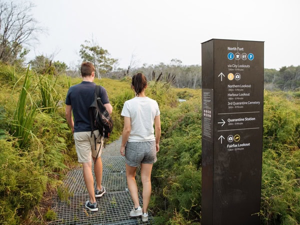
North Head boasts impressive cliffs and a network of 10 walking paths, and it’s possible to jump onto a short tour with the Sanctuary Foundation’s visitor centre to learn more. There is also the Memorial Walk, which honours those who have served in the defence of Australia in war and peacetime. If you’re after a meal, try the Yorky Coffee Caravan or the Bella Vista cafe.
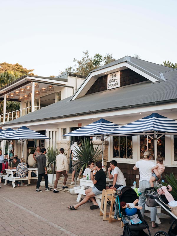
There are a few more surprises left before the walk finishes. Enjoy walking along the beautiful, family-friendly Shelly Beach. This coastal gem is part of the Cabbage Tree Aquatic Reserve, also an excellent snorkelling spot. This marine reserve seeks to preserve and protect underwater marine life. If you didn’t grab food earlier, stop by The Boathouse , and take in the tranquil scene.
On the walk back to Manly Beach you’ll pass the delightfully charming Fairy Bower Rockpool, considered one of Sydney’s best pools. As you make your way to Manly Beach, where the Bondi to Manly walk ends, make sure you congratulate yourself on your epic effort – 80 kilometres is quite an achievement! Try one of Manly’s many excellent coffees, or go for a laidback drink in the afternoon sun at one of the beach pubs and coastal bars in the area. While there are bus options that will take you back to the city, it seems right to mark the milestone with a final ferry back to Circular Quay.