
Suck up the city’s cleanest air while admiring its most magical sights with the best bush and coastal walks in Sydney.
Renowned for its natural beauty, Sydney excels at luring you into the great outdoors. As a step-counting native, I rate the bush and coastal walks of Sydney among the best in the country, especially given that many of the latter trace stunning Sydney Harbour. From walks with prime whale-watching vantage points to trails speckled with endemic treasures and secret swimming holes, the city’s most sublime tracks always manage to fill my cup.
Here are our favourite bush and coastal walks in Sydney.
Easy hikes
1. Middle Head — Gubbuh Gubbah to Georges Head Walking Track, Sydney Harbour National Park
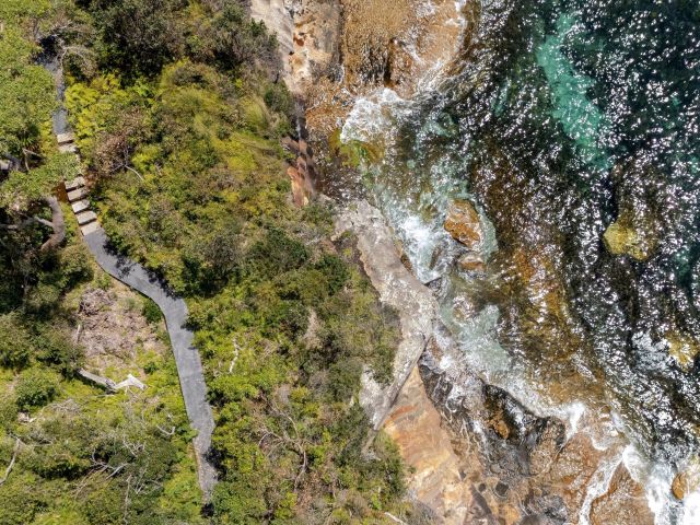
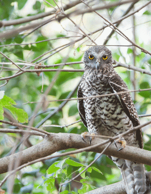
History buffs rejoiced when the Middle Head — Gubbuh Gubbuh to Georges Head Walking Track opened in March 2025 after six years of construction. The coastal walk in Sydney connects Chowder Bay in Mosman to the Bondi to Manly Walk (more on that below), weaving past ancient forts, gun emplacements, canons and other military structures sure to stir the warrior in all of us. When you’re not combing extraordinary relics, a shifting landscape pops you between rainforest-reminiscent surroundings and the coastline, while twitchers should look for a fairy wren or spotted pardalote along the way. There for the water views? Uninterrupted eyefuls of Sydney Harbour should suffice.
Getting there: Follow Middle Head Road to the end, then head down Chowder Bay Road to Car Park 4. The walk’s entrance is next to it.
Distance: 3 kilometres
Level: Easy, Grade 2 — expect gentle hills and occasional steps
Accessibility: NSW National Parks says there may be an accessible section between Middle Head Road, Inner Midde Head and Outer Middle Head, but visitors should remember that there are scattered steps throughout
2. Hungry Point Cliff Top Walk, Cronulla
If solid boardwalk strolling gets you moving, look no further than the extended portion of the Cronulla Coastal Walkway, the Hungry Point Cliff Top Walk. Unveiled in December 2025, the trail boasts sensational views across Port Hacking and out to the Sutherland Shire’s Royal National Park, Bundeena and Maianbar, so it’s crystal-clear water for days. Linking the Cronulla Esplanade with Hungry Point Reserve, the elevated path isn’t filled with any fancy extras – this is a path dedicated entirely to soaking up true serenity.
Getting there: Drive to Cowra Place in Cronulla, at the southern end of the suburb, to access the walk directly. You can also park along Cronulla Esplanade. If you’re going by train, hop off at Cronulla Station which is within walking distance to the Esplanade.
Distance: 1 kilometre
Level: Easy, Grade 2 – expect mostly flat conditions and occasional steps
Accessibility: This walk is not accessible but there is an accessible viewing platform
3. America Bay Walking Track, Ku-ring-gai Chase National Park
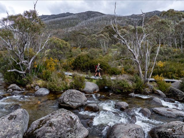
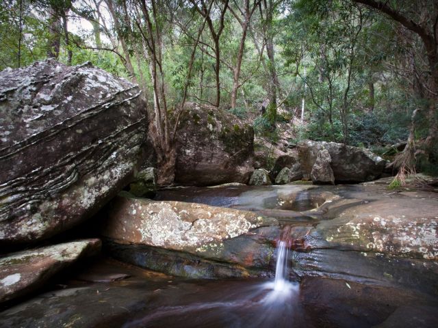
One of Sydney’s most soothing picnic spots lies at the end of the America Bay Walking Track where a cascading waterfall surrounded by dense bush beckons. Before you pull out the sandwiches, you’ll follow a sandstone ridgeline past scribbly gum and bloodwood trees until a distant trickle of water grows in urgency. Once you reach a rock platform, you’re on the home stretch to lunch o’clock as tranquil America Bar sparkles down yonder. Keep a lookout for small watering holes along the way, nestled between red rocks and filled with yabbies and tadpoles.
Getting there: America Bay is in the West Head precinct of Ku-ring-gai Chase National Park. Driving is the best option; however, the track is also accessible from the waterfront if you’re lucky enough to have a boat.
Distance: 1.8-kilometre return
Level: Medium, Grade 3 – expect short, but steep hills and occasional steps
Accessibility: This walk is not suitable for those with access needs
4. The Sanctuary Loop, North Head Sanctuary, Manly
Score a sweeping view of Sydney Harbour and the CBD, plus a history lesson, while tackling North Head Sanctuary’s Sanctuary Loop. The 3-kilometre circuit goes past Sydney’s former Army School of Artillery, plus the Third Quarantine Cemetery built in 1881, and offers vivid insight into how Australia’s quarantine history has evolved. Hanging swamps and banksia scrub make up some of the unique vegetation along the walk, and there are several small beaches to help cool you down along the way. Wrap your efforts with a coffee at North Head Sanctuary’s Bella Vista Cafe on the headland near the visitor centre.
Getting there: Buses to North Head Sanctuary from Manly Wharf run regularly. There’s also a bike path that stretches along the same route.
Distance: 3-kilometre return
Level: Easy – expect a well-marked trail and minor inclines
Accessibility: While North Head Sanctuary welcomes guests with access needs via disabled parking spaces and toilets, this walk’s terrain is not paved in full. Prams and wheelchairs will struggle
5. Harold Reid Foreshore Track, Castlecrag
Blending the best of the bush with the best of the ocean, the Harold Reid Foreshore Track in Sydney’s lower north shore showcases Middle Harbour and its staggering beauty. The highlight is Harold Reid Headland, known locally as Sugarloaf, a spectacular sandstone structure that dramatically looms above sea level. A coastal walk in Sydney that’s suitable for families, this trail boasts an idyllic birdlife backdrop that spans grey fantails, kookaburras and fairy wrens, while views out to Castle Cove’s Innisfallen Castle enchant the inner prince or princess in everyone.
A picnic area with a gas barbecue also makes for a fun family day out.
Getting there: Start at the end of Sugarloaf Crescent in Castlecrag where you can park on the street before hitting the walk’s entrance.
Distance: 3.5 kilometres one-way
Level: Easy to medium – expect unsealed portions and slippery surfaces
Accessibility: This walk is not suitable for visitors with access needs
Need tips, more detail or itinerary ideas tailored to you? Ask AT.
AI Prompt
6. Riverside Walking Track, Lane Cove National Park
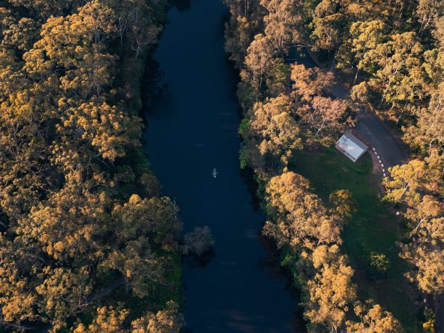
I love packing a picnic lunch and enveloping my mind, body and soul in the lush Riverside Walking Track. Dotted with serene spots to spread out a feast, the peaceful trail runs along the Lane Cove River so exploring is also freckled with water views. I recommend getting your binoculars out and spying on the local birdlife, or sniffing out the odd swamp wallaby, too.
Getting there: Reach the trail from either Delhi Road in West Chatswood or Lane Cove Road in Macquarie Park. There’s parking along the entire stretch including the Koonjeree Picnic Area towards the southern end of the trail.
Distance: 5 kilometres one-way
Level: Easy to medium, Grade 3 – expect some steep hills and obstacles
Accessibility: This walk is not suitable for visitors with access needs
Moderate hikes
7. Sphinx Memorial to Bobbin Head Loop Track, Ku-ring-gai Chase National Park
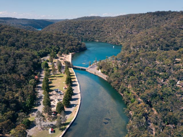
Level up your step game with the Sphinx Memorial to Bobbin Head Loop Track through a maze of thick mangroves, red bloodwoods and apple gums. You’ll kick off at the Sphinx Memorial, a striking sandstone monument built in memory of the lives lost during World War I, before climbing your way to the end at Bobbin Head where picnic tables and barbeques reward hard work. This trail is also home to a significant Indigenous heritage site so you’ll likely spy middens, a lasting remnant of daily mealtime, sprawled across the ground.
Getting there: You need a car to reach this walk; however, there’s plenty of parking at the grounds. Follow Bobbin Head Road from the Pacific Highway at Turramurra.
Distance: 10-kilometre loop
Level: Medium, Grade 4 – expect steep inclines and many steps
Accessibility: This walk is not suitable for visitors with access needs
8. Resolute Beach Circuit Walk, Ku-ring-gai Chase National Park
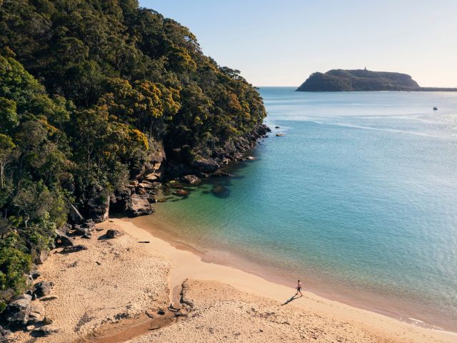
Discover several of Sydney’s less-lazed-upon beaches all in one day with the Resolute Beach Circuit Walk from the Resolute Picnic Area. Offering access to Resolute Beach, one of Sydney’s best covert swimming spots, the trail also sweeps in West Head and Great Mackerel beaches where giant monitor lizards often sunbake on rocks. Once you’ve navigated your way through, plonk yourself on Resolute itself where views across Pittwater and Barrenjoey Headland dazzle.
Getting there: Start from the Resolute Picnic Area at the end of West Head Road where a carpark makes life easy.
Distance: 6-kilometre loop
Level: Medium – expect uneven terrain and steep sections
Accessibility: This walk is not suitable for visitors with access needs
9. Aboriginal Heritage Walk, Ku-ring-gai Chase National Park
While we’re talking all things Ku-ring-gai Chase National Park, consider the exceptional Aboriginal Heritage Walk, too. Culturally significant for its rock art and engravings, the trail hits the incredible Red Hands Cave and its ochre handprints within the first ten minutes. For many, stickybeaking the cave and heading right back is an easy one-kilometre journey, but I recommend sticking it out for the entire distance to uncover further artworks and a historical shelter that once kept families warm amid the chill.
Getting there: Follow West End Road in Ku-ring-gai Chase National Park until you reach a car park at the end. It’s right next to the Resolute Picnic Area where the walk begins.
Distance: 4.4-kilometre loop
Level: Medium, Grade 4 – expect a rough, steep track with many obstacles and steps
Accessibility: This walk is not suitable for visitors with access needs
Hard hikes
10. Curra Moors Loop Track, Royal National Park
A longish but flat walk that offers remarkable coastal views – and whale watching opportunities between June and November – the Curra Moors Loop Track is plain beautiful. It delivers scribbly gums that open onto a blossoming heath, while ocean-facing sandstone cliffs dial up the drama. During spring, this hike’s flora will give your nostrils a delightful sensory experience and you might also spot echidnas roaming amongst the magic.
Getting there: Driving is the way to go as there’s a car park on Sir Bertram Stevens Drive. Visitors should note, however, that it gets busy over the weekend so beat the crowds by arriving early.
Distance: 10-kilometre loop
Level: Medium to hard, Grade 4 – expect steep hills, limited signage and some obstacles
Accessibility: This walk is not suitable for visitors with access needs
Weekly travel news, experiences
insider tips, offers, and more.
11. Benowie Walking Track, Berowra Valley National Park
Pack up and disappear for a few days along the Benowie Walking Track which links Pennant Hills and Berowra Waters. A mixture of smooth boardwalk and uneven dirt winds through rural bushland, and you’re invited to roll out your canvas for a sleep along the way. Lined with Sydney blue gums and budding black wattles, this trail forms just one part of the Great North Walk, stretching from Sydney to Newcastle. Keep a lookout for ancient Aboriginal rock engravings and the remnants of an old quarry, too. History abounds in this standout journey.
Getting there: Most tracks out of Sydney require a car, however this one’s only one kilometre from both Hornsby and Pennant Hills train stations.
Distance: 25 kilometres one-way
Level: Hard, Grade 5 – expect very steep hills and no directional signage
Accessibility: This walk is not suitable for visitors with access needs
12. Bondi to Manly Walk, Bondi to Manly
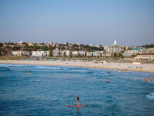
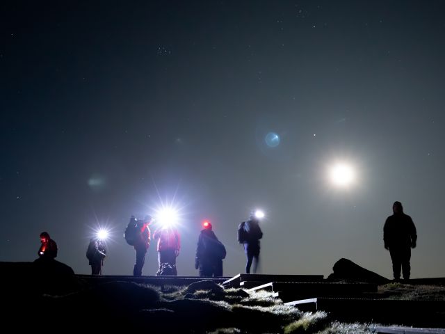
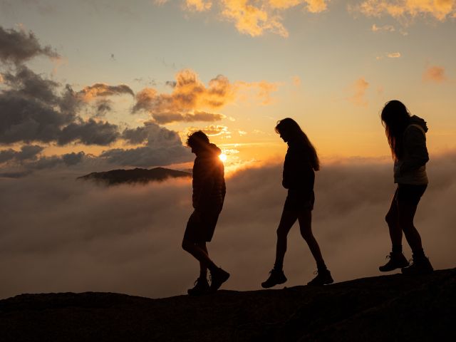
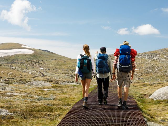
Sydney’s longest coastal trail shines a light on two of the city’s most outstanding locales while merging the best of both worlds: epic bushwalking and exceptional ocean-gazing. The Bondi to Manly Walk will take you anywhere from two to six days, depending on your pace. Go slow and you’ll be spoilt with secluded natural rockpools, sandstone cliffs, quiet beaches, breathtaking headlands, historical relics and even the Sydney Harbour Bridge. Best of all, no part of the walk is overtly strenuous (however, there are many stairs), and it’s clearly signposted from start to finish. The only reason it’s rated hard is due to its colossal length. My tip: download the app for step-by-step guidance.
Getting there: Start at Bondi Beach and make your way south along the South Head of Sydney’s Eastern suburbs. Buses regularly travel to Bondi Beach from Bondi Junction daily.
Distance: 80 kilometres
Level: Hard
Accessibility: This walk is not suitable for visitors with access needs
How should I prepare for a walk in Sydney?
Step 1: Research and plan
Google everything you can about the trail. Get a feel of the route, particularly if it’s a long one, and check the difficulty level even if you’re an experienced bushwalker. Conditions change and sections may undergo maintenance so gather as much information as possible prior to go-time.
Step 2: Check the weather
It’s a no-brainer but one should always be reminded. Ensure your day isn’t rained out or that the heat won’t sizzle you.
Step 3: Piece together the perfect outfit
No matter the route you pick, waterproof and windproof clothing is your best bet. Layering tops makes it easy to cool down as the day heats up, while opting for long, loose pants will keep insects and grazes at bay. Choose sturdy, protective shoes with soles that grip, and don’t forget a hat.
Step 4: Pack like a pro
Here’s the checklist: sunscreen, insect repellent, more than two litres of water per person, nutritious snacks, a torch, a simple first aid kit that includes Band-Aids, antiseptic, small scissors, your mobile phone and screenshots of a map. If you’re camping, you’ll need a tent and sleeping bag at a minimum.
Step 5: Download an app
The NSW National Parks app offers up-to-date information on hundreds of Sydney’s best walks. Plus, you can download your route before you go, so if you’re out of range, your map stays with you.
Step 6: Tell a friend
Finally, make sure somebody knows you’re out and may be uncontactable. It may seem extreme, but accidents happen and it’s better to err on the side of caution if you’re planning an epic adventure.
Want to see more stories from Australian Traveller in your Google search results?
- Click here to set Australian Traveller as a preferred source.
- Tick the box next to "Australian Traveller". That's it.