The Deep South Australia coastal walk to a hidden waterfall

hero media
Just 100 kilometres from Adelaide, a relatively unknown guided walk reveals the magic and mystery of the southern Fleurieu Peninsula.

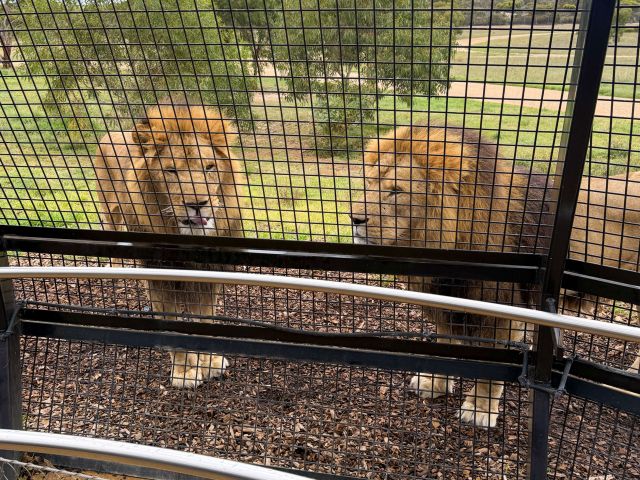
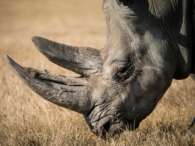
I’ve never known Australia’s most iconic marsupials to be camera shy. Usually they can be relied upon to glance up disinterestedly between mouthfuls of grass or take a few bounds away before peering warily over their shoulders. But the mob of western greys at Tapanappa Ridge is stubbornly refusing to look in my direction.

Southern Ocean Walk
The perfect sunset view at Tapanappa Ridge. Photo: Southern Ocean Walk Barry Duykers

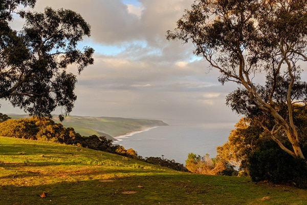
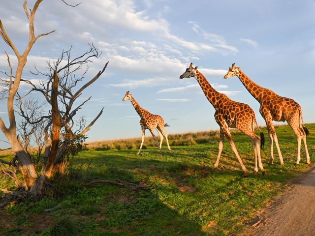
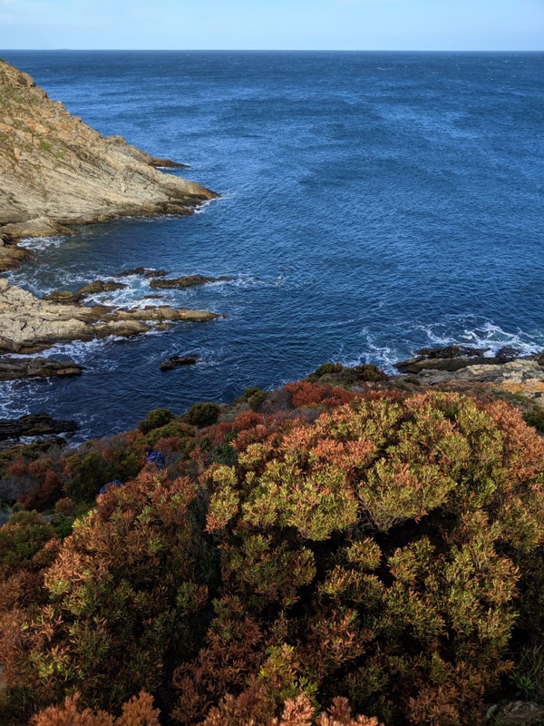
Still, it’s hard to blame them when I check out the alternative. A wall of cliffs stretches up the coast like gap-toothed baleen broken by glittering green slopes sliding straight into the ocean. Tiny hidden coves and broad beaches alike are pounded by waves that have travelled all the way from Antarctica . In the other direction, the outline of Kangaroo Island is discernable beyond undulating hills of open woodland thick with wildflowers. And despite the sense of isolation, this rugged stretch of coastline south of Adelaide is surprisingly accessible.

A hidden gem

“It never ceases to amaze me how many people in South Australia have never been to Deep Creek," Barry Duyker says. “It’s simply incomprehensible". After four days in his company, I’m inclined to agree. The Conservation Park sits at the very tip of the Fleurieu Peninsula, where the Mount Lofty Ranges that form the peninsula’s backbone meet the western edge of the Murray Mallee. The combination of these intersecting ecosystems and the area’s hyperkinetic topography means the region harbours an astonishing variety of landscapes, from wild ocean beaches and estuaries to shifting dunes, lofty clifftops, open woodland and thick sclerophyll forest.

Southern Ocean Walk
You’ll trek through a variety of landscapes along the Southern Ocean Walk in South Australia. Photo: Southern Ocean Walk Barry Duykers.

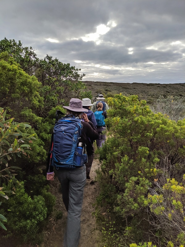
Barry and his wife Jane have spent 25 years providing accommodation for visitors who want to see the region without camping, and in 2018 they launched a guided walk using one of their homesteads as a base. Each section of the pack-free four-day walk covers 12 –14 kilometres, meaning that it’s approachable for anyone with a decent level of fitness. And because of its proximity to Adelaide, it’s easy to completely immerse oneself in this stunning and ever-changing landscape without having to take more than a couple of days off. Barry will even pick you up from the city if you don’t have time for a lazy drive through McLaren Vale.

Only the beginning

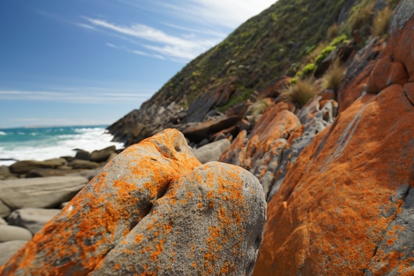
The trail starts at Cape Jervis, which overlooks the Backstairs Passage between the mainland and Kangaroo Island. Visible across the steely blue water, its towering sea cliffs and undulating pastures will be a constant companion for the walk’s first few days. In the foreground, orange lichen-covered granite and farmland that’s lush despite a dry winter compete for attention with a small sign announcing the start of the Heysen Trail .

Southern Ocean Walk
Striking orange lichen-covered granite along the coast at Aaron Cove. Photo: Southern Ocean Walk Barry Duykers

It’s a rather humble beginning for the longest dedicated walking track in the country. The trail stretches 1200 kilometres to the Flinders Ranges in the state’s arid north, but the Southern Ocean Walk covers just a fraction of that distance. Over four days, we’ll travel as far as the holiday town of Victor Harbor but it soon becomes clear that this is not a simple stroll.

Cliff notes

The Fleurieu looks like a placid land of gently rolling hills from a distance, but up close those hills can be surprisingly steep. The undulations mean there’s no shortage of climbing on the walk and soon we’ve all worked up a sweat. Still, Barry says with a smile, “that’s what makes the landscape interesting."

Marrano Creek
The 4-day hike will take you past Marrano Creek. Photo: Southern Ocean Walk Barry Duykers.

The trail begins in private farmland, occasionally tracking inland to avoid the steepest ravines, but further on there’s reason to be grateful for the hills. The topography of the land, which was too rugged and steep for bullock carts, is what saved the remnant vegetation at Deep Creek. The demand for dairy farms and summer homes means that 90 per cent of the Fleurieu’s native vegetation has been cleared. It makes both Deep Creek and nearby Newland Head Conservation Park vitally important pockets of remnant bushland, and both protect many endangered species.


The cliffs overlooking the Southern Ocean don’t just provide spectacular views; they’re also home to the ospreys that wheel overhead. Newland Head is also home to white-bellied sea eagles that were until recently the only breeding pair on South Australia’s mainland, and the track was re-routed in 2006 to protect them.

Forest bathing

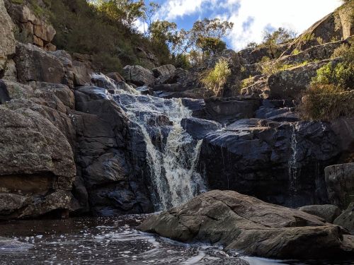
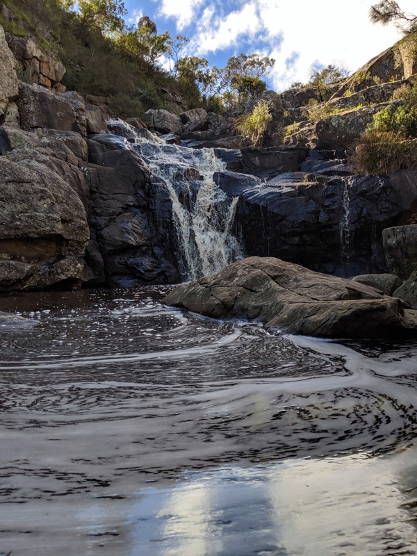
In Deep Creek, the trail meanders past cascades and crossings where the sound of trickling water mingles with birdsong and surprisingly melodic frogs that serenade us from the water’s surface. Pockets of deliciously cool air travel above the creeks, but the most refreshing spot is Deep Creek Waterfall. There, tannin-stained waters cascade over rocks to an appropriately deep pool that remains chilly even in the middle of summer.

Southern Ocean Walk
Deep Creek Waterfall is a highlight along the walk. Photo: Southern Ocean Walk Barry Duykers.


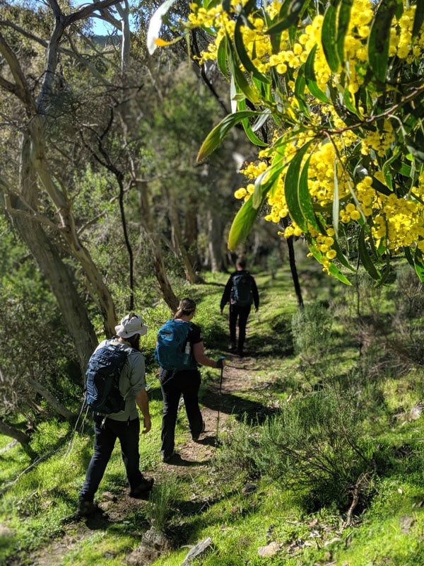
The trail follows the contours of the land, winding past coastal overlooks and offering views of the slopes opposite where daubs of brilliant yellow wattle are splashed between clumps of pink gums that resemble florets of broccoli from a distance. Closer at hand, glimpses of purple, yellow and white by the path turn out to be delicate native orchids with intricate patterns of spikes, spots and beards. And everywhere, from fire-scarred valleys to dense bushland, an unmanageable profusion of shaggy xantheria plants springs forth, their spiky crowns of grass-like leaves making them look like something from a Dr. Seuss book.

Southern Ocean Walk
A spider orchid spotted along the trek. Photo: Southern Ocean Walk Barry Duykers.
Southern Ocean Walk
There is an abundance of native flora and fauna along the 4-day hike. Photo: Southern Ocean Walk Barry Duykers.

Comfort zone

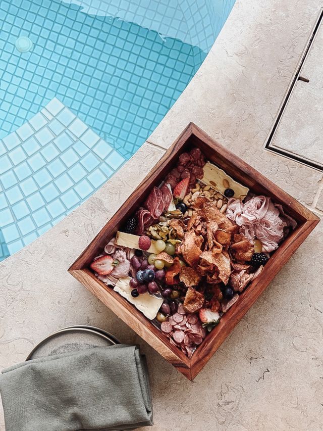
Because nights are spent at a homestead within Deep Creek, there’s no need to search for a flat spot to pitch a tent at the end of each day. And if the lure of a warm shower and fresh clothes isn’t enough, we’re greeted by little touches like a warm foot bath with lavender and Epsom salts (made even more relaxing by the local sparkling that accompanies them). The meals showcase food and wine drawn from the surrounding region, right down to mid-hike morning tea from the Willunga Farmers’ Market down the road, and the three-course dinners are enough to sate even the heartiest of appetites.


But the location is isolated enough that it’s easy to forget about the rest of the world. If you want network coverage, you’ll need to walk to the top of the nearest hill, and Barry describes the homestead as comfortable rather than luxurious. Still, I feel pretty snug sitting next to the combustion heater in the morning and watching the abundant roos pad over the frost-covered lawns. In fact, I think one of them just looked at me with a hint of jealousy.


Want to know more about travelling South Australia? Read our ultimate travel guide to South Australia here.
Alexis Buxton-Collins
Alexis Buxton-Collins spent his twenties working as a music journalist and beer taster before somehow landing an even dreamier job as a freelance travel writer. Now he travels the world from his base in Adelaide and contributes to publications including Qantas, Escape, The Guardian and Lonely Planet. Alexis has never seen a hill he didn't want to climb and specialises in outdoor adventures (he won the 2022 ASTW award for best nature/wildlife story for a feature on Kangaroo Island). When he's not scouring South Australia for the newest wineries and hikes, he's looking for excuses to get back to spots like Karijini and Ningaloo.
See all articles
hero media

Taking the route less travelled along the Great Ocean Road

The Great Ocean Road has captured the hearts of Australians with its astounding scenery since 1932, but going off-course can enrich your experience with untouched nature, foodie delights and charming towns. 

It’s a chilly 16 degrees. My husband pulls on a steamer and jogs – as all seasoned surfers do – into the water. We’re at Bells Beach , the legendary break on Victoria’s Surf Coast that’s home to the Rip Curl Pro, the world’s longest-running event in competitive surfing. Each year, over the Easter long weekend, up to 40,000 people descend on the region for the event. Today, though, we have the beach almost to ourselves, and the less-than-favourable temperature doesn’t deter my husband from surfing this famous break.  

Bells Beach
Bells Beach is known for its epic surf break and is at the start of the Great Ocean Road. (Image: Tourism Australia)

Torquay to Anglesea and Aireys Inlet 

Split Point Lighthouse
The red dome of Split Point Lighthouse in Aireys Inlet. (Image: Tourism Australia)

The nearby surf town of Torquay marks the starting point for the Great Ocean Road . Unfolding our map, which we have marked out with a highlighted route for our children to follow, we set off for lesser-known Anglesea, a chilled-out town 20 minutes south of here. Its wide, sandy beach is a gentler swimming option for our young family. Groms can learn to surf here with Go Ride a Wave, which also runs stand-up paddle boarding on the Anglesea River.  

Split point lookout
The lighthouse overlooks the Shipwreck Coast. (Image: Tourism Australia)

After a couple of nights in Anglesea, we hit the road again, first stopping at Aireys Inlet. Here we stretch our legs at Split Point Lighthouse, which was made famous by the 1990s television series Round the Twist, before driving under the Memorial Arch that welcomes us, officially, to the Great Ocean Road.  

This 243-kilometre coastal road was built by returned First World War servicemen and serves as a permanent memorial to those who fought and died during the war. Carved into rock using hand tools and horse-drawn carts, it was a huge engineering feat and provided much-needed access to isolated coastal communities. 

Lorne to Birregurra 

Lorne is a delightful beachside stop for lunch and browsing boutique stores. It’s also the gateway to Great Otway National Park , which comprises a varied landscape of old-growth forests, cool-temperate rainforests, heathy woodlands and rugged coast. With the highest rainfall in Victoria, the region is home to many waterfalls – 10 of which are within 10 kilometres of Lorne.  

Turning slightly off the main drag, we wind along a gum-shaded road to Erskine Falls. Here, our son leads the way through the hyper-green rainforest and down 200-plus stairs to the cascade that drops 30 metres into a lush fern gully. We hop over large boulders to get closer to the falls, enjoying the entire place to ourselves; it’s worth the return climb.  

From Sheoak Falls Picnic Area, there are walking trails to Henderson Falls, Phantom Falls, Won Wondah Falls and Kalimna Falls, some of which follow an old timber tramway from forest-logging days, which only came to an end in 2008.  

Erskine Falls
Erskine Falls is one of many falls within a day trip of Lorne. (Image: Visit Victoria)

You can follow your appetite north to the town of Birregurra, which is part of the Otway Harvest Trail that connects farm gates, markets, wineries, breweries and distilleries. It’s home to three-hatted modern Australian restaurant Brae , helmed by celebrated chef Dan Hunter, set among native gardens and an organic farm, and Otways Distillery, which produces small-batch spirits using local produce and botanicals.  

Brae restaurant
Brae is a three-hatted restaurant in Birregurra. (Image: Tourism Australia)

Apollo Bay to The Otways 

Back on track, the cliff-hugging stretch between Lorne and Apollo Bay is breathtaking. At Teddys Lookout, we overlook the winding road ahead and St George River spilling into the ocean. We spend languid days in Apollo Bay, a buzzy seaside town that boasts a three-kilometre-long, crescent-shaped beach with a backdrop of rolling green hills. One evening, as the sun sets, we take the steep 10-minute walk to Marriners Lookout, which affords panoramic views of the ocean, hinterland and town.  

A 15-minute drive along the road, Maits Rest is a lush rainforest gully that has been protected since the early 20th century. Wandering along the 800-metre boardwalk, we inspect the delicate moss-covered forest floor and the gnarled roots of 300-year-old myrtle beech trees, then crane our necks to see their canopies, some 50 metres above us. It’s therapy in nature.  

Cape Otway to the Twelve Apostles 

Twelve Apostles
One of the famous Twelve Apostles, limestone sea stacks that rise from the Southern Ocean. (Image: Ben Savage)

The southernmost tip of Cape Otway is a delightful detour, home to the 1848-built Cape Otway Lightstation, the oldest surviving lighthouse on mainland Australia. We climb the narrow winding staircase to the gallery deck, explore the keepers’ quarters and telegraph station, and enjoy a coffee and some ‘famous’ scones at the charming onsite cafe.    

It’s a pinch-me moment to finally see the Twelve Apostles in person. This unmistakable cluster of limestone stacks rising abruptly from the sea were never 12, however. When coined this in the 1890s as a marketing ploy, there were only nine; today, only seven remain after two collapsed in 2005 and 2009. We admire these Aussie icons from the viewing platform, in awe of Mother Nature’s ever-evolving artwork.  

The Grotto
The Grotto is another natural attraction within Port Campbell National Park. (Image: Carmen Zammit)

Edging the wild Southern Ocean, this part of the coast – dubbed Shipwreck Coast – is made up of many sea-carved natural wonders including London Bridge, The Grotto and Gibson Steps. After exploring the lookout trails of Loch Ard Gorge/Poombeeyt Kontapool – its English name taken from the site of the 1878 shipwreck – we nestle into the sandy beach encircled by towering sandstone cliffs, as our children splash about on the water’s edge, and soak it all in.  

Port Campbell to Timboon 

Timboon Fine Ice Cream
Timboon Fine Ice Cream is part of a regional foodie trail. (Image: C McConville)

Just north of Port Campbell National Park, the region of Timboon is part of the 12 Apostles Food Artisans Trail, filled with purveyors of delicious foodstuffs such as Timboon Fine Ice Cream , Timboon Railway Shed Distillery and Apostle Whey Cheese. As an antidote to the indulgence, the 20-kilometre Poorpa Yanyeen Meerreeng Trail is a self-guided ride or walk between Port Campbell and Timboon through tall forests, over historic bridges and past sparkling lakes and farmland with grazing cattle.  

Warrnambool to Port Fairy 

Warrnambool building
A 19th-century building in Warrnambool. (Image: Peter Foster)

In Warrnambool, a town rich in maritime history, we take the four-kilometre Thunder Point Walk that traces the coast. The kids squeal when an echidna shuffles out from beneath the wooden boardwalk, and we stop to admire a seal lazing on a rock at the port.  

Further along, the streets of quaint fishing village Port Fairy are lined with 19th-century cottages, old stone churches and Norfolk pines. Follow the historic walking trail to see some of the 60-plus National Trust buildings. Port Fairy is also home to Port Fairy Folk Festival (6-9 March), one of the country’s longest-running music and cultural festivals. You could time your road trip with the event for a fittingly celebratory end to any journey.  

The Great Ocean Road can easily be done in three days, but we’ve spent a week on the road. The highlighted line on our now creased and well-worn map doesn’t follow the famous route precisely. It has sprouted branches in many directions, leading us to untouched rainforest and charming rural towns filled with culinary delights, and where we experienced some of our most memorable moments on the Great Ocean Road.    

A traveller’s checklist 

Staying there

Oak & Anchor
The Oak & Anchor in Port Fairy.

The Monty is a highly anticipated, newly refurbished motel with a chic Palm Springs-inspired aesthetic set across the road from the Anglesea River. Basalt Winery in Port Fairy grows cool-climate wines such as pinot noir and Riesling in rich volcanic soil. Stay among the vines in its tiny home, complete with a kitchen, lounge area and outdoor firepit. 

The Oak & Anchor Hotel has been a Port Fairy institution since 1857. Cosy up by the bar in winter or bask in the sunshine of the Lawn Bar in summer. The rooms are beautifully boutique with considered details, such as luxe baths for sinking into post-road trip. 

Eating there

The Coast in Anglesea is a modern Australian restaurant focused on local ingredients. Grand Pacific Hotel has been a local landmark in Lorne since 1879 and recently underwent a restoration. It serves a mix of traditional pub and Italian fare alongside ocean views.  

Graze is a cosy 40-seat dining room in Apollo Bay with a modern Australian menu complemented by regional wines. Apollo Bay Distillery offers tasting flights, a gin blending masterclass and serves woodfired pizzas.